Forschungsprojekte
Diese Seite listet alle aktuell zu bearbeitenden sowie bereits abgeschlossenen Forschunsprojekte an unserer Professur. Eine nach Themenschwerpunkten kategorisierte Übersicht findet sich unter Forschungsfelder.
Sonderforschungsbereiche / Graduiertenkollegs
SFB/TRR 280: Konstruktionsstrategien für materialminimierte Carbonbetonstrukturen: Grundlagen für eine neue Art zu bauen
GRK2250: Mineral-bonded composites for enhanced structural impact safety
GRK2947 "AirMetro": Technisch-betriebliche Integration hochautomatisierter Luftfahrt in Ballungszentren
Forschungsprojekte
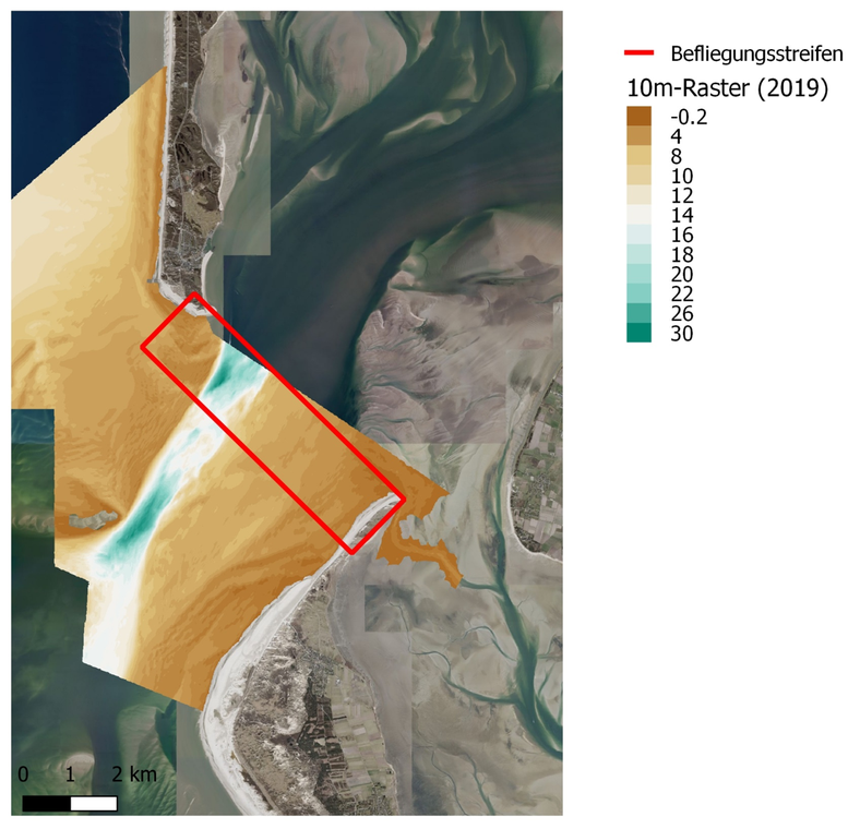
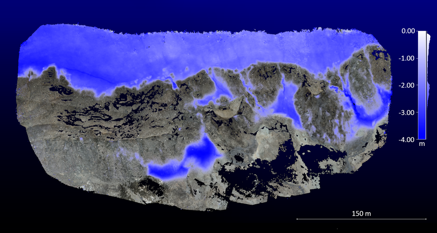
Laserbathymetrie in küstennahen Bereichen der Nordsee

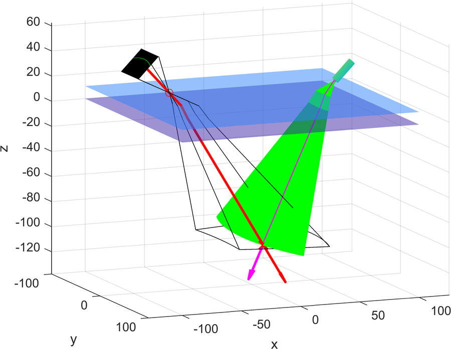
Strenge Geometrische Modelle für die Unterwassertriangulation
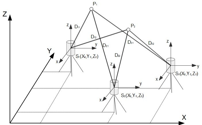
Modellierung und Kalibrierung der Abbildungsgeometrie eines Unterwasser- Linienlaser-Triangulationssystems.
4D Überwachung von Gletscherrandveränderungen auf der Basis von multitemporalen 3D-Punktwolken
Erkennung von schuttbedeckten Gletscherfronten aus stereoskopischen Bilddaten unterschiedlicher Maßstäbe
Tomographische Ansätze zur Laserbathymetriedatenverarbeitung
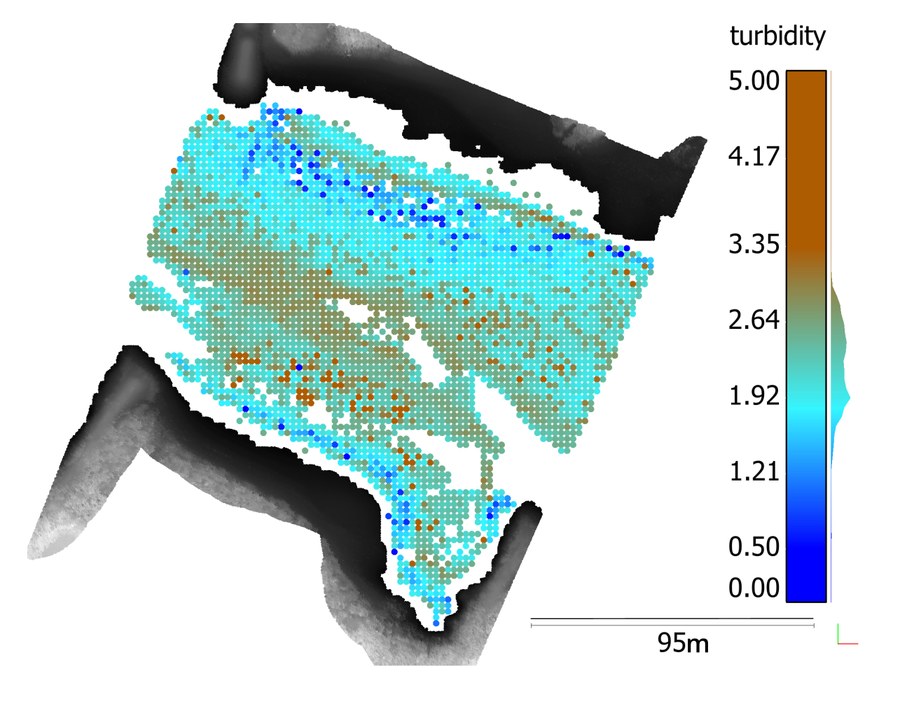
Entwicklung von Ansätzen zur Steigerung der Genauigkeit und Zuverlässigkeit der Gewässerbodendetektion sowie der Ableitung räumlich hochaufgelöster Gewässertrübungsparameter

ImPRESSing
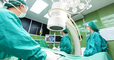
Erhöhung der Präzision der Patientenpositionierung in der Strahlentherapie durch hilfsmittelreduzierte Positionierung auf Basis von Kameras
ARAILIS
Augmented Reality und künstliche Intelligenz zur Unterstützung der laparoskopischen Bildgebung in der Chirurgie
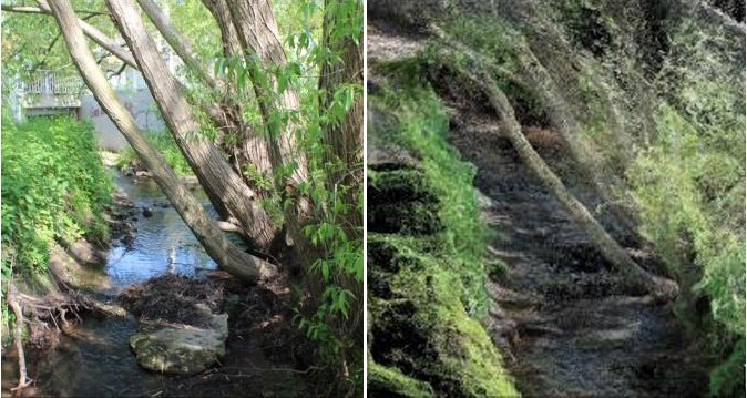
Creek 4D - Messung von Kleinstgewässern Automatisierte hochauflösende Erfassung gewässermorphologischer Parameter kleiner Gewässer zur Unterstützung des Hochwasserrisikomanagements sowie der Erreichung des guten ökologischen Zustandes
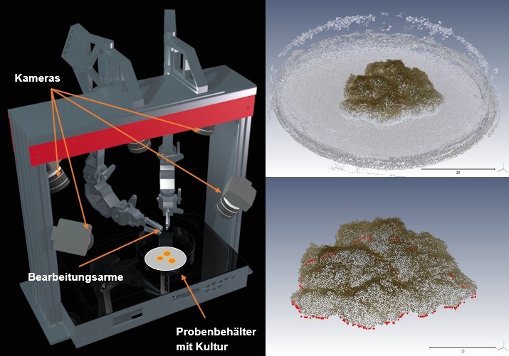
3Dbot - 3D-Erfassung biologischer Proben • Entwicklung und Praxistest einer schnellen Methode für die Erzeugung von 3D – Modellen von biologischen Proben aus multiperspektivischen Bilddaten
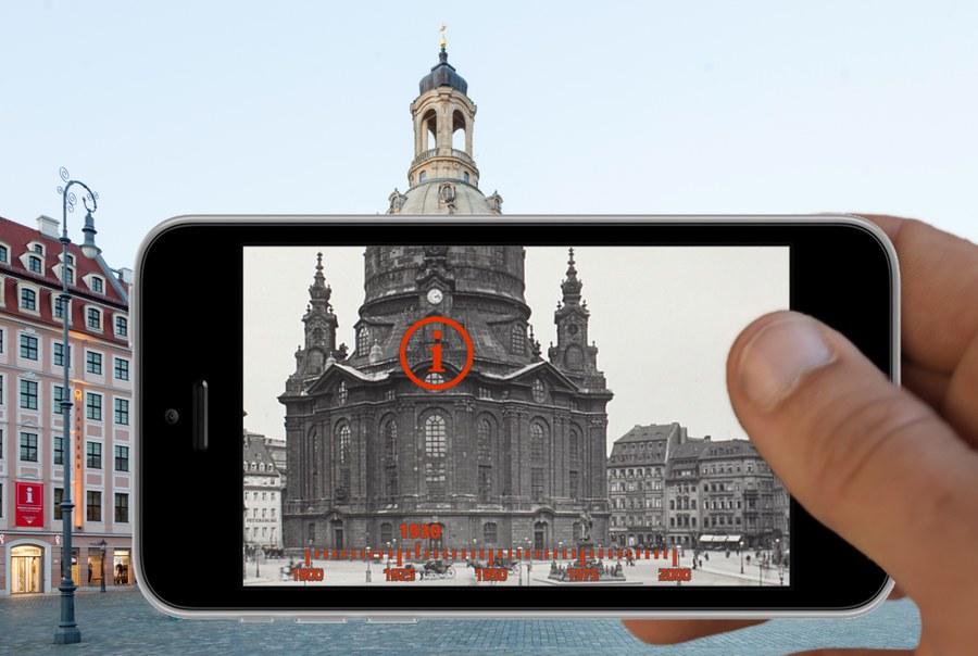
UrbanHistory4D – Multimodale Zugänge zu historischen Bildrepositorien • Automatisierte Geo- und Zeitreferenzierung von historischen Fotoaufnahmen der SLUB-Fotothek und photogrammetrische Erstellung eines historischen 3D-Stadtmodells

3D-Erfassung der Seeufer zweier Seen des Lausitzer Seenlandes mittels mobilem Laserscanning (Auftragsforschung Lausitzer und Mitteldeutsche Bergbau-Verwaltungsgesellschaft mbH)
Kalibriermethoden und Untersuchung der Genauigkeit terrestrischer Laserscanner • Teil des Projektes Prozessoptimierung, Qualitätsverbesserung & Auswertewerkzeuge für multi-texturierte Oberflächenmodelle (PROQUATO)

Quantitative Bildsequenzanalyse im Umweltmonitoring • Operationalisierung anspruchsvoller Messaufgaben im Umweltmonitoring
Modell-basierte photogrammetrische 3D-Erfassung dynamischer Prozesse • Projekt C1 des Graduiertenkollegs 2250/1: Impaktsicherheit von Baukonstruktionen durch mineralisch gebundene Komposite

Extremereignisse in kleinen und mittleren Einzugsgebieten (EXTRUSO) • Neue Monitoring- und Vorhersagetechnologien zum kooperativen Risikomanagement
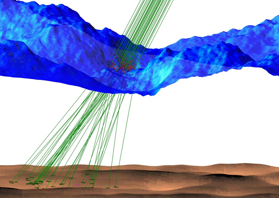
Refraktionseffekte in der Laserbathymetrie • Entwicklung eines Modells zur strengen Berücksichtigung von Refraktionseffekten in der Airborne Laserscanning Bathymetrie
stadtPARTHEland – Kulturlandschaftsmanagement als Brücke zwischen Metropole und ländlichem Raum • UAV-basierte photogrammetrische Datenakquistion und -auswertung

Photogrammetrische Überwachung von Umwelt-Prozessen in Patagonien • Veränderungsüberwachung von Gletschern und UAV-basiertes Monitoringkonzept für hangrutschungsgefährdete Flussläufe
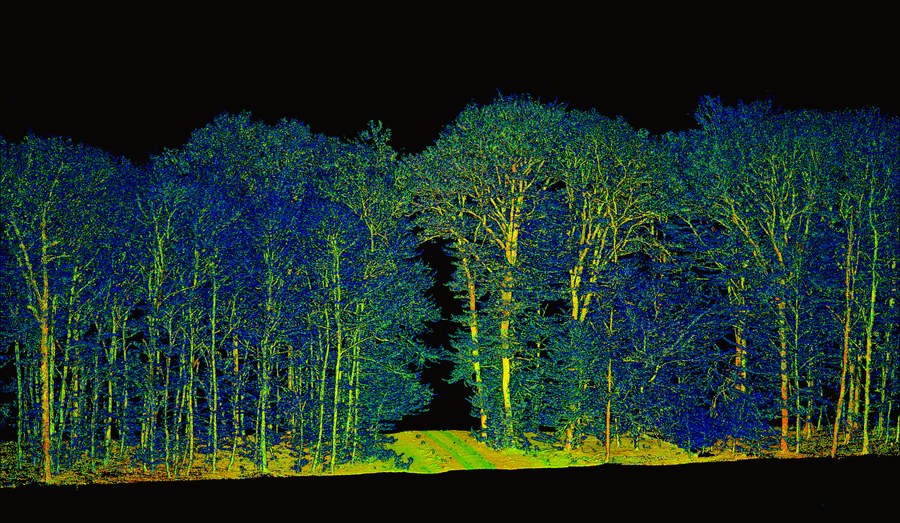
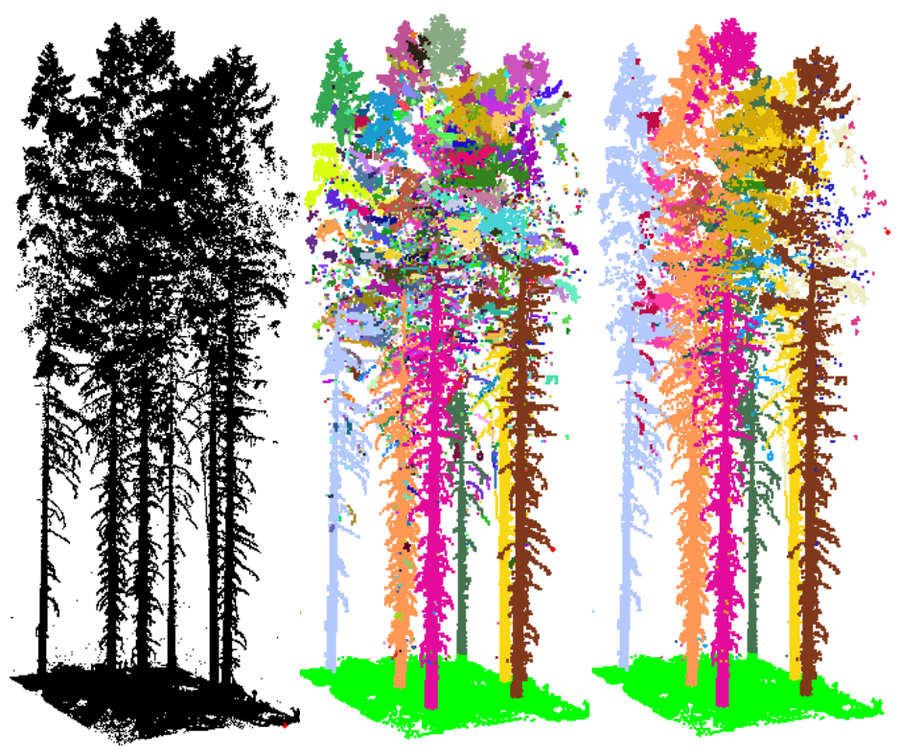
Analyse von Biodiversitätseffekten auf die Produktivität oberirdischer Biomasse in Wäldern • Weiterentwicklung des mechanistischen Verständnisses zeitlich-räumlicher Dynamik der Kronenraumbesetzung mithilfe Mobilen Laserscannings
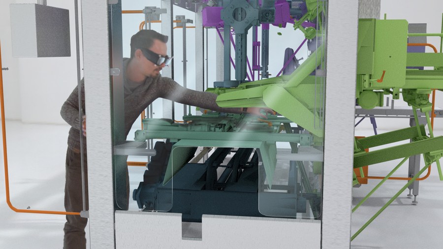
Chancen und Risiken von Ambient Intelligence (AmI) und Industrie 4.0 aus sicherheitstechnischer Sicht • Sichere Personenerkennung in der Mensch-Maschine-Interaktion
ADFEX • Adaptive föderative 3D-Exploration mit Multi-Roboter-Systemen

Volumetrische Rekonstruktion von Waldbeständen aus flugzeugbasierten Fullwaveform Laserscannerdaten • Voxelraum-basierte Analyse dämpfungskorrigierter Waveforms
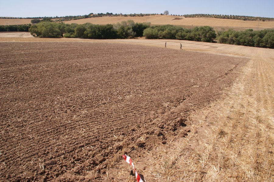
Bodenerosion in den Mergellandschaften Andalusiens • Hochauflösende Detektion und Modellierung langfristiger Geländeveränderungen mit TLS und UAV
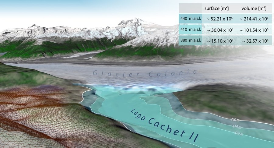
Photogrammetrische Überwachung von Gletscherrandseen • Konzeption eines GLOF-Frühwarnsystems
Reflektive Optiken für breitbandige photogrammetrische Messsysteme • Optimierung und Verifikation geometrischer Modelle für ein reflektives Kamerasystem

Multisensorielle Methoden zur Rekonstruktion der dreidimensionalen Waldstruktur • Dreidimensionale Rekonstruktion der Vegetationsstruktur und ihrer saisonalen Änderung
Turbulent exchange processes between forested areas and the atmosphere (TurbEFA) • Photogrammetrische dreidimensionale Erfassung und Analyse von Vegetationsbeständen
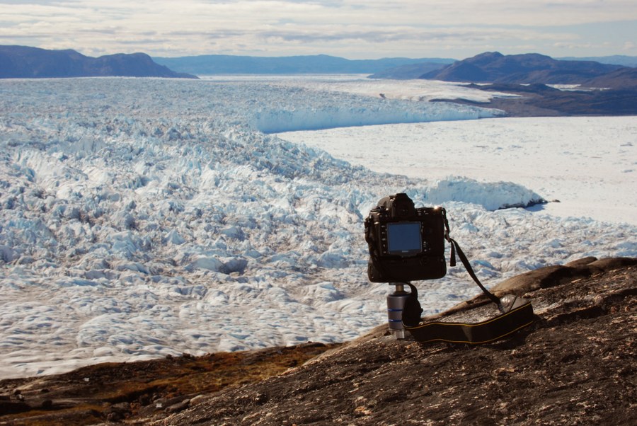
Messung und Analyse von Gletscherbewegungen • Photogrammetrische Bestimmung räumlich-zeitlich aufgelöster Geschwindigkeitsfelder an arktischen und patagonischen Gletschern

Terrestrisches Laserscanning in der Forstinventur • Automatische Bestimmung von forstinventur-relevanten Baumparametern aus terrestrischen Laserscannerpunktwolken
3D Building Extraction from LIDAR Data and Aerial Imagery
3D Particle Tracking Velocimetry • Bestimmung dreidimensionaler Strömungsgeschwindigkeitsfelder im Windkanal mittels einer multi-okularen Hochgeschwindigkeitskamera
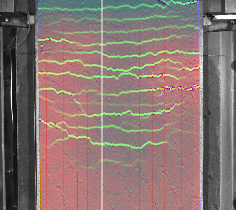
Versuchsgrenzlastindikatoren bei Belastungsversuchen • Rissdetektion und -verfolgung an Bauteilen aus Spannbeton und Bauteilen ohne Querkraftbewehrung
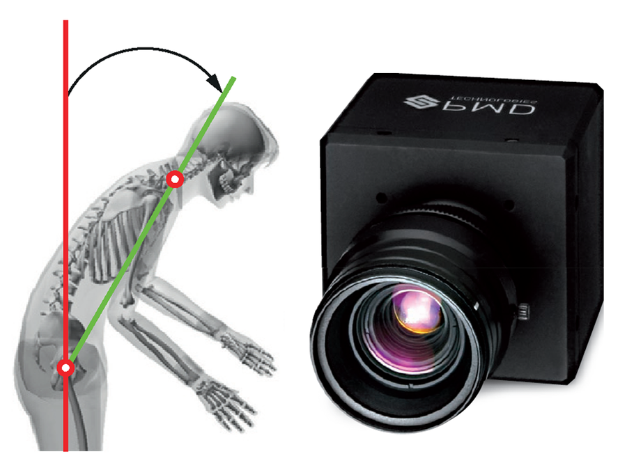
Automatische 3D-Erfassung von Zwangshaltungen am Arbeitsplatz • Strukturierte 3D-Bewegungsanalyse auf Basis von Tiefenbildkamera-Bildsequenzen

Earth observation and environmental modelling for the mitigation of health risks • Detektion von Umweltveränderungen in Geodaten und Untersuchung ihres Einflusses auf die menschliche Gesundheit
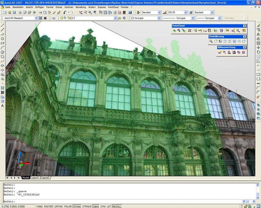
CAD-basierte bildgestützte Interpretation von Punktwolken • Automatisierte Referenzierung zwischen Punktwolken und Digitalbildern
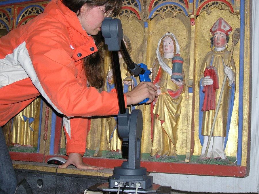
3D-Laserdigitalisierung von Skulpturen mit dem MicroScan 3D • Digitalisierung ausgewählter Skulpturen spätgotischer Flügelaltäre und Erzeugung von 3D-Modellen der Skulpturen

Hemisphärische Photogrammetrie in der Forstwissenschaft • Verbesserung der Diagnostik von Waldökosystemen unter besonderer Berücksichtigung strahlungsökologischer Fragen in Verbindung mit digitaler hemisphärischer Photogrammetrie

3D Gebäudemodellierung aus Flugzeuglaserscannerdaten• Entwicklung von Methoden zur automatischen Ableitung von 3D-Gebäudemodellen aus Laserscannerpunktwolken
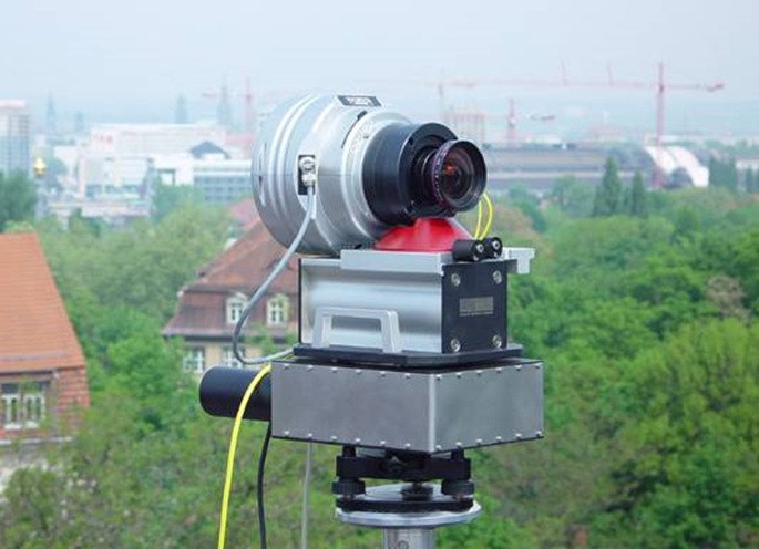
Geometrische Modellierung einer Panoramakamera • Geometrische Modellierung, Kalibrierung und photogrammetrische Anwendungen einer hochauflösenden Panoramakamera (--)
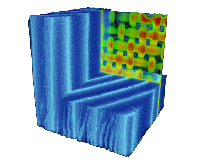
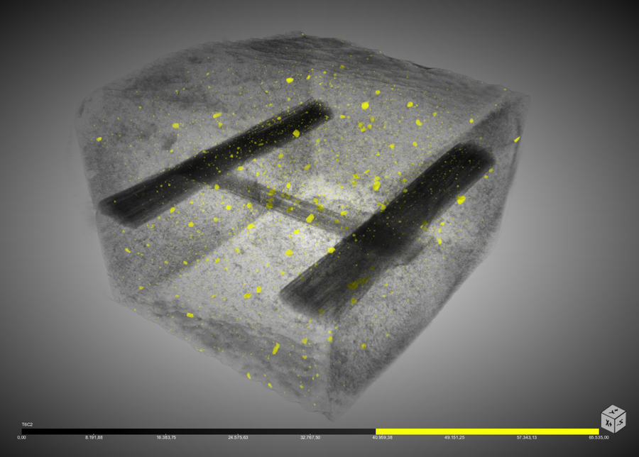
Computertomographie • Entwicklung von Bildanalyseverfahren zur Segmentierung von Voxeldaten und zur Änderungsdetektion in Voxeldatensequenzen
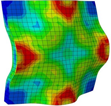
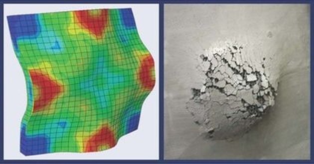
Materialprüfung • Erfassung der Verformungs-, Riss- und Schädigungsentwicklung von Baukonstruktionen bei baumechanischen Untersuchungen mit Hilfe digitaler photogrammetrischer Verfahren
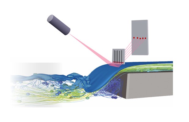
Photogrammetrische Bestimmung von Wasserspiegelprofilen • Verfahren der optischen Triangulation zur Bestimmung von zeitaufgelösten Wasserspiegelprofilen in hydraulischen Modellen
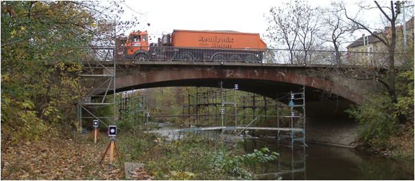
Photogrammetrische Deformationsmessung • Pilotstudie zur photogrammetrischen Deformationsmessung an Brücken auf Basis monoskopischer Bildsequenzauswertung