Apr 15, 2026
Measurement Campaign in Šluknov
Day 1 – Luční Potok
Starting at 10:00, the CTU team began setting up the necessary equipment to collect data in the beaver wetland. This included GPS-based mapping of pond boundaries and systematic water level measurements across gridded point networks, capturing the spatial variability of water surfaces within the ponds. The aim is to measure the volume of water in beaver wetlands. Moreover, the team collected data from the photos placed at the sites to monitor beaver activity and from the pressure sensors installed to monitor water levels. Around 16:00, the team moved to the second field site, Liščí potok, to check and get the data from the sensors and cameras installed. The filmmaker also joined the group to document these activities and conduct interviews with the team. This footage will contribute to the project's planned short film on the beaver dams.
Day 2 – Liščí Potok
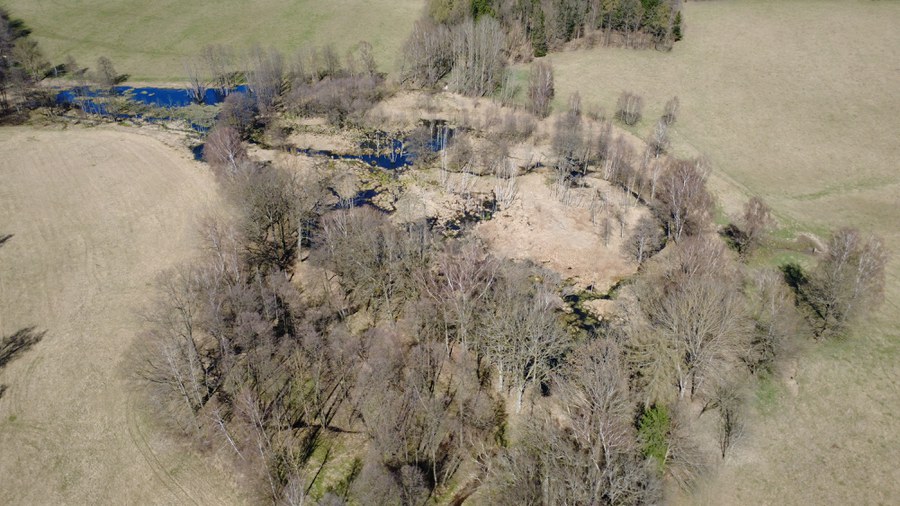
The second day was dedicated entirely to Liščí potok. The CTU team continued with the pond boundary surveys and gridded water level measurements to build a comprehensive picture of the wetland system's current hydrological state. On this day, the TUD team joined at Liščí Potok to measure the inflow and outflow of the beaver wetland. The TUD team also used GPS to map the river cross-sections upstream and downstream. Water levels and velocities at several points along the river were also recorded. Moreover, drone flight footage was captured to provide a bird 's-eye view of the wetland area.

© M. Schwöbel / IWD

© M. Schwöbel / IWD

© M. Schwöbel / IWD

© M. Schwöbel / IWD

© M. Bauer / CTUP

© M. Bauer / CTUP

© M. Bauer / CTUP


