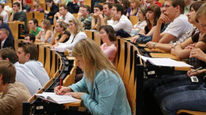
Umweltfernerkundung an der TU Dresden studieren
Die Professur bietet Lehrveranstaltungen in den Bachelorstudiengängen Umweltinformatik, Geographie und Geodäsie/Geoinformation sowie in den Masterstudiengängen Geoinformationstechnologien, Geodäsie, Geographie, Cartography, Forstwissenschaften und Tropical Forestry an.


 © M. Forkel
Lehre
Die Professur bietet Lehrveranstaltungen in den Studiengängen BSc Umweltinformatik, BSc Geographie, BSc Geodäsie und Geoinformation, MSc Geographie, MSc Geoinformationstechnologien, MSc Geodäsie, MSc Cartography, MSc Forstwissenschaften und MSc Tropical Forestry an. Der Schwerpunkt der Lehre liegt auf einer Vermittlung von Wissen an der Schnittstelle zwischen Fernerkundung (Sensoren, Daten, Methoden), Umweltforschung (Kohlenstoff- und Wasserkreislauf, Klimawandel, Ökosystemmodellierung) und Datenwissenschaft (Statistik, Zeitreihenanalyse, Bildverarbeitung, maschinelles Lernen, Parameterableitung).