Photogrammetry at TU Dresden
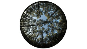
Photogrammetry is the technology for extracting precise and reliable 3D information from image data. Photogrammetry uses image analysis techniques for the automation of image measurement tasks, combined with strict geometric and stochastic modelling for optimizing solutions. The research focus of the Chair of Photogrammetry at TU Dresden is on the integration of imaging sensorics and image data processing chains with the goal of developing efficient solutions to new measurement tasks.
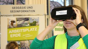
In teaching, our main activities are in the bachelor and master programs in Geodesy and Geoinformation Technology. In addition, we offer courses for forest science students and a minor for IT students at TU Dresden.
![Bild](https://tu-dresden.de/bu/umwelt/geo/ipf/photogrammetrie/ressourcen/bilder/professur/kontakt/bilder/huelssebau.gif/@@images/950e9d71-0ecd-45d2-8e99-7377760f2122.jpeg)
How to contact us
Secretariat
Mrs. Marta Bukowska-Bosse
Tel: +49 351 463-33680
Place
TU Dresden, HÜL-W5xx
Helmholtzstraße 10
D-01069 Dresden
Mail
TU Dresden
Institute of Photogrammetry and Remote Sensing
D-01062 Dresden
Parcels
TU Dresden
Institute of Photogrammetry and Remote Sensing
Helmholtzstraße 10
D-01069 Dresden
How to get to there by plane
• Airport Dresden International
• Suburban railway S2 (to Pirna), get off at Dresden Main Station
• Tram Line 3 (to Coschütz), get off at Münchner Platz
How to get to there by train
• German Railways (Deutsche Bahn) to Dresden Main Station
• Tram Line 3 (to Coschütz), get off at Münchner Platz
• Connection informatino (DVB AG)
How to get to there by car
• A17 to exit Südhöhe
• Approx. 1.5 km to towards the centre (Zentrum)
• Turn left at Fritz-Förster-Platz
• Approx. 300 m to Nürnberger Platz
• Turn left onto Münchner Straße
• After approx. 200 m turn left onto Helmholtzstraße (crossing tram rails)
• Parking on Helmholtzstraße and George-Bähr-Straße
• Routing (Google Maps)
Further information
• TU Dresden guest houses
• TU Dresden campus maps