Raivo - Miniaturized Drones and a Connected Automatic Shunting Vehicle for Digital Freight Terminals
Raivo combines an autonomous shunting vehicle, miniaturized drones, hybrid positioning and secure communication in a cooperative system for digital freight yards.
Within the subproject of the Chair of Information Technology for Transport Systems at TU Dresden, methods and system architectures for a drone-based positioning and communication system are being developed. The drones perform several functions: they capture the environment from an elevated perspective, serve as mobile reference points for positioning and support the autonomous vehicle as a “flying eye” and electronic towbar.
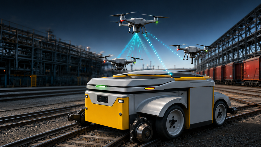
A major focus is the combination of different positioning and communication technologies. GNSS, Ultra-Wideband, LiFi, Bluetooth Low Energy and inertial sensors are integrated to provide robust positioning both outdoors and in areas with limited satellite visibility. The resulting data are fused and incorporated into a continuously updated digital situation map of the shunting area.
The LiFi-based electronic towbar enables precise distance and relative-position measurements between the drone and the vehicle. Optical data transmission also provides low-latency communication that is robust against electromagnetic interference. This allows the drone to support vehicle navigation, environmental monitoring and safety-related decision-making.
Another research topic is a mobile, self-configuring positioning network. Several drones can act as flying anchors, reducing the need for permanently installed infrastructure. This approach aims to lower the effort required for the installation, calibration and adaptation of stationary positioning systems.
A closed drone dock will be integrated into the road-rail vehicle to support autonomous drone operation. It enables automated take-off, landing, charging and protected transportation. Alternating operation of several drones is intended to provide continuous environmental and situation monitoring.
The ITVS research activities include:
- hybrid indoor and outdoor positioning,
- LiFi-based communication and ranging,
- drone-based SLAM mapping,
- multisensor data fusion,
- dynamic object tracking,
- flying positioning anchors,
- integration into a digital situation map,
- and safety-oriented decision logic.
The developed methods will first be evaluated in laboratory and demonstration environments in Dresden and will subsequently be tested together with the project partners under realistic operating conditions.
Objective
The objective is to develop a robust system for the safe automation of shunting operations with reduced dependence on fixed infrastructure. By combining vehicles, drones, sensors and a digital situation map, obstacles can be detected earlier, positions can be determined more accurately and operational processes can be planned more efficiently.
Project partner
- Bahnkonzept GmbH Deutschland
- dresden elektronik ingenieurtechnik GmbH
- Havelländische Eisenbahn AG
- Technische Universität Dresden, Professur für Informationstechnik für Verkehrssysteme
- G. Zwiehoff GmbH
- Railway Areas Innovation Lab Berlin Brandenburg e. V. as an associated partner
Project duration
1 June 2026 to 31 May 2029
Contact
Robert Richter
Chair of Information Technology for Transport Systems
TU Dresden
Email:
Funding Agency and Grant Program
Bundesministerium für Forschung, Technologie und Raumfahrt
Förderprogramm: KMU-innovativ
Technologiefeld: Elektronik und autonomes Fahren; Supercomputing