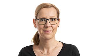
Dr.-Ing. Christin Henzen
 © GI
© GI
Dr.-Ing. Christin Henzen
Send encrypted email via the SecureMail portal (for TUD external users only).
Visiting Address:
Hülssebau, HÜL O154 Helmholtzstraße 10
01069 Dresden
Deutschland
Curriculum vitae
- 2022 - ongoing: Coordination NFDI4Earth
- 2022 - ongoing: OGC Data Quality DWG Co-Chair; Liason Expert in ISO19157-3 Development
- 2020 - ongoing: Head of Working Group Geo UX, German UPA
- 2017: Phd: Usability-Patterns für Webanwendungen in Geodateninfrastrukturen
- 2016 - 2018: 52°North Geoprocessing Community Co-lead
- 2014 - heute: 52°North Contributor, Software development
- 2014 - 2017: PhD student at the Faculty of Environmental Sciences, Technische Universität Dresden
- 2012 - ongoing: Consulting (Freelancer) for various IT projects
- 2012 - 2017: Webmaster for the Association of Geographic Information Laboratories for Europe (AGILE)
- 2011 - today: Software Engineering and Research for Various Projects and Teaching at Chair of Geoinformatics, Technische Universität Dresden
- 2009 - 2010: Software Engineering and Research for Various Projects and Teaching at Chair of Geoinformation Systems, Technische Universität Dresden
- 2008 - 2009: Concept and Realization of E-Learning Courses at Professorship of Biblical Theology, Technische Universität Dresden
- 2007 - 2010: Media Design, Software Engineering and Research for Various Projects and Teaching at Professorship of Media Design, Technische Universität Dresden
- Studies of Media and Computer Science, Minor: Cartography, Voluntary Courses: Art and Design, Technische Universität Dresden
Reviewing
- International Congress on Environmental Modelling and Software (iEMSs)
- ACM Conference on Designing Interactive Systems (DIS)
- International conference on Human-Computer Interaction with Mobile Devices (Mobile HCI)
- ACM SIGCHI Annual Symposium on Computer-Human Interaction in Play (CHI PLAY)
- ACM Symposium on Spatial User Interaction (SUI)
- ACM Intelligent User Interfaces (IUI)
- ACM Conference on Computer-Supported Cooperative Work and Social Computing (CSCW)
- ACM CHI
- ACM SIGCHI Symposium on Engineering Interactive Computing Systems (EICS)
- ACM Creativity and Cognition
- International Journal of Spatial Data Infrastructures Research
- Kartographische Nachrichten
Courses
Geoinformatics
- Entwicklung objektorientierter Geo-Software (Studiengänge Geographie, Geodäsie, Kartographie und Geomedientechnik; 2 SWS)
- Projektanwendungsseminar Geoinformatik I und II – Visualisierung zeitvarianter Geodaten in Geodateninfrastrukturen | Usability in der Geoinformatik (Studiengänge Geoinformationstechnologien, Informatik; 2 SWS)
- Geoinformatik II – Geodateninfrastruktur (Studiengänge Geoinformationstechnologien, Geodäsie, Geographie, Forstwissenschaften, Hydrologie, Raumentwicklung und Naturressourcenmanagement; 2 SWS)
- Geostatistik (Studiengang Geographie; 2 SWS)
- Grundlagen der Geoinformatik (Studiengang Geographie; 2 SWS)
Media Design
- Bildsprache (Studiengang Medieninformatik; 2 SWS)
- Grundlagen der Gestaltung (Studiengang Medieninformatik; 2 SWS)
- Mediengestaltung 2 (Studiengang Medieninformatik; 2 SWS)
- Intelligente Kamera (Studiengänge Medieninformatik, Informatik; 4 SWS)
Activities
- NFDI4Earth
- GeoKur (completed)
- Technische Umsetzung der geplanten Rechtsänderung für den Vertrieb digitaler Daten (completed)
- BOOT (completed)
- COLABIS (completed)
- GLUES 2 (completed)
- GLUES (completed)
- AG Geoportal Sachsen (completed)
- SchulWebGIS (completed)
Publications
2015
-
Design, implementation and test of a serious online game for exploring complex relationships of sustainable land management and human well-being, 2015, In: Environmental Modelling and Software. p. 58-66, 9 p.Electronic (full-text) versionResearch output: Contribution to journal > Research article
-
Geoprocessing Appstore – Open-Source-Community- Plattform für Geoprozessierung, 2015, In: AGIT : Journal für angewandte Geoinformatik. 1-2015, p. 404-408Electronic (full-text) versionResearch output: Contribution to journal > Conference article
-
Gesture Formalization for Multitouch, 2015, In: Software, practice & experience. 45, 4, p. 527-548, 22 p.Electronic (full-text) versionResearch output: Contribution to journal > Research article
2014
-
Experiences with a serious online game for exploring complex relationships of sustainable land management and human well-being: LandYOUs, 2014, p. 1121-1128, 8 p.Research output: Contribution to conferences > Paper
-
Experiences with a serious online game for exploring complex relationshops of sustainable land management and human well-being: LandYOUs, 2014Electronic (full-text) versionResearch output: Contribution to conferences > Paper
-
GeoMetaFacet 2.0 - Interaktive nutzerfreundliche Visualisierung von geograpischen Metadaten, 2014, Geoinformationen öffnen das Tor zur Welt: 34. Wissenschaftlich-Technische Jahrestagung der DGPF, 62. Deutscher Kartographentag der DGfK, Geoinformatik 2014 der GfGI und des GIN. Seyfert, E., Gülch, E., Heipke, C., Schiewe, J. & Sester, M. (eds.). Deutsche Gesellschaft für Photogrammetrie, Fernerkundung und Geoinformation (DGPF) e.V., Vol. 23. p. 302-309Electronic (full-text) versionResearch output: Contribution to book/conference proceedings/anthology/report > Conference contribution
-
GLUES GDI - Eine Geodateninfrastruktur für wissenschaftliche Umweltdaten, 2014, In: gis.Science - Die Zeitschrift für Geoinformatik. 4, p. 129-137, 9 p.Electronic (full-text) versionResearch output: Contribution to journal > Research article
-
Scientific geodata infrastructures: Challenges, approaches and directions, 2014, In: International Journal of Digital Earth. 7, 7, p. 613-633Electronic (full-text) versionResearch output: Contribution to journal > Research article
-
Spatial is special. Geodaten und -prozesse suchen, 2014Research output: Contribution to conferences > Paper
