
Prof. Dr. Lars Bernard
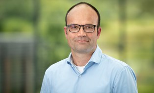 © Robert Lohse
Professor
NameProf. Dr. Lars Bernard
Send encrypted email via the SecureMail portal (for TUD external users only).
Visiting Address:
Hülssebau, HÜL O161 Helmholtzstraße 10
01069 Dresden
Deutschland
Lars Bernard is a full Professor for Geoinformatics; holds a Ph.D. in Geoinformatics and a Diploma Degree in Geography.
From 1995 to 2001, he worked as a research associate at the University of Münster; since 2001, he has served as a research assistant and in 2003, he stood in for a full Professorship in Geoinformatics at the University of Münster. In addition to his research and teaching in geoinformatics, he was actively involved in the development of GDI NRW during this time. In 2003, Lars moved to the Joint Research Center of the European Commission (Ispra, Italy). In the Spatial Data Infrastructures department, he supported the development of European Spatial Data Infrastructures, particularly the INSPIRE initiative, and coordinated research on the development of software architectures for distributed applications for the analysis and processing of geospatial data. In 2007, Lars Bernard became Professor for Geoinformations Systems in the Faculty of Environmental Sciences at TUD, Dresden University of Technology. In 2015 he becameFull Professor for Geoinformatics at TUD. In his research and teaching, he focuses on geoinformatics with an emphasis on GIS, GDI, and GI services for spatiotemporal simulation. Lars Bernard has (co-)authored a large number of scientific publications, (co-)organized numerous national and international conferences, and serves on a number of national and international committees.
Since 2019, Lars Bernard is the spokesperson for NFDI4Earth, the National Research Data Infrastructure for Earth System Sciences.
At TUD, he served as Dean of the Faculty of Environmental Sciences and Spokesperson for the School of Civil Engineering and Environment. Since 2020, he has been Chief Digitalization and Information Management Officer (CDIO) at TUD. In 2025, he became Vice Rector for Digitalization and University Development at TUD.
Curriculum vitae
- 2025- Vice-Rector Digitalization and University Development at TUD
- 2020- Chief Digitalization and Information Management Officer (CDIO) at TUD
- 2015- Full Professor for Geoinformatics (W3), Faculty of Environmental Sciences, Technische Universität Dresden
- 2007-2015 Associate Professor for GIS (W2), Faculty of Environmental Sciences, Technische Universität Dresden
- 2003-2006 Scientific Officer, European Commission, DG Joint Research Centre in Ispra (Italy)
- 2003-2004 Guest Lectureship, Carinthia University of Applied Sciences (Villach, Austria)
- 2003 Temporary Representing a Full Professorship in Geoinformatics, University of Münster
- 2001-2003 Assistant Professor, Institute of Geoinformatics, University of Münster
- 2001 Dr. rer. nat. in Geoinformatics, University of Münster
- 1995-2001 Research Associate, Institute of Geoinformatics, University of Münster
- 1995-2001 Software Engineer, con terra GmbH, Münster
- 1995 Diploma in Physical Geography, University of Münster
Activities (excerpt)
University (excerpt)
- Chairperson of the Board of the School of Civil and Environmental Engineering (TU Dresden 2019-2020)
- Dean of the Faculty Environmental Sciences (TU Dresden, 2018-2020)
- CIO School of Civil and Environmental Engineering (TU Dresden, 2013-2020)
- Chair of the Geosciences Department (TU Dresden, 2013-2019)
- Member of the Faculty Board Environmental Sciences (TU Dresden, 2010-)
- Student Advisor Geoinformation Technologies (TU Dresden, 2010-2020)
- Coordinator for the Master Geoinformation Technologies (Dresden, 2009-2018)
- Dean of Studies Geodesy, Cartography and Geoinformation Technologies (TU Dresden, 2010-2012)
- Member of the University Board for Data Processing Issues (TU Dresden, 2007-2013)
- Member board of the Faculty of Geosciences (University of Münster, 2002-2003)
- Student Advisor Geoinformatics (University of Münster, 1998-2003)
Scientific Boards, Conferences, Journals (excerpt)
- Spokesperson Base4NFDI (Base4NFDI, 2023-)
- Co-Chair RfII (RFII, 2020-)
- Spokesperson NFDI4Earth (NFDI4Earth, 2019-)
- Member of the Council for Information Infrastructures (RFII), established by the German a Joint Science Conference (Gemeinsamen Wissenschaftskonferenz-GWK) (2014-)
- Co-Chair der Association of Geographic Information Laboratories for Europe (AGILE, 2014-2016)
- National Delegate Academia European Spatial Data Research (EuroSDR, 2014-)
- Chair Commission 5 Network Services European Spatial Data Research (EuroSDR, 2011-2013)
- Council Member Association of Geographic Information Laboratories for Europe (AGILE, 2007-2016)
- Co-Chair AGILE-EuroSDR-OGC persistent GI-Testbed (2007-2013)
- Member Editorial Board Environmental Modelling & Software (2014-2018)
- Member Editorial Board International Journal of Spatial Data Infrastructures Research (2007-)
- Member Editorial Board GIS.Science (2007-)
- Co-Chair Scientific Program Committee AGILE 2009 (Hannover)
- Chair Scientific Program Committee AGILE 2008 (Girona)
- Chair Editorial Boards of the Journal GIS.Science (2007-2010)
- Co-Chair Workshop Beyond Spatial Data Infrastructures, GI Science 2006 (Münster)
- Co-Chair Research Workshop on Cross-learning on Spatial Data Infrastructures and Information Infrastructures 2005 (Enschede) Chair OpenGIS & ISO-TC 211 Tutorial and Interoperability Workshop, AGILE 2004 (Crete)
- Co-Chair IEEE Workshop Geographic Information Management 2004 (Zaragoza), 2005 (Copenhagen)
- Chair Scientific Committee GI-Tage 2003 (Münster)
- Chair AGILE Working Group Interoperability (2003-2006)
- Chair GeoSim 2000 (Münster)
- Member of Scientific Program Committees: AGILE (since 2004), EnviroInfo (since 2010), GSDI Scientific Track (2006, 2007), GI Forum (since 2007), GI Tage (since 2004), EC-GI & GIS Conference (2004, 2005) Reviewer for Computers & Geosciences, Environmental Earth Sciences, Environmental Modelling & Software, GIS.Science, International Journal on Geoinformation Science, International Journal of Spatial Data Infrastructures, ISPRS Journal of Photogrammetry and Remote Sensing, Transactions in GIS
- Reviewer for Scientific Journals: Computers & Geosciences, Environmental Earth Sciences, Environmental Modelling & Software, GIS.Science, International Journal on Geoinformation Science, International Journal of Spatial Data Infrastructures, ISPRS Journal of Photogrammetry and Remote Sensing, Transactions in GIS,...
- Reviewer for a number of Scientific Projects
Professional Boards and Working Groups (excerpt)
- Member Steering Committee GDI-DE, the German Geodata Infrastructure (2012-)
- Member Advisory Board 52°North GmbH (since 2008)
- Member Steering Committee GDI Sachsen (2008-2014)
- Member INSPIRE Drafting Team on Network Services (2005-2013)
- Chair Workshop Development of Portals for Geographic Information and Services, EC-GI & GIS Conference 2004 (Warsaw)
- Chair GDI NRW Testbed II (2002)
- Member GDI NRW Seering Committee (2002-2004)
Publications
2012
-
Wissenschaftliche Umweltdaten in Geodateninfrastrukturen, 2012, In: GIS-Report : Software, Daten, Firmen. 2012/13, p. 15-20Electronic (full-text) versionResearch output: Contribution to journal > Short survey/Review
2011
-
Linking the Outcomes of Scientific Research: Requirements from the Perspective of Geosciences, Oct 2011, LISC'11: Proceedings of the First International Conference on Linked Science. Kauppinen, T., Pouchard, L. C. & Keßler, C. (eds.). CEUR-WS.org, Vol. 783. p. 25-30, 6 p.Electronic (full-text) versionResearch output: Contribution to book/conference proceedings/anthology/report > Conference contribution
-
The role and development of a persistent interoperability test bed for geosciences research, 1 Sep 2011, Societal Challenges and Geoinformatics. Sinha, A. K., Arctur, D., Jackson, I. & Gundersen, L. C. (eds.). Boulder, Colo. : GSAElectronic (full-text) versionResearch output: Contribution to book/conference proceedings/anthology/report > Chapter in book/Anthology/Report
-
INSPIRE Umsetzung in der GDI Sachsen, 2011, Geoinformationssysteme: Beiträge zum 16. Münchner Fortbildungsseminar. Schilcher, M. (ed.). Heidelberg: abcVerlag, Vol. Edition GIS.Events. p. 114-121, 8 p.Research output: Contribution to book/conference proceedings/anthology/report > Conference contribution
-
Using Processing Descriptions for Service based Schema Transformations, 2011Research output: Contribution to conferences > Paper
-
Web-services for spatial data transformation and exchanges in SDI, 2011Research output: Contribution to conferences > Paper
-
Web-services for spatial data transformation and exchanges in SDI, 2011Research output: Contribution to conferences > Paper
2010
-
Moving code in spatial data infrastructures: Web Service Based Deployment of Geoprocessing Algorithms, Jul 2010, In: Transactions in GIS. 14, S1, p. 101-118, 18 p.Electronic (full-text) versionResearch output: Contribution to journal > Research article
-
Multi-criteria Evaluation for Emergency Management in Spatial Data Infrastructures, 15 Jan 2010, Geographic Information and Cartography for Risk and Crisis Management: Towards Better Solutions. Konecny, M., Zlatanova, S. & Bandrova, T. (eds.). Neuerscheinung ed., Heidelberg: Springer, Berlin [u. a.], Vol. 1. p. 273-286, 14 p., (Lecture Notes in Geoinformation and Cartography)Electronic (full-text) versionResearch output: Contribution to book/conference proceedings/anthology/report > Chapter in book/Anthology/Report
-
An Organisational Frame for Interoperability Testing in Spatial Data Infrastructures, 2010Research output: Contribution to conferences > Paper
 This information is provided by the FIS.