
An Overview of the offered Courses
Table of contents
Current Courses
Winter Semester
Summer Semester
Fundamentals of Geoinformatics
Course Materials:
OPAL
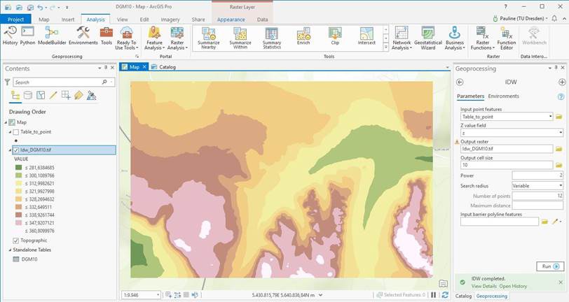
Geoinformatics (geoinformation science) deals with the development and application of computational methods to solve discipline-specific problems in the geo- and environmental sciences, with particular emphasis on the spatiotemporal references of the data; geoinformatics methods are used to derive discipline-specific geoinformation from geodata.
The lecture introduces the relevant mathematical and computational foundations of geoinformatics, the fundamentals of geodata modeling and analysis, and the basics of geodatabases and geographic information systems (GIS). The lab exercises introduce students to databases and geographic information systems (ArcGIS) using simple application examples. This module is conducted in German.
Offered in the winter semester in the B.Sc. Geodäsie & Geoinformation (UW-B-GG-05), B.Sc. Umweltinformatik (UW-UI-B-101), B.Sc. Geographie (UW-GeoB-315), LA Geographie Gym (UW-SEGY-GEO-11), Diplom Informatik NF (INF-D-510), M.Sc. Computer Science (INF-25-Ma-NGR-GEO), B.Sc. Angewandte Informatik (Geoinformatik), M.Sc. RUN (UWMRN 2.1.10), B.Sc. Hydrowissenschaften (UW-BHW-106), Verkehrsingenieurwesen (VW-VI-592), M.Sc. Mobility Systems (VW-MOBS-90-DM) (among others)
GIS and Geodatabases
Course Materials:
OPAL

Teaching students how to create conceptual geodata models and how to implement or realize these models using a geodatabase (PostgreSQL/PostGIS). The fundamentals are taught and applied in an introductory section consisting of lectures and exercises (focusing in particular on relational databases, normal forms, Spatial SQL, index structures, and database integrity). Students then apply this knowledge in a practical GIS project (selecting their own analysis topic, developing research questions, building a geodatabase, conducting geodatabase-based analysis, and presenting and interpreting the results). This module is conducted in German.
Offered in the summer semester in the B.Sc. Geodäsie & Geoinformation (UW-B-GG-18), B.Sc. Umweltinformatik (UW-UI-B-402), B.Sc. Geographie (UW-GeoB-633 / UW-GeoB-654), Diplom Informatik NF (INF-D-510), M.Sc. Computer Science (INF-25-Ma-NVE-GEO), B.Sc. Angewandte Informatik (Geoinformatik), B.Sc. Hydrowissenschaften (UW-BHW-659), M.Sc. RUN, M.Sc. Mobility Systems (VW-MOBS-91-DM), Verkehr (among others)
Development of Object-Oriented Geosoftware
Course Materials:
OPAL

Introduction to the design and programming of object-oriented geosoftware using UML and Python. The module focuses specifically on Python-based programming of geographic applications (geosoftware). Therefore, common open-source libraries (including Geopandas and Xarray) for geodata processing, analysis, and visualization are introduced and used. The course is intended for beginners in programming with basic knowledge of geoinformatics. A prerequisite for participation is completion of the “Fundamentals of Geoinformatics” course. This module is conducted in German.
Offered in the summer semester in the B.Sc. Geodäsie & Geoinformation (UW-B-GG-09), B.Sc. Umweltinformatik (UW-UI-B-201), B.Sc. Geographie (UW-GeoB-450), B.Sc. Angewandte Informatik (Geoinformatik)
Geostatistics
Course Materials:
OPAL

Fundamentals of the most important quantitative and qualitative statistical methods and their application to the geosciences and environmental sciences.
The most important quantitative methods (in particular descriptive, inferential, and exploratory statistics) as well as multivariate statistical methods are implemented using the statistical software packages of R. This module is conducted in German.
Offered in the summer semester in the B.Sc. Umweltinformatik (UW-UI-B-202), B.Sc. Geographie (UW-GeoB-211), B.Sc. Angewandte Informatik (Geoinformatik)
Geodata Infrastructures (GDI)
Course Materials:
OPAL

Provides knowledge regarding the organizational and technical concepts of geodata infrastructures as well as the interoperability of geoinformation. The lecture provides an overview of -organizations dedicated to building infrastructures based on interoperable geoinformation services (GDI/SDI), -architectures and protocols for interoperable systems, -specifications for interoperable geoinformation services, and current research in these fields.
In the lab exercises, students gain hands-on experience with GDI and set up and test interoperable geoinformation services. Topics covered include the use of OGC-compliant web services for providing metadata, map visualizations, and geodata; the cross-platform use of these interoperable geoinformation services; and the provision of geoinformation services for data processing. This module is conducted in English.
Offered in the winter semester in M.Sc. Geoinformatics (UW-M-GI-01), M.Sc. Geodäsie (UW-M-G-29, GDI und Generalisierung: UW-M-G-17), Int. Cartography M.Sc. (MSc Cart 10), M.Sc. Hydrologie (MHW-UW-M-GEO-K4), Diplom Informatik NF Geoinformatik (INF-25-Ma-NSP-GEO1, INF-D-920), M.Sc. Computational Modelling and Simulation (CMS-TRK-ED5), M.Sc. Transportation Economics (VW-TEc-MA-VIW 132), M.Sc. Mobility Systems (VW-MOBS-192-DM) (among others)
Geoinformation Services
Course Materials:
OPAL
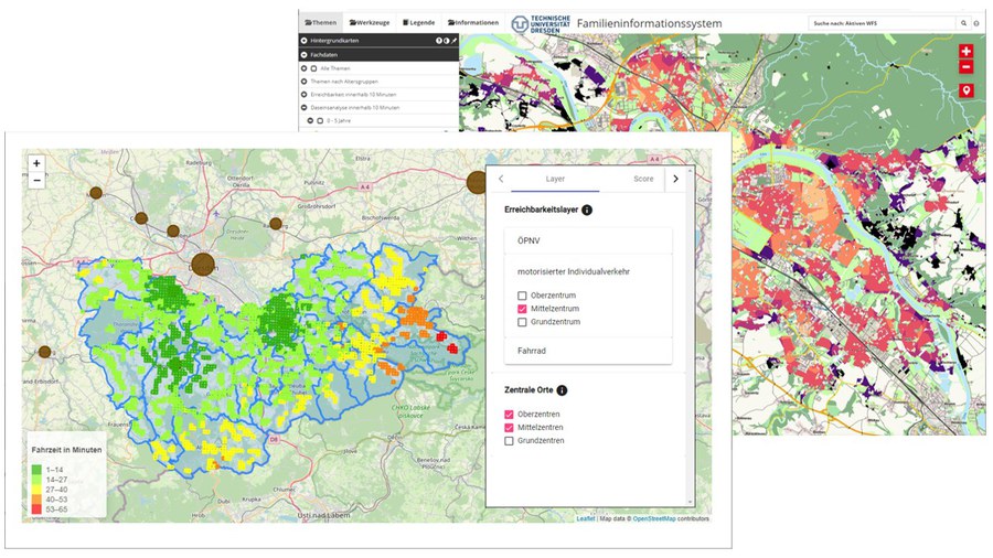
Seminar and practicum on current research and developments in the field of geoinformation services and systems (e.g., on technologies such as SensorWeb, distributed geoprocessing, or AI, or on specific GI application areas such as public services or urban mobility). The module is often offered in cooperation with government agencies or companies.
In the seminar, the specific topics are explored theoretically, potential solutions are developed and then prototypically implemented in a team-based project. This module is conducted in English.
Offered in the M.Sc. Geoinformatics (UW-M-GI-106), M.Sc. Geodäsie (UW-M-G-30), Diplom Informatik NF Geoinformatik (INF-25-Ma-NSP-GEO2, INF-D-920), M.Sc. Mobility Systems (VW-MOBS-193-DM)