Studying global change with satellites
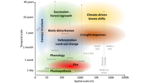
Our research focuses on the application and development of satellite data sets and derived products to observe, analyse, model and predict changes in vegetation and the related impacts on the carbon and water cycle in ecosystems. We use and develop data-driven methods such as time series analysis and machine learning as well as process-based environmental models and model-data integration techniques.
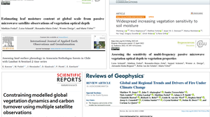 © TUD-EnvRS
Research of the Environmental Remote Sensing Group
We develop and apply satellite data sets and derived products to observe, analyse, model and predict changes in vegetation, fires and the related impacts on the carbon and water cycle in ecosystems. We use and develop data-driven methods such as time series analysis and machine learning as well as process-based environmental models and model-data integration techniques.
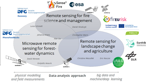
The research in the EnvRS group is clustered in three inter-linked research topics. The research topics cover different scales (local to global) and make use of different approaches of data analysis in remote sensing (e.g. field measurements, physical modelling, radiative transfer modelling, model inversion, time series analysis, machine learning, deep learning):
- Microwave remote sensing of forest-water interactions
- Integrative remote sensing for fire science and management
- Remote sensing for landscape change and agriculture

