Calibration methods and accuracy assessment for terrestrial laser scanners (PROQUATO)
Overall project title
Process optimization, quality improvement & analysis tools for multi-textured surface models (PROQUATO)
Funding
The Central Innovation Program for SMEs (ZIM) on behalf of the Federal Ministry for Economic Affairs and Energy (BMWi), coordinated by the research network „3D-Pointcloud“ GEOkomm e.V.
Description
In the sector of cultural heritage documentation, restauration documentation and building research, a complex optimization concept will be implemented. Therefore, procedures in data acquisition, processing and transfer of generated data will be improved and the overall efficiency will be increased. The aim is to create more precise and reliable documentary results and to open up for a wider target group.
The first optimization concept part is focused on the full exploitation of the terrestrial laser scanner (TLS) accuracy potential. Terrestrial laser scanners are pre-calibrated by the manufacturers for a cross-section of their respective application area. Since there is a strong variation in TLS applications regarding to spatial extension of the measurement object, type and characteristic of the object geometry and the expected accuracy, there is a demand for an end-user feasible and project-specific TLS calibration.
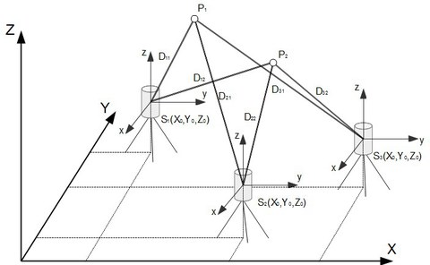
The project aims to develop and to evaluate an almost manufacture-independent calibration with variable parameterization, which will be integrated into the project partners (fokus GmbH) software package. Thus end-user will be able to perform an TLS on-the-job-calibration and improve the 3D point cloud quality. The calibration-procedure should be applicable for different TLS-types and directly on the actual measurement project data (multiple stations, discrete target points).
In this subproject a variable parameterized geometric model, which will be adaptable for different laser scanner architectures, will be developed. Pre-existing parameterization should be evaluated and integrated depending on their determinability and statistical significance. Economic efficancy and accuracy in using terrestrial laser scanning will be increased due to the integration of the developed calibration module in the fokus GmbH software package.
In future works, additional image informations should be included in the laser scanner calibration process to enhance the accuracy.
Relevant Publications
Project Partners
ContaCt
- Dr.-Ing. Danilo Schneider (project management)
- Dipl.-Ing. Robert Blaskow, Dipl.-Ing. David Mader (project work)

