Environmental monitoring in Patagonia
Project title
Monitoring of environmental processes in Patagonia using photogrammetric and remote sensing techniques
Funding
Federal Ministry of Education and Research (BMBF)
Motivation
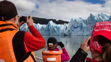
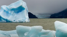
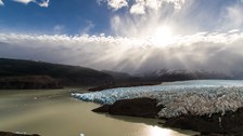
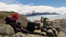
The main objectiv of the research project with the Dirección de Programas y Antárticos Subantárticos (DPA) of the Universidad de Magallanes (UMAG) in Punta Areas was the development of photogrammetric and remote sensing methods for monitoring environmental processes in Patagonia. The main focus of the project was thereby on the monitoring of Patagonian glaciers in Chile (using the example of Grey glacier) on the one hand, and the development of a concept for a camera-supported pre-warning system of flood hazards (using the example of the Rio de las Minas in Punta Arenas) on the other hand.
Data Acquisition & Processing
Glacier monitoring
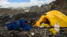
- Installation of a terrestrial camera system at Grey Glacier
- Acquisition of a temporal and spatial high-resolution image sequence
- 3D terrain model generation based on an additionally measured photogrammetric network
-
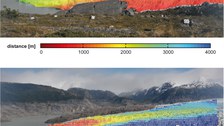
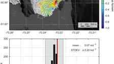
Determination of glacier flow velocities by tracking glacier surface features in the sequence images and by scaling the derived motion vectors using 3D terrain information
-
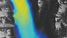
Validation of terrestrial flow velocities by comparing them to velocity fields derived from satellite data (Landsat 8)

© Robert Koschitzki

© Robert Koschitzki

© Robert Koschitzki

© Robert Koschitzki

© Robert Koschitzki

© Robert Koschitzki
River monitoring
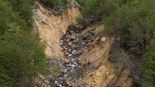
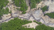
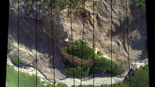
- Comprehensive examination of the landslide prone river Las Minas in Punta Arenas
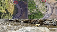
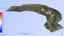
- Aerial survey of endangered areas and record of high temporal resolution image sequences at two epochs (2014/2015)
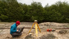
- Measurement of natural reference points in the river valley with DGPS
- Deriving three-dimensional terrain information using "structure-from-motion" techniques and geo-referencing via the measured reference points
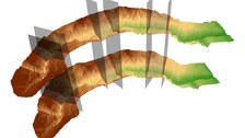
- Compensation of local modeling inaccuracies via iterative co-registration in sections
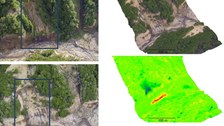
- Terrain model comparison and deformation analysis

© Robert Koschitzki

© IPF

© Robert Koschitzki

© IPF

© IPF
Results
Glacier monitoring
- Dense velocity field for the middle terminal glacier tongue of Grey Glacier covering an area of 2 x 2 km.
- Determination of the maximal flow velocity of Grey Glacier with 2.8 m·d-1close to
the glacier front. In a distance of 2 km from the glacier front the maximal flow velocity decreases to 1.5 m·d-1. - Mean standard deviation of terrestrial velocity determination: ±6,9 cm·d-1
- Good agreement of the terrestrial results with velocity values derived from satellite images (mean differences: ±0,2 m·d-1).

© IPF

© IPF

© IPF
River monitoring
- Determination of volume changes (erosion- and ablation zones) between two epochs and localisation of landslides in the river valley
- Developement of a UAV-based monitoring concept for the river "Rio de las Minas"

© IPF

© IPF

© IPF
Related Publications
Project partnerS
- Dr.-Ing. Carlos Cárdenas, M.Sc. Erling Johnson (Dirección de Programas Antárticos y Sub-Antárticos, Punta Arenas/Chile)
CONTACT
- Prof. Dr. habil. Hans-Gerd Maas (project managment)
- Dipl.-Wirt.-Ing. Robert Koschitzki, Dr.-Ing. Ellen Schwalbe (project work)

