Schriftenreihe - Fernerkundung und angewandte Geoinformatik
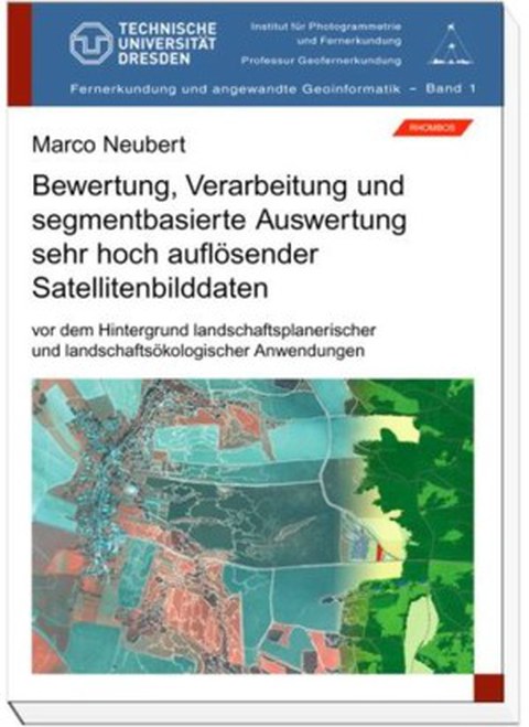
Bewertung, Verarbeitung und segmentbasierte Auswertung sehr hoch auflösender Satellitenbilddaten vor dem Hintergrund landschaftsplanerischer landschaftsökologischer Anwendungen
Autor: Marco Neubert
Herausgeber: Elmar Csaplovics
Band: 1
Preis: 30,- € [bestellen]
Verlag: [Rhombos Verlag]
Inhalt: Die computergestützte Bildauswertung gewinnt gegenüber analogen Verfahren mehr und mehr an Bedeutung. Diese modernen Arbeitsmethoden werden insbesondere zur Auswertung der sehr hoch aufgelösten Fernerkundungsdaten eingesetzt, die sich in den vergangenen Jahren rasant weiterentwickelt haben. Vor diesem Hintergrund spannt die Methodisch angewandte Arbeit einen Bogen von den für das Verständnis notwendigen theoretischen Grundlagen der Bildverarbeitung, über spezielle Verfahren der segementbasierten Klassifikation bis hin zu konkreten Einsatzmöglichkeiten. Die hier vorgestellten Anwendungsbeispiele dienen der Informationsgewinnung aus Fernerkundungsdaten zu Planungszwecken. Die angewendeten segmentbasierten Bildverarbeitungsverfahren finden derzeit international große Beachtung und werden erst in wenigen aktuellen Lehrbüchern erwähnt.
Marco Neubert, geboren 1974 studierte von 1994 bis 2000 an der Technischen Universität Dresden Geographie. Während seines Studiums absolvierte er Arbeitsaufenthalte an der Simon Fraser University in Vancouver (Kanada) sowie am Umweltforschungszentrum Leipzig. Seit 2000 ist er Wissenschaftlicher Mitarbeiter am Leibniz-Institut für ökologische Raumentwicklung e.V. Dresden. Mit der vorliegenden Dissertation promovierte er 2005 an der Technischen Universität Dresden. Seine Arbeitsschwerpunkte sind Angewandte Geoinformatik (GIS, Fernerkundung, digtale Bildverarbeitung) und Landschaftsökologie.
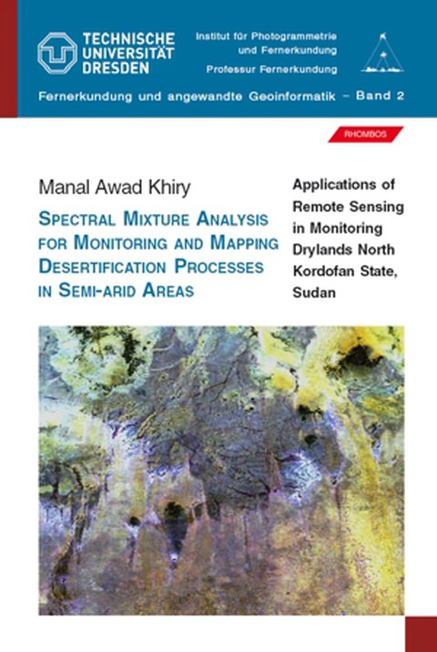
Spectral Mixture Analysis for Monitoring and Mapping Dessertification Processes in Semi-Arid Areas; Applications of Remote Sensing in Monitoring Drylands North Kordofan State, Sudan
Autor: Manal Awad Khiry
Herausgeber: Elmar Csaplovics
Band: 2
Preis: 39,50 € [bestellen]
Verlag: [Rhombos Verlag]
Inhalt: Land degradation due to environmental hazards or man malpractices coupled with successive drought episodes are major problems reducing the capacity of land to produce and regenerate spontaneously in the fragile arid zone of North Kordofan State.Traditional shifting cultivation together with concentration of livestock around perennial sources of water causes excessive utilization of forage plants and alters vegetation composition which ultimately contributes to vegetation and land degradation, sand encroachment and invasion by mobile dunes in the study area. To fill the gap in the technical knowledge with regard to application and adoption of spectral mixture analysis (SMA) and multi-temporal remote sensing data to detect and map desertification processes in semi-arid region of North Kordofan. Three Landsat MSS, TM and ETM+ scenes were selected. Linear Mixture Model (LMM) and Principle Component Analysis (PCA) were conducted. Eolain Mapping Index (EMI) was also used to map the areas that are frequently subjected to wind erosion hazard. Interpretation of ancillary data and field observations as well as statistical measurements was used to verify the role of human impacts on temporal change of both vegetation cover and sand soil. In this way of thinking, the current study tried to merge remote sensing, climatic and field data to enlighten the nature and consequences of desertification processes in the targeted area. This linkage imposes logical framework to the package of analysis undertaken by author.
Manal Awad Khiry was born in 1970 in Karema, Northern State-Sudan. She has obtained her B.Sc. at the Faculty of Forestry, University of Khartoum in 1997, where she has been working as teaching assistant since then. She has been graduated with her M.Sc. at the Institute of International Forestry and Forest Products, Dresden University of Technology- Germany in 2003. Recently (2007), she has acquired her PhD degree at the Institute of Photogrammetry and Remote Sensing, Dresden University of Technology. Ms. Khiry has distinguished herself as a conscientious and energetic pioneer in the field of remote sensing and GIS. Her teaching and practical capabilities have grown enormously as she has been enrolled in teaching process at the Institute of Photogrammetry and Remote Sensing. She participated in several international workshops and scientific forums. This assists her greatly to spread her excitement and to share her talents with others. Alongside the remote sensing and GIS as major field, Ms. Khiry has motivated her skills as key person with regard to some technical aspects in such major context as multiteporal satellite images analysis and land cover change in drylands.
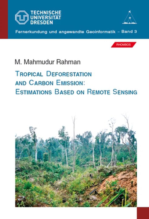
Tropical Deforestration and Carbon Emission: Estimations Based on Remote Sensing
Autor: M. Mahmudur Rahman
Herausgeber: Elmar Csaplovics
Band: 3
Verlag: [Rhombos Verlag]
Inhalt: The issue of climate change is often discussed by the environmentalists and carbon emission is one of the main drivers of this threat. Increasing accumulation of atmospheric CO2 is the consequence of human activities including fossil-fuel emission and deforestation. Our civilization would not be able to drastically cut fossil-fuel burning unless an alternative source of energy is discovered. On the other hand, global carbon emission can be reduced by halting deforestation. This research work contributes to integrate remote sensing and terrestrial sample-based forest inventory data for estimation of carbon pool in a forest ecosystem using an alternate regression technique. Regression has been used to estimate forest biomass (carbon stocks) from remotely sensed data over decades. The investigation applied dummy variables in regression analysis and the dummies were set from the optimal stratification of forest-land. The finding increased the correlation that often used as an indicator of precision in regression modelling. Tropical forest region of south-eastern Bangladesh was selected as testsite, which had been affected by deforestation in the past decades. Finally, the study estimated the amount of carbon released with the result of forest cover change in the region. The technique proposed in this study can be extended to the deforestation hotspots to estimate carbon emission and would help to understand the terrestrial carbon dynamics and global climate change.
M. Mahmudur Rahman was born in 1972 in Mymensingh, a northern city of Bangladesh. He obtained B.Sc. (Hons.) at Institute of Forestry (later changed to Institute of Forestry and Environmental Sciences), University of Chittagong (Bangladesh). He started his professional career as Assistant Conservator of Forests (ACF) at Bangladesh Forest Department in 1995. After a few months he changed his job to Bangladesh Space Research & Remote Sensing Organization (SPARRSO) and started working as a researcher. He completed M.Sc. (2000) and PhD (2004) from Faculty of Forest, Hydro- and Geosciences, Dresden University of Technology (Germany). Then he returned back to SPARRSO and applied remote sensing techniques for various applications in Bangladesh. Currently he is working at Center for Environmental Remote Sensing (CEReS), Chiba University (Japan) as a post-doctoral researcher funded by Japan Society for the Promotion of Science (JSPS). He presented his research-work at many international conferences and published peer-reviewed articles in scientific journals. Mr. Rahman has devoted himself to carry out investigations for several environmental issues of the Earth using both optical and microwave remote sensing technology.
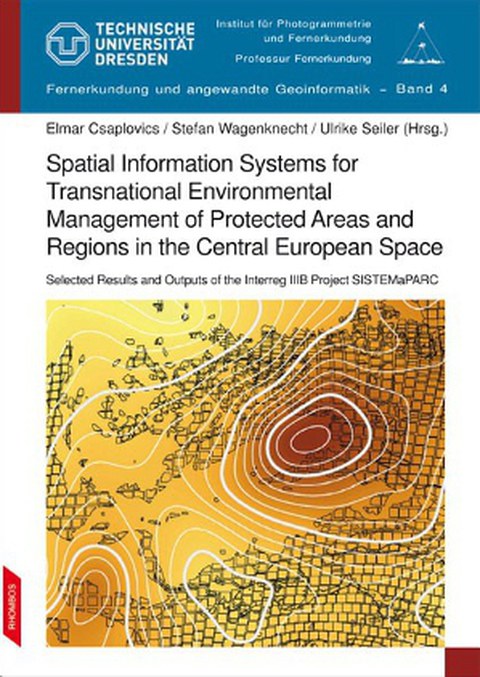
Spatial Information Systems for Transnational Environmental Management of Protected Areas and Regions in the Central European Space - Selected Results and Outputs of the EU-Project SISTEMaPARC
Autor: Stefan Wagenknecht
Herausgeber: Elmar Csaplovics
Band: 4
Verlag: [Rhombos Verlag]
Inhalt: Often one region of cultural and natural heritage is divided by frontiers into two or more protected landscape areas with two or more administrative authorities and two or more management structures and - if existing – with two or more different approaches to the integration of spatial geographic information systems (SIS/GIS). The increasing demand for transnational initiatives in planning and management of cross-border protected regions in particular is backed by various European and global initiatives like the Flora Fauna Habitat directive of the European Community, the World Conservation Monitoring programme of the UN-Environmental Programme and the UNESCO - World Heritage list. These initiatives foster efforts to improve or establish cooperations between administrative authorities from local to transnational level. There is urgent need for cross-border homogenised documentation of natural heritage. It is a matter of fact that a synthesis of management issues of protected areas by networks of spatial information systems has to be strengthened. The project SISTEMaPARC within the EU-INTERREG III B CADSES programme was aimed to establish, develop and maintain joint cross-border and transnational communication and management platforms of spatial information analysis, exchange and application for improving networks connecting partner regions in Central Europe. The cross-border regions of Saxon-Bohemian Switzerland (G/CZ), Lake Neusiedl-Seewinkel / Fertö-Hanság (AT/HU), Giant Mountains (CZ/PL) and Triglav / Prealpi Giulie (SI/IT) were the core regions in the project. The establishment of a transnational homogenised data base network and management including easy-to-handle software tools for data treatment and communication procedures in accordance with the framework of European and global environmental initiatives were the main project objectives. The project closure was linked to the first International Symposium on Geoinformatics in European Nature Protection Regions - Nature Protection : GIS, which assembled over 100 experts in spatial regional management of protected areas and regions and allowed for the extension and consolidation of contacts and perspectives of cooperation with partners from all over Europe (www.natureprotection-gis.de). The transnational approach of the project mission is thoroughly open-ended and allowed for the successive integration of additional regions during the project duration as well as for the preparation and implementation of follow-up activities.
The project SISTEMaPARC (Spatial Information Systems for Transnational and Environmental Management of Protected Areas and Regions in CADSES) was part of the Community Initiative Programme INTERREG III B CADSES (Central, Adriatic, Danubian and South-Eastern European Space) and was part-financed by the European Union. It was approved in summer 2003 under programme priority 3 (Promotion and Management of Landscape, Natural and Cultural Heritage), measure 3.2 (Protecting and Developing Natural Heritage). It integrated 20 partners from 7 European countries (Italy, Slovenia, Hungary, Austria, Czech Republic, Poland, Germany) and ran from January 2004 till December 2006 and - for reasons of financial processing - till June 2007 respectively. It is followed by the accepted project TransEcoNet (Transnational Ecological Networks in Central Europe) under the Community Initiative INTERREG IVB CENTRAL with a scheduled runtime from January 2009 till April 2012.
Vergleichende Untersuchungen der Atmosphärenkorrekturprogramme ATCOR und FLAASH auf der Datengrundlage des Satellitensystems IKONOS
Autor: Andreas Schmidt, Pierre Karrasch, Marco Neubert
Herausgeber: Elmar Csaplovics
Band: 5
Verlag: [Rhombos Verlag]
Inhalt: Elektromagnetische Strahlung stellt in der Satellitenfernerkundung den Träger der Information dar. Häufig geschieht dies durch die Verwendung passiver Systeme, bei denen solare Strahlung die Atmosphäre auf ihrem Weg zum Sensor zweimal durchläuft. Dabei zeigt sich, dass verschiedene Absorptions- und Streuprozesse das ungestörte Sonnenspektrum nach dem Eintritt in die Erdatmosphäre modifizieren. Über die breitbandige Abschwächung hinaus, welche in erster Linie durch Aerosole und Moleküle erfolgt, stellen vor allem Bestandteile wie Wasserdampf, Ozon, Kohlendioxid und Methan wichtige Absorptionsbanden dar. Daraus folgt, dass die Satellitenfernerkundung ihre Aufgabe als Datenlieferant für Geoinformationssysteme nur dann wahrnehmen kann, wenn dieser Einfluss minimiert oder beseitigt wird. Anbieter fernerkundlicher Software haben diesen Bedarf erkannt und in den vergangenen Jahren ihre Produkte mit entsprechenden Tools ausgestattet, die die oberhalb der Atmosphäregemessenen Daten (TOA, engl. top of atmosphere) in Reflektanzen am Boden überführt. Die Reflektanz ist dabei eine physikalische, stoffkennzeichnende Größe, welche abhängig von der betrachteten Wellenlänge und dem Material ist. Gerade mit Blick auf die räumliche und zeitliche Vergleichbarkeit zeigt die Größe der Reflektanz ihre Vorteile. Unabhängig vom Aufnahmeort und der Aufnahmezeit lassen sich auch sensorübergreifend Daten zuverlässig miteinander vergleichen. Die Atmosphärenkorrektur stellt somit einen wichtigen Schritt der Vorprozessierung fernerkundlich gewonnener Daten dar und ermöglicht es, dass der Vielzahl verschiedener Verfahren der Informationsgewinnung solide Basisdaten zur Verfügung gestellt werden können. Im Rahmen dieser Arbeit wurden mit ATCOR und FLAASH zwei Produkte vergleichend untersucht. Das ursprünglich von Dr. Rudolf Richter am DLR entwickelte ATCOR stand dafür als Implementierung von ERDAS IMAGINE 9.1 zur Verfügung. Das von Spectral Sciences, Inc. gemeinschaftlich mit dem U.S. Air Force Research Laboratory (AFRL) und Spectral Information Technology Application Center (SITAC) entwickelte FLAASH, wurde innerhalb der Softwareumgebung von ENVI 8.3 genutzt (ITT VISUAL INFORMATION SOLUTION, 2006). Nach einführenden Kapiteln, die dem Leser einen kompakten Einblick in die der Atmosphärenkorrektur zugrunde liegenden physikalischen Aspekte elektromagnetischer Strahlung geben sollen und nach einer Darstellung der Funktionsweise der verwendeten Software wurden drei Schwerpunkte des Vergleichs gewählt: Programminterner Vergleich: Beide verwendeten Programme geben dem Nutzer die Möglichkeit, eine Reihe von Einstellungen zu tätigen. Hierzu gehören unter anderem die Wahl des Atmosphärenmodells, des Aerosolmodells sowie des Parameters der Sichtweite. Es wird gezeigt, wie groß der Einfluss dieser auf das Resultat einer Atmosphärenkorrektur ist. Programmübergreifender Vergleich: Ohne Referenzmessungen besteht keine Möglichkeit, die absolute Genauigkeit der Korrekturverfahren zu bestimmen. Dennoch kann der Vergleich zwischen zwei Softwarelösungen, die mit gleichen Parametereinstellungen arbeiten, ein Indiz für die zu erwartenden Genauigkeit sein. Anwenderorientierter Vergleich: Anwender jenseits des wissenschaftlichen Bereiches, beispielsweise in Ingenieurbüros oder auch Datenlieferanten, interessiert vorwiegend das Korrekturergebnis. Darüber hinausspielen aber auch andere Faktoren eine Rolle, die in diesem Abschnitt näher betrachtet werden sollen. Angewandt wurden die genannten Programme auf eine IKONOS-Satellitenbildszene vom 1. August 2000, die einen Teil der Vorderen Sächsischen Schweiz abbildet und in deren südlichem Teil Dunst und Wolkenformationen vorhanden sind, welche unterschiedliche Grade der Transparenz aufweisen.
Andreas Schmidt, geboren 1980, studierte von 2001 bis 2008 an der Technischen Universität Dresden Geodäsie. Seine Diplomarbeit, mit der er das Studium an der TU Dresden als Diplom Ingenieur abschloss, bildete die Grundlage für die vorliegende Veröffentlichung. Seit 2009 ist er wissenschaftlicher Mitarbeiter an der Hochschule Anhalt.
Pierre Karrasch, geboren 1978, studierte von 1998 bis 2005 an der Technischen Universität Dresden Geodäsie. Seit 2006 ist er Stipendiat des Freistaates Sachsen und arbeitet am Institut für Photogrammetrie und Fernerkundung der TU Dresden.
Marco Neubert, geboren 1974, studierte von 1994 bis 2000 an der Technischen Universität Dresden Geographie. Seit 2000 ist er Wissenschaftlicher Mitarbeiter am Leibniz-Institut für ökologische Raumentwicklung e. V. Dresden im Themenfeld angewandte Geoinformatik. Er promovierte 2005 an der TU Dresden.
Enhanced methods for analysing landscape structure
Landscape metrics for characterising three-dimensional patterns and ecological gradients
Autor: Sebastian Hoechstetter
Herausgeber: Elmar Csaplovics
Band: 6
Verlag: [Rhombos Verlag]
Inhalt: One of the central goals of landscape ecology is relating spatial patterns to ecological processes. Therefore, effective methods for measuring landscape structure are needed. One of the most widely used approaches in this context is the patch-corridor-matrix model, which regards landscapes as being mosaics made up of different units or elements. But this concept is connected with a number of problems. For example, the third spatial dimension (elevation) and ecological gradients are largely neglected and cannot be analysed using standard landscape metrics. In this research study, these deficiencies are dealt with in detail and possible methodical solutions are presented. This way, this work is meant to contribute to an improved concept of landscape structure analysis in order to meet the challenges posed by the complexity of landscape ecological problems. It addresses the needs of both scientists and practitioners in this field.
Sebastian Hoechstetter (born in 1979) studied Geoecology at the University of Karlsruhe and the Eberhard Karls University Tübingen from 1999 to 2004 with study and research stays in Ireland (University College Cork) and Switzerland (Agroscope Reckenholz-Tänikon Research Station). He also completed an internship at the Helmholtz Centre for Environmental Research – UFZ in Leipzig. Since 2005, he has been working as a research associate at the Leibniz Institute of Ecological and Regional Development in Dresden in the fields of landscape ecology, biodiversity and climate research. This thesis was part of his PhD degree received from the Dresden University of Technology in 2009.
Remote Sensing & GIS for Land Cover/Land Use Change Detection and Analysis in the Semi-Natural Ecosystems and Agriculture Landscapes of the Central Ethiopian Rift Valley
Autor: Bedru Sherefa Muzein
Herausgeber: Elmar Csaplovics
Band: 7
Verlag: [Rhombos Verlag]
Inhalt: This research work represents a valuable step towards the establishment of the relationship of spectral signatures of MODIS satellite imagery and biophysical characteristics of agricultural and semi-natural ecosystems along parts of the Ethiopian Rift Valley. Important issues regarding the assessment of multi-temporal dynamics of the encroachment of protected areas by livestock are systematically investigated by analyzing the monthly animal feed shortage or surplus as detected by MODIS imagery. Easy-to-handle empirical formulae and extended models of respective calculation are provided. The trend of degradation of ecologically important areas is accurately mapped and the annual net loss is calculated. Experts and stakeholders in natural resources management, in remote sensing and GIS with special regard to assessment of land degradation and sustainable land management as well as policy makers dealing with environment governance and students aspiring to become experts in natural resources management and remote sensing and/or GIS for ecological regional development may find this book useful for enlarging their methodological as well as practical level of knowledge.
Bedru Sherefa Muzein studied Forestry at the Alemaya University (Ethiopia) and worked in various natural resources management related projects. In 1999 he joined the Technology University of Dresden where he completed his MSc (2001) and PhD (2007) in the use of Remote Sensing and GIS technologies for monitoring land degradation and ecosystems dynamics. Bedru S. Muzein is an expert in the use of contemporary geospatial technologies for natural resources and environmental monitoring. He has been working in the areas of natural resources, biodiversity, water management and related fields in international and national organisations in Europe and Africa. He is a recognised practitioner and trainer of GIS and Remote Sensing methods in these fields. This thesis was written in partial fulfilment of his Dr. rer. nat. degree received from the Institute of Photogrammetry and Remote Sensing at the Technology University of Dresden in 2007.
Integration of Remote Sensing and GIS in Studying Vegetation Trends and Conditions in the Gum Arabic Belt in North Kordofan, Sudan
Autor: Hassan Elnour Adam
Herausgeber: Elmar Csaplovics
Band: 8
Verlag: [Rhombos Verlag]
Inhalt: The gum arabic belt in Sudan plays a significant role in environmental, social and economical aspects. The belt has suffered from deforestation and degradation due to natural hazards and human activities. Data bases of land cover and vegetation can be used to develop maps of habitat suitability (digital vegetation map) including information on forest cover and canopy structure. Remote sensing offers a quick and efficient approach to the classification and mapping of land use land cover in a basis for future planning. This study used remotely sensed imagery to identify and delineate various land use land cover categories and types of vegetation cover present in the gum arabic belt in Kordofan region using recent methodologies of classification such as sub-pixel approach using object-based approach. Also, the integration of terrestrial forest inventory and remotely sensed data for the estimation of forest stand parameters of Acacia senegal trees was tested. The study integrated data from different sources and used different methods and approaches to analyse the long term land use land cover changes and trends during the previous three decades in the gum arabic belt in Kordofan State. The approach includes imageries from different satellites (Landsat and TERRA) for multi-temporal dates and integrated to fieldwork (forest inventory). A vegetation maps are derived as an approach for vegetation evaluation, which is required for the effective management of natural resources in Kordofan region. The land cover modifications in condition and composition of vegetation cover as important aspects of change are considered in current research, as well as providing forest managers with more current and improved data for the purposes of forest inventory. The research contributes to the fundamental concerns of resources management including forestry and land use with developed approaches and methodologies using remote sensing and GIS and providing useful information for specific purposes.
Hassan Elnour Adam was born in 1970 in Elobeid, Sudan. He graduated from Faculty of Forestry, University of Khartoum with B.Sc. (Hons.). He has been working as a teaching assistant since 1995 in the Forestry and Range Sciences Department, University of Kordofan. In 2000 he obtained his MSc. (Tropical Forestry) at the Technology University of Dresden, where he also completed his PhD degree (2011) at the Institute of Photogrammetry and Remote Sensing. Currently he is working as assistant professor at University of Kordofan, Sudan. Mr. Adam E. Hassan is an expert in the area of application of remote sensing and GIS in sustainable forest management and land use land cover analysis. He presented his research in many international conferences. Also he enrolled in supervision of MSc. students, lecturing and teaching of practical courses in the field of remote sensing and applied geoinformation analysis. Mr. Adam E. Hassan is able to accomplish a broad spectrum of tasks related to the fields of his study.
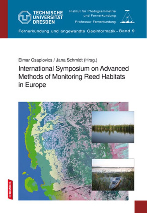
International Symposium on Advanced Methods of Monitoring Reed Habitats in Europe
Herausgeber: Elmar Csaplovics
Band: 9
Preis: 39,50 € [bestellen]
Verlag: [Rhombos Verlag]
Inhalt: Reed habitats are multi-functional ecotopes characterised by a unique diversity of plant and animal life. Their enormous ecological values are more and more spoiled by impacts of economical regional development such as the expansion of industry and agriculture, of tourism, road transport infrastructure and subsequently by various forms of environmental pollution. There is an urgent need for the establishment of balanced management strategies taking into account spatial planning for both nature conservation as well as sustainable regional development. Reliable methodologies of spatial monitoring and mapping of reed stands provide the baseline for any kind of measures both in terms of conservation as well as in terms of sustainable resource management. Spatial data acquisition over large wetland areas is essentially supported by hybrid methods of airborne and spaceborne remote sensing coupled with detailed ground sampling. Various sensor systems and image types cover a wide range of different spectral bands and provide very high geometric resolution of ground land cover and land use. The operational application of those systems and methodologies for detailed mapping of wetland vegetation in general and reed plant communities in particular both in space as well as in time (time series) is still at the dawn. Nevertheless a steadily growing number of related activities is set up by different administrative and research institutions since a few years.
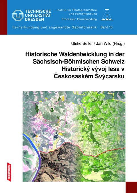
Historische Waldentwicklung in der Sächsisch-Böhmischen Schweiz
Historický vývoj lesa v Českosaském Švýcarsku
Herausgeber: Ulrike Seiler, Jan Wild, Elmar Csaplovics
Band: 10
Preis: 59,80 €
Verlag: [Rhombos Verlag]
Zum Buch
Die Forst- und Schutzgebietsverwaltungen in der grenzüberschreitenden Nationalpark-region Sächsisch-Böhmische Schweiz koordinieren in gegenseitiger Abstimmung die Pflege- und Entwicklungsplanung der Wälder. Deren Ziel ist die langfristige Umwandlung der ehemals zum Teil intensiv forstwirtschaftlich genutzten Wälder in einen wei-testgehend naturnahen Zustand. Für diese Aufgabe sind Kenntnisse über die histori-schen Einflüsse und über Ursachen der Landschaftsveränderungen sowie deren zeitliche Abfolge von großer Bedeutung. Auf dieser Grundlage wird das Verstehen aktueller Waldzustände, aber auch die konkrete Formulierung zukünftiger Entwicklungsszenarien effizienter und zielgerichteter möglich. Mit der Bereitstellung von historischen Geodaten zur Waldentwicklung befasste sich das von der Professur für Fernerkundung der TU Dresden geleitete Projekt. Gemeinsam mit dem Projektpartner, dem Institut für Botanik der Akademie der Wissenschaften der Tschechischen Republik wurde das Vorhaben im Zeitraum April 2009 bis März 2013 realisiert.
Kniha
Lesní správy a správy chráněných oblastí v přeshraničním regionu národních parků Českosaského Švýcarska koordinují po vzájemné dohodě plánování péče a vývoje lesů. Cílem je postupná přeměna v minulosti často intenzivně obhospodařovaných porostů do přirozeného či přírodě blízkého stavu. Pro splnění tohoto úkolu mají velký význam poznatky a údaje o historických vlivech a příčinách změn krajiny, i jejich časové posloupnosti. Na základě těchto poznatků je zabezpečena lepší identifikace aktuálního stavu porostů, jakož i sestavení konkrétních vývojových scenářů. Projekt vedený profesurou pro dálkový výzkum TU Drážďany se zabýval poskytováním historických geodat o vývoji lesů. Společně s projektovým partnerem Botanickým ústavem Akademie věd České republiky, v. v. i. byl tento záměr uskutečněn v období od dubna 2009 do března 2013.
Historische Waldentwicklung
Das Projekt „Raumbezogene historische Informationen als Grundlage für die Pflege- und Entwicklungsplanung naturnaher Wälder in der Sächsisch-Böhmischen Schweiz“ (kurz: Historische Waldentwicklung) wurde im Rahmen des Ziel3 Programms zur Förderung der grenzübergreifenden Zusammenarbeit zwischen dem Freistaat Sachsen und der Tschechischen Republik realisiert. Es wurde im Förderbereich Verbesserung der Situation von Natur und Umwelt bewilligt und aus Mitteln der Europäischen Union, der Tschechischen Republik und des Freistaates Sachsen finanziert.
Historický vývoj lesa
Projekt „Prostorově vázené historické informace jako podklad pro plánování péče a rozvoj přírodě blízkých lesů v Českosaském Švýcarsku“ (zkráceně: Historický vývoj lesa) byl realizován v rámci programu Cíl 3 na podporu přeshraniční spolupráce mezi Svobodným státem Sasko a Českou republikou. Byl schválen v oblasti podpory Zlepšení situace přírody a životního prostředí a byl financován z prostředků Evropské Unie, České republiky a Svobodného státu Sasko.

