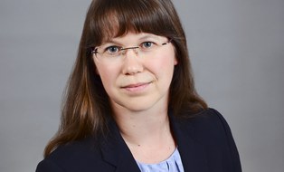
Dr.-Ing. Katja Richter
Inhaltsverzeichnis
 © Katja Richter
Wiss. Mitarbeiterin
NameFrau Dr.-Ing. Katja Richter
Eine verschlüsselte E-Mail über das SecureMail-Portal versenden (nur für TUD-externe Personen).
Lebenslauf
- Geodäsie-Studium an der TU Dresden 2003-2008
- Mitarbeiterin am IPF seit 2008
- 2018 Abschluss der Promotion zum Thema "Analyse von full-waveform Flugzeuglaserscannerdaten zur volumetrischen Repräsentation in Umweltanwendungen" (Dissertation Katja Richter)
Auszeichnungen
- SICK Messtechnikpreis 2018 für die beste Dissertation zum Thema "Messtechnik" SICK Messtechnikpreis 2018
- Lehrpreis 2021 für die Lehrveranstaltung "Photogrammetrie und Fernerkundung in der Flächen- und Vorratsinventur" Lehrpreis 2021
-
Fernerkundungs-Preis der Nico Rüpke-Stiftung und der DGPF für den besten Beitrag zum Tagungsband 2026 mit dem Titel "Classifying Morphologially Similar Tree Species in Central European Forests using Geometric Bark-Structure Features Derived from Terrestrial Laser Scanning" Fernerkundung-Preis 2026
Projekte
- DFG-Projekt "Effective methods for assessing vegetation structure and change
from multi-echo and full-waveform laser scanner data of terrestrial
LiDAR systems" - DFG-Projekt (abgeschlossen) "Tomographische Ansätze zur Laserbathymetriedatenverarbeitung"
- DFG-Projekt (abgeschlossen) "Entwicklung eines Modells zur strengen Berücksichtigung von Refraktionseffekten in der Airborne Laserscanning Bathymetrie"
- DFG-Projekt (abgeschlossen) "Volumetric forest structure reconstruction from full-waveform airborne laser scanner data"
- Projekt (abgeschlossen) "Ableitung von Trübungsparametern und Performanceverbesserungen der Auswertealgorithmen der Laserbathymetrie im Bereich Elbe/Klöden"
- DFG-Projekt (abgeschlossen) "Reflektive Optiken für breitbandige photogrammetrische Messsysteme"
- Projekt (abgeschlossen) "Generierung von Oberflächenmodellen mit dem Triangulationssensor Microscribe/ Microscan"
Lehre
- Betreuung von Bachelor- und Masterarbeiten
- Vorlesung: Einführung in die Geodäsie - Ringvorlesung, Teil Photogrammetrie
- Vorlesung: Grundlagen der Photogrammetrie - Teil 2
- Vorlesung: Photogrammetrie und Fernerkundung in der Flächen- und Vorratsinventur
- Vorlesung: Methoden der Fernerkundung und Datenanalyse - Laserscanning in Forstanwendungen
- Übung: Airborne Laserscanning
Publikationen
43 Einträge
2019
-
Detektion und Extraktion von Gewässersohlenpunkten aus Laserbathymetriedaten unter Nutzung von Full-WaveformStacking, 2019, Dreiländertagung der DGPF, der OVG und der SGPF in Wien, Österreich – Publikationen der DGPF. Band 28. S. 407-417, 11 S.Elektronische (Volltext-)VersionPublikation: Beitrag in Buch/Konferenzbericht/Sammelband/Gutachten > Beitrag in Konferenzband
-
Improvements in lidar bathymetry data analysis, 2019, in: International Archives of the Photogrammetry, Remote Sensing and Spatial Information Sciences . S. 113-117, 5 S.Elektronische (Volltext-)VersionPublikation: Beitrag in Fachzeitschrift > Forschungsartikel
-
Volumetric forest structure reconstruction from full-waveform airbornelaser scanner data, 2019, Geophysical Research Abstracts EGU General Assembly 2019. Band 21Elektronische (Volltext-)VersionPublikation: Beitrag in Buch/Konferenzbericht/Sammelband/Gutachten > Beitrag in Konferenzband
2018
-
Analyse von full-waveform Flugzeuglaserscannerdaten für die volumetrische Repräsentation in Umweltanwendungen, 2018Elektronische (Volltext-)VersionPublikation: Hochschulschrift/Abschlussarbeit > Dissertation
-
Numerical simulation and experimental validation of wave pattern induced coordinate errors in airborne Lidar bathymetry, 2018, in: International Archives of the Photogrammetry, Remote Sensing and Spatial Information Sciences . S. 961-967, 7 S.Elektronische (Volltext-)VersionPublikation: Beitrag in Fachzeitschrift > Forschungsartikel
-
Recent Developments in Lidar Bathymetry, 2018, Proceedings 5° IAHR Europe CongressElektronische (Volltext-)VersionPublikation: Beitrag in Buch/Konferenzbericht/Sammelband/Gutachten > Beitrag in Konferenzband
2017
-
Analysis and correction of ocean wave pattern induced systematic coordinate errors in airborne LiDAR bathymetry, Juni 2017, in: ISPRS Journal of Photogrammetry and Remote Sensing. 128, S. 314-325Elektronische (Volltext-)VersionPublikation: Beitrag in Fachzeitschrift > Forschungsartikel
-
An Approach to Determining Turbidity and Correcting for Signal Attenuation in Airborne Lidar Bathymetry, 2017, in: PFG - Journal of Photogrammetry, Remote Sensing and Geoinformation Science. S. 31-40, 10 S.Elektronische (Volltext-)VersionPublikation: Beitrag in Fachzeitschrift > Forschungsartikel
2016
-
Analysis of the Effect of Wave Patterns on Refraction in Airborne LiDAR Bathymetry, Juli 2016, in: International Archives of the Photogrammetry, Remote Sensing and Spatial Information Sciences . 41, B1, S. 133-139, 7 S.Elektronische (Volltext-)VersionPublikation: Beitrag in Fachzeitschrift > Forschungsartikel
-
Analysis and modelling of the effect of wave patterns on refraction in airborne LiDAR bathymetry, 2016, 24th annual IFHS Hydrographic Conference and Exhibition "HYDRO 2016"Publikation: Beitrag in Buch/Konferenzbericht/Sammelband/Gutachten > Beitrag in Konferenzband