Photogrammetric monitoring of glacier margin lakes
Project titles
- Photogrammetric concepts of virtual GLOF-monitoring level (DFG, completed)
- Photogrammetric techniques within the prediction of glacier lake outburst floods in Patagonia (BMBF, completed)
- Conceptional investigations of a GLOF-monitoring-system (BMBF, completed)
Funding
- German Research Foundation (DFG)
- Federal Ministry of Education and Research (BMBF)
- Fondo Nacional de Desarrollo Científico y Tecnológico (FONDECYT)
Motivation
The ongoing retreat of glaciers all over of the world rapidly increases the danger potential of so-called glacier lake outburst floods (GLOFs). The term GLOF refers to the spontaneous drain of a glacial water reservoir, which has been dammed by the glacier itself or a moraine. The destabilization of the natural barrier, for example by the formation of tunnels under the glacier, can lead to a sudden outflow of the accumulated glacier lake water within a very short time.
GLOFs often lead to flood hazards in the downstream areas and thus cause serious damage to people and nature as well as to the economy and infrastructure. Regarding the increasing danger potential, there is a growing need for concepts for early warning systems, which can recognize and report GLOFs on the basis of reliable indicators a few hours bevor the outburst .
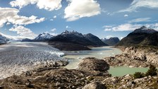
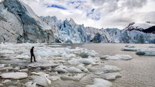
Lago Cachet II - GLOF Feb. 2014: Drainage of glacier margin lake within a few hours © IPF
Objectives
In collaboration with Chilean partners, the basic concept for an optical early warning system has been developed. It is based on the photogrammetric analysis of single images of an image sequence. In the images the water level can be determined from a safe distance in order to recognize the start of the drainage at an early stage. The basic idea of the method is the intersection of the water lines extracted from the images with a digital terrain model. The advantage of the non-contact measurement method compared to conventional level measuring systems (GPS buoys, pressure sensors) is that it is not influenced by dangers like collision with icebergs or by sedimentation.
Data acquisition & Processing
- Development of a measurement concept and adaptation of the measurement technique for the image sequence acquisition in Patagonia
-
Installation of several time-lapse cameras at Lago Nef and Lago Cachet II for temporal high-resolution monitoring of the glacier lakes
- Generation of a digital surface model while the lake is empty (alternative methods such as laser scanning, etc. possible)
-
Georeferencing of the image sequence on the basis of control points (determined with centimeter accuracy)
-
Development and adaptation of appropriate methods for the evaluation of sequence images with regard to a GLOF early warning:
- Compensation of the camera movements (caused by wind etc.): Measurement of permanently installed target marks in the foreground and resampling of the images with the first image of the sequence as a reference
- Measurement of the water line in the image sequence: edge-based tracking of the water line with an adaptive prediction range
-
Transformation of the measured values into object space: Intersection of the image ray with the digital terrain model of the empty lake.
- Photogrammetric determination of the flow velocity of Colonia glacier and its correlation with glacier lake drainage of Lago Cachet II

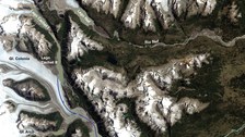
© USGS/NASA Landsat, annotations by IPF

© Robert Koschitzki

© Robert Koschitzki

© Stephan Schön (Sächsische Zeitung)

© Stephan Schön (Sächsische Zeitung)

© Ellen Schwalbe

© Stephan Schön (Sächsische Zeitung)

© Stephan Schön (Sächsische Zeitung)

© Stephan Schön (Sächsische Zeitung)

© Robert Koschitzki

© Stephan Schön (Sächsische Zeitung)

© Robert Koschitzki
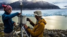
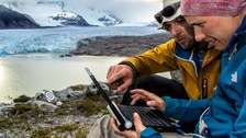
Research expedition in Chile to investigate the phenomenon of spontaneous GLOF events on Lago Cachet II © ravir film & Robert Koschitzki
Resultats
Field campaign 2009/10
Waterlevel change of Lago Nef Norte between the 4th of December in 2009 and the 8th of February in 2010. At the end of the sequence an approaching GLOF event is looming. Indeed, the drainage of the glacier lake was finished till the 10th of February. © IPF
- Image sequences of GLOF events at Lago Nef Norte and Lago Cachet II between 2009 and 2014
-
Manual extraction of the water line in the image sequences along a profile line
-
Transformation of the measurement results into object space on the basis of scale information and slope from GPS data
Field campaign 2013/14
- Further development of the image sequence analysis with regard to an automatic approach and measurement value scaling using a 3D surface model
-
Calculation of the water level at Lago Cachet II for different GLOF events and comparison with data from a locally installed pressure gauge
- Determination and visualization of the volume changes of the Cachet II for a glacier lake drainage
-
Localization and visualization of the subglacial drainage tunnel at Colonia Glacier during the drainage of Lago Cachet II: Photogrammetric measurement of spatially and temporally high-resolution motion fields of glaciers (see Schwalbe et al., 2016b)
- Creation of a non-contact optical monitoring / early warning concept for glacier lakes

© IPF

© IPF

© IPF

© IPF
Motion behaviour of Colonia Glacier during a GLOF event: Superposition of the sequence image with vertical glacier movements (top left); projection of movements into satellite image (right) and related water level changes of Cachet II (bottom left) © IPF
Related Publications
Project Partner
- Gino Casassa, Anja Wendt (Centro de Estudios Científicos, Valdivia/Chile)

