3D Building Extraction
Project title
3D Building Extraction from LIDAR Data and Aerial Imagery
Funding
German Academic Exchange Service (DAAD)
Aim
This project aims at the development of an efficient strategy for automatic 3D building reconstruction from airborne laser scanning and aerial images. It uses the strengths of both methods, by exploiting the 2.5D structure and reliability of LIDAR height data and the spatial resolution potential of aerial imagery. In that, no predefined geometric primitives or ground plans are required. The raw, irregular LIDAR data is used directly. The focus is on reliably modelling the roof structure and boundaries. Given that, the complete model is easily obtained. Only roofs composed of planar patches are considered.
Approach
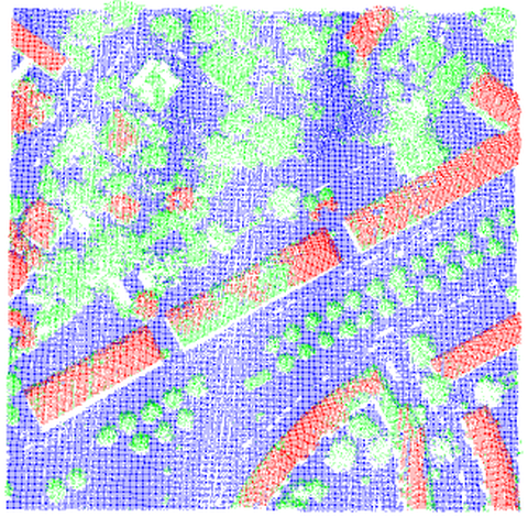
In a classified LIDAR point cloud planes are detected through a procedure independent from local surface normals.

Fig. 1: Result of automated classification
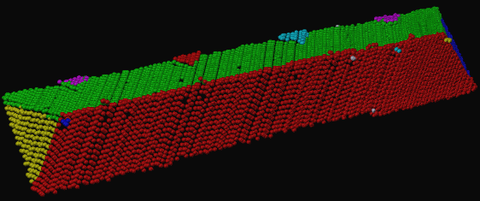
That is based on an iterative implementation of a 3D Hough transform combined with connectivity and completeness checks, which leads to the sequential recognition of all roof segments.

Fig. 2: Detected roof planes
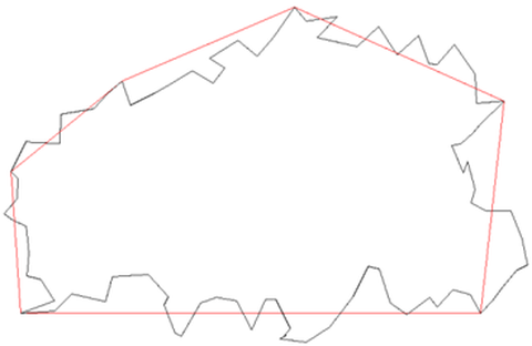
Step edges and break lines are identified and treated accordingly. The main purpose of image integration is the refinement of the building outline. The initial approximation of the outline is obtained from the triangulation of the LIDAR data and its generalization through Ramer’s algorithm.

Fig. 3: Building outline and its generalization derived solely from LIDAR data
Related Publications
Contact
- Prof. Dr. habil. Hans-Gerd Maas (project management)
- M. Sc. Angelina Novacheva (project work)
