Hemispherical Photogrammetry
Project title
Improving forest ecosystem diagnostics with special emphasis on radiation ecology issues in conjunction with digital hemispheric photogrammetry (DFG, completed).
Funding
German Research Foundation (DFG)
Motivation
Hemispheric photography is an established tool for assessing the radiation situation in forest stands. It has a clear advantage over the use of conventional radiation sensors because of the spatially resolved detection of the crown structure by a snapshot.
Objectives
The aim of the project was to derive geometric information about the canopy structure from hemispheric images for the determination of photosynthetically effective radiation values. This led to the following tasks:
- Modeling the geometric projection for fisheye camera systems.
- Development of a calibration method for cameras used for radiation determination.
- Development of an automatic subpixel-accurate classification method for the determination of radiation-relevant areas in the images
Results
Geometric modeling
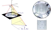
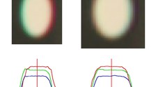
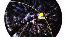
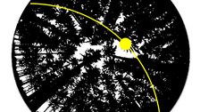
The functional relation between the object point and the corresponding image point was formulated for different fishey models and implemented in a bundle block adjustment. This allows the calibration of the fisheye camera systems with the help of a suitable calibration room. By determining individual distortion parameters for each channel of the hemispherical image, chromatic aberration effects can be corrected. A precise geometrical relation between the image of the fisheye camera and the reality can be established. The state of the sun, meteorological parameters and values from radiation models can now be transferred to the hemispherical crown images.

© IPF

© IPF

© IPF
Classification of canopy images
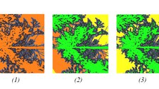
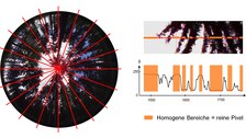
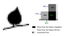
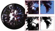
An automatic method has been developed with which the radiation transmittance of individual pixels can be quantified subpixel-accurately. It is based on the gray value analysis along radial profiles in order to separate pure pixels from mixed pixels (1). The classification of the pure pixels takes place in two stages. A global rough classification (2) is followed by a local refinement (3). The classification of mixed pixel (4) is performed by scaling the gray value on the basis of local reference values of already classified pixels. The method is suitable for different weather conditions, different types of forest stands and is adapted to the special properties of hemispherical images.

© IPF

© IPF

© IPF

© IPF

© IPF
Related Publications
Project Partners
The project was conducted in cooperation with the Institute of Silviculture and Forest Protection, Chair of Silviculture, Technische Universität Dresden.
- Prof. Dr. habil. Sven Wagner
- M.Sc.Forestry Manuela Kenter
Contact
- Prof. Dr. habil. Hans-Gerd Maas (project management)
- Dr.-Ing. Ellen Schwalbe (project work)

