Model project Smart City Dresden – Digital Flood Twin
Table of contents
Short Description
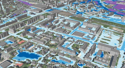
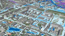
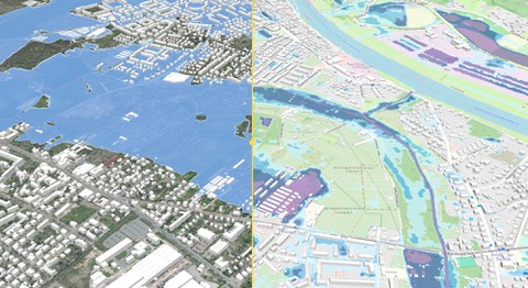
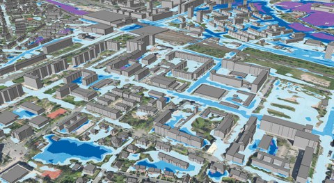
This measure aims to digitally record environmental qualities relevant to districts and buildings across the city using sensors and to make the data available in a digital urban 3D twin. This is being carried out using the example of the densification of the water level and rain measurement network in areas particularly at risk of heavy rainfall.
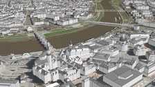
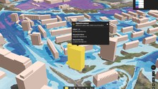
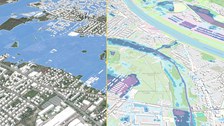
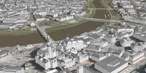
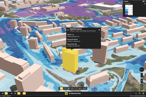
In order to make the city more resilient to flooding in the face of climate change, the data is to be processed and made available in an interactive 3D city model that is particularly intuitive for the public, so that the population and administration are able to act more effectively. In addition, the sensor data will be used to further specify and calibrate both the radar-based precipitation analysis and the flood forecasts for heavy rainfall based on the actual effects of the event and to validate the results. To this end, the core elements of a city-wide digital (heavy rain) twin are to be developed using smart approaches. To this end, the 3D city model will be qualified with typified, addressable objects relevant to heavy rainfall to map the grey (buildings, roads), blue (water bodies, sewers) and green (other areas) infrastructure. Using the example of heavy rainfall, the water-related specialist information is assigned to these objects, from precipitation to the resulting runoff or flooding through to damage potential, so that the thematic digital specialist twin is created. At a later stage, these approaches can be transferred particularly well to other specialist subject areas, especially in the field of climate adaptation (e.g. dealing with heat, water-sensitive urban development) and climate protection (e.g. mapping thermal balances of buildings, solar potentials).
At the same time, this will create a digital platform for inter-agency collaboration within the administration, for the networking of specialist data and, above all, for the public provision of sensor-based information on the current status of neighborhood, street and building-relevant environmental qualities as well as the resulting forecasts and recommendations for action. The aim is to create effective and efficient instruments that are smart in terms of usability for citizens on the basis of a qualified geodatabase and specialist database. These will enable the public to be warned of heavy rainfall in a spatially and temporally differentiated manner down to the building level, raise awareness of how to deal with the resulting hazards and ultimately minimize the impact of extreme meteorological events on the operation of public infrastructure and road traffic (see sub-measure traffic management) as a result of more qualified, knowledge-based action by those affected. Through the innovative digital typing of residential buildings, roads, water components, canal systems and natural surfaces as core elements of a digital twin, the typed objects can be used beyond the heavy rainfall issue for other diverse requirements (e.g. maintenance management of roads) to identify hazards due to climate change and also potentials for climate change adaptation.
Further advantages are associated with the measure:
- The smart approaches and technologies, here in particular for the typification of geobasis objects such as buildings, transport infrastructures, bodies of water and sewers, can be transferred to other topics. This considerably reduces development costs for other topics for integration into an urban digital twin.
- The newly created digital data, in particular on the typified objects, can be used directly in other subject areas (e.g. energy calculations for buildings), significantly reducing the effort required for basic investigations.
- The acquisition of robust measurement technology not only serves to directly inform those affected and offices (fire and disaster control office, road and civil engineering office, etc.) about the developing flood risks, but also to derive high-quality digital products. The basis for this is the management in the cross-city sensor database UZO (Umwelt-Zustand-Online). The permanent use and provision of sensor data in the 3D city model, e.g. as rain radar, in heavy rain nowcasting or for flood forecasts, requires the reliable operation of the measurement technology.
Media
© WAWUR (LH DD), VirtualCitySystems
© IWD
© IWD
© IWD
Project Data
|
Kerninformation |
|
|
Website |
|
|
Period |
04/2024 – 12/2026 |
|
Type of Funding |
Third Party |
|
Fundgiver |
|
| TUD Research Priority Areas (RPAs) | Energy, Mobility and Environment › Water Research |
| Sustainable Development Goals (SDGs) |
SDG 6 - Clean water and sanitation SDG 11 - Sustainable cities and communities SDG 13 - Climate action SDG 17 - Partnership for the goals |
| Keywords | Heavy rainfall, flood risk management, digital twin, early warning systems, climate adaptation |
Project Management
 © André Terpe
Research Associate
NameMr Lars Backhaus M.Sc.
Send encrypted email via the SecureMail portal (for TUD external users only).
Office of the Chair of Hydraulic Engineering
Visiting address:
Beyer-Bau, Room 04-08 George-Bähr-Str. 1
01069 Dresden
Office hours:
Please arrange a specific appointment in advance by e-mail.
Project Partners
|
Partner |
Type |
Website |
| Landeshaupstadt Dresden (Umweltamt, Amt für Geodaten und Kataster, Eigenbetrieb IT) |
Project Lead |
https://www.dresden.de/de/rathaus/aemter-und-einrichtungen/oe/dborg/stadt_dresden_6813.php |
| Photogrammetry (TU Dresden) | Internal (Qualification of watercourses) | https://tu-dresden.de/bu/umwelt/geo/ipf/photogrammetrie |
| Building Construction / Building Conservation (HTW Dresden) |
External (Building classification and damage modeling) |
https://www.htw-dresden.de/hochschule/fakultaeten/bauingenieurwesen/studium/lehrgebiete/baukonstruktionslehre/bauwerkserhaltung |
| Department of Geodesy and BIM (HTW Dresden) | External (Qualification of building models) | https://www.htw-dresden.de/hochschule/fakultaeten/geoinformation/ueber-uns |
Publications
No scientific publications to date.
Further Information
Press Releases
|
Date |
News |
Source |
|
24.09.2024 |
Forscher der TU Dresden entwickeln App für Starkregen-Simulation |
Dresdner Neueste Nachrichten |
|
20.09.2024 |
TU Dresden |
Exhibitions
|
Date |
Exhibition |
Place/Organizer |
|
15.11.2024 – 28.02.2025 |
TUD Interactive Science Lab |
|
|
16.04.2024 – 18.07.2024 |
COSMO Wissenschaftsforum |
Funding
The “Environmental Monitoring/Digital Urban Flood Twin” measure is funded by the Smart Cities pilot projects program of the Federal Ministry of Housing, Urban Development and Building and the project sponsor Kreditanstalt für Wiederaufbau (KfW).

