Jun 25, 2026
74th German Cartography Congress
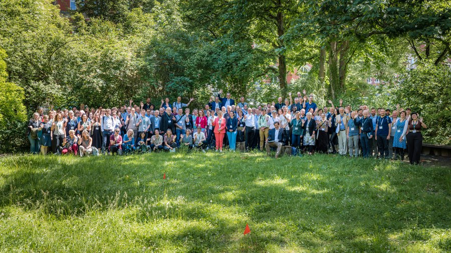
Group photo of all participants of the 74th DKK
The 74th German Cartography Congress (DKK) took place from 27 to 29 May 2026 at Dresden University of Technology. 140 participants from Germany, Austria, Poland, Switzerland and the Czech Republic came together to discuss the latest developments in cartography, geoinformation and geovisualisation.
The conference started with a day of workshops offering practical insights into current methods and tools. Alongside a workshop on mobile field mapping organised by OCAD, two workshops were run by staff from the Institute of Cartography at Dresden University of Technology: Mathias Gröbe presented options for three-dimensional visualisation using QGIS, whilst Jakob Listabarth discussed the creation of interactive web maps using Vector Tiles and MapLibre. In the afternoon, the general meeting of the German Society for Cartography took place.
The focus of the following two days of the conference was on a total of 48 presentations in parallel sessions. The topics ranged from current research to practical applications. The two keynote presentations provided particular highlights: Jochen Topf discussed the opportunities, developments and significance of open geodata, using OpenStreetMap as an example, whilst Rolf Böhm reflected on the tension between cartographic tradition and innovations in map production. The presentations thus spanned a spectrum from technological developments to fundamental questions regarding the cartographic identity.
The presentation programme was accompanied by a small trade exhibition featuring five exhibitors, which gave participants the opportunity to learn about the latest products, services and developments in the fields of cartography and geoinformatics.
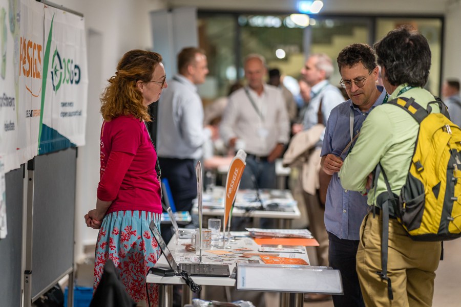
Lively discussions at the exhibitors’ stands during the breaks
The academic programme was complemented by excursions to the historical map collection at the Saxon State Library – Dresden State and University Library, and to the Dresden Office for Geodata and Cadastral Surveying. Both visits provided interesting insights into the diversity of cartographic work – from historical collections to current administrative and digitisation projects.
There was also plenty of opportunity for personal interaction. Two evening events provided a chance to maintain existing contacts and forge new ones – an aspect that many participants found just as valuable as the academic programme itself.
The award for the best presentation provided a particularly memorable finale. Manfred Müller received the most votes for his presentation on the Atlas of the Digedags’ Travel Routes, published in 2025, for which he had created all the maps. However, this very atlas was, as it happened, intended as the prize for the best presentation. So, without further ado, the atlas was awarded to the second-place winner, keynote speaker Rolf Böhm. He accepted the award with particular delight – not least because he and Manfred Müller have known each other well since their days as students at Dresden University of Technology. Needless to say, another prize was subsequently found for the actual winner.
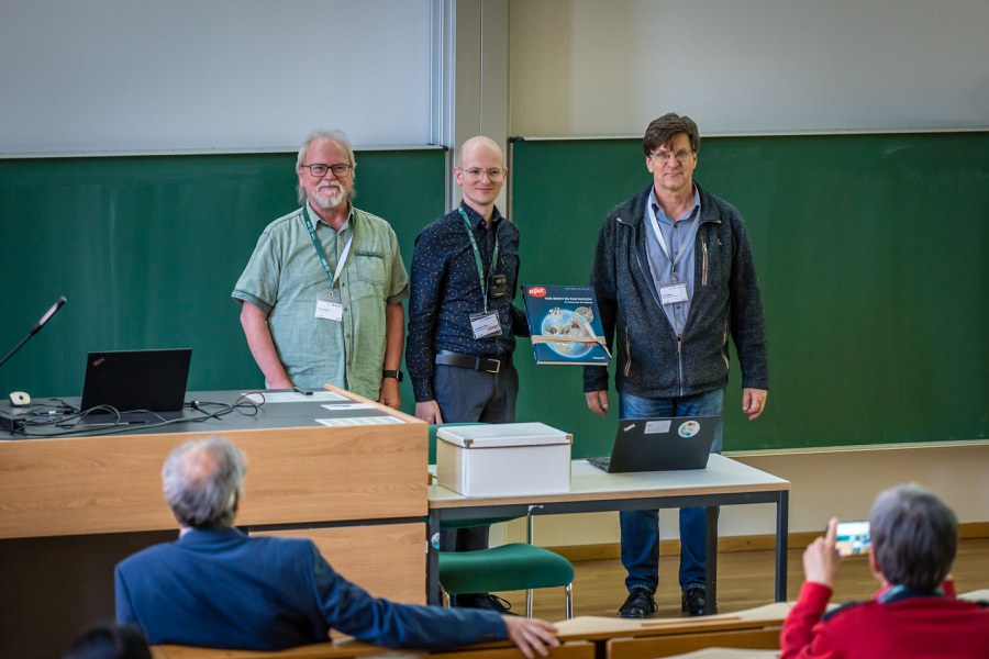
Award for the best presentation (from left: Manfred Müller, Mathias Gröbe, Rolf Böhm)
The conference programme can be accessed retrospectively here: https://dkk.dgfk.net/