Research Projects
Volunteered Geographic Information: Interpretation, Visualisierung und Social Computing (SPP 1894)
Am 20. März 2015 wurde von der Deutschen Forschungsgemeinschaft (DFG) die Einrichtung neuer Schwerpunktprogramme (SPP) beschlossen, die in hohem Maße interdisziplinär ausgerichtet sind und sich durch den Einsatz innovativer Methoden auszeichnen.
Insbesondere durch Verbreitung von sozialen Netzwerken, Web-2.0-Plattformen und kostengünstigen Sensortechnologien hat sich in den letzten Jahren die Verfügbarkeit von raumbezogenen Daten rasant entwickelt. Kennzeichen dieser Entwicklung ist die Beteiligung der Nutzer, die unter Verwendung von Smartphones und sonstigen mobilen Geräten „nutzergenerierte geografische Informationen“ (Volunteered Geographic Information, kurz VGI) erzeugen. Diese Daten bieten vielfältige Anwendungsmöglichkeiten sowohl für die Lösung gesellschaftlicher Herausforderungen z.B. in den Bereichen Umwelt, Gesundheit oder Verkehr aber auch für die Entwicklung kommerzieller Produkte und Dienstleistungen.
Wesentlicher Kern des beantragten Schwerpunktprogramms ist die Fragestellung, wie Visualisierungsmethoden zur Erschließung von VGI beitragen und die Interaktion zwischen Handlungsakteuren unterstützen können. Forschungsfragen betreffen hier sowohl den Bereich der Gewinnung raumbezogener Informationen, der visuellen Analyse und kartografischen Kommunikation als auch die Berücksichtigung des sozialen Kontexts bei der Erhebung und Nutzung von VGI.
An der Antragstellung zum DFG-Schwerpunktprogramm waren neben Prof. Burghardt vom Institut für Kartographie der TU Dresden auch Prof. Wolfgang Nejdl (Leibniz Universität Hannover, Forschungszentrum L3S), Prof. Jochen Schiewe (HafenCity Universität Hamburg, g2lab Geoinformatik und Geovisualisierung) und Prof. Monika Sester (Leibniz Universität Hannover, Institut für Kartographie und Geoinformatik) beteiligt.
Als Koordinator und Sprecher wird Prof. Burghardt tätig sein.
Geovisual analysis of VGI for understanding people’s behaviour in relation to multi-faceted context (EVA-VGI 2)

cultural and landscape motifs
The rise of so-called Volunteered Geographic Information (VGI) has brought with it fundamental changes not only in the nature of geographic data, but also its production and accessibility.
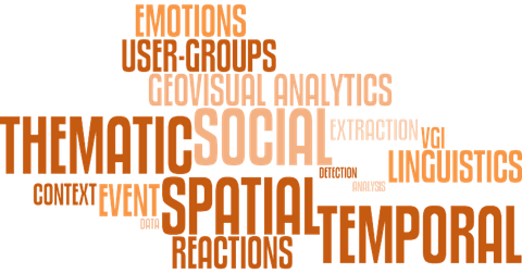
Volunteered Geographic Information (VGI) in the form of actively and passively generated spatial content offers extensive potential for a wide range of applications. Realising this potential however requires methods which take account of the specific properties of such data, for example its heterogeneity, quality, subjectivity, spatial resolution and temporal relevance. The creation and production of such content through social media platforms is an expression of human behaviour, and as such influenced strongly by events and external context. In this project we will develop geovisual analysis methods which show how actors interact in LBSM, and how their interactions influence, and are influenced by, their physical and social environment and relations.
In the first phase of the project, we developed and demonstrated a conceptual model enabling the extraction, analysis and visualisation of events and reactions to events in location based social media (LBSM). A central element of this model and its implementation is the integration of spatial, temporal, thematic and social dimensions combined with an explicit link between events and reactions. The follow up project will concentrate on the development of methods allowing links to be made between reactions, human activities and emotions. Furthermore, the social and physical context of events, and the resulting influences on and from behaviour will form a central research element. The project will explore the representativity of LBSM and its limits with respect to a range of research questions and application fields. An important focus will be on the identification of relationships between different actors and events, supported by the use and further development of a broad palette of methods and workflows from the domain of visual analytics.
As well as the development of generic approaches enabling comparative analysis using geostatistical and visual methods, we will refine, combine and parameterise methods for specific application domains. The focus here lies in three thematic areas to which the project consortium can bring experience and contact to partners from practice: 1) landscape and urban planning for the analyse and evaluation of green areas, 2) transport planning to explore group and individual mobility patterns and 3) political science through the application of comparative visual methods.
Leading participants
TU Dresden:
Prof. Dirk Burghardt
Dr. Alexander Dunkel
Dr. Eva Hauthal
University Bonn & Fraunhofer IAIS:
Prof. Stefan Wrobel
Prof. Gennady Andrienko
Prof. Natalia Andrienko
University of Zurich:
Prof. Ross Purves
Development of web processing services for the automated generalisation of isolated polygon groups (WPS-PolyGen)
The production of topographic and thematic maps in printed and digital form is increasingly realised by means of automated procedures. These procedures are being supported by manual and interactive editing (preparation and post-processing), depending on the application and the quality requirements.
The production of topographic and thematic maps in printed and digital form is increasingly realised by means of automated procedures. These procedures are being supported by manual and interactive editing (preparation and post-processing), depending on the application and the quality requirements.
The aim of the proposed project is to further develop the automated generalisation procedures, especially approaches for the processing of grouped cartographic objects. This requires a consideration of the structural relations, which is termed by Bertin (1974) as the generalisation problem with the highest complexity.
The main goal is to provide further generalisation operators for isolated polygon groups as a web processing services (WPS). Research questions will focus on the interaction of the generalisation operators, developed for single objects and object groups. This could be a way to overcome the still predominating isolated generalisation of single objects.
Project manager: Dirk Burghardt
Project staff: Thomas Gründemann, Xiao Wang
Geodatenerhebung, GIS-Aufbau und Kartenerstellung für das Russische Altai-Gebirge (Sibirien)
Das deutsch-russische Gemeinschaftsprojekt wurde 1995 mit einer Vorexkursion gestartet. 1997, 1998, 1999, 2001 und 2004 wurden Forschungsexpeditionen von jeweils vier bis acht Wochen Länge in den Zentral-Altai durchgeführt. Im August 2009 wurden mit Kollegen der Uni Novokusnezk Felduntersuchungen zur rezenten Morpho- und Klimadynamik im Nordost-Altai angestellt.
Die Startphase des Projektes zielte auf eine digitale topographische Datenbasis, auf Erfassung von pleistozänen geodynamischen Phänomenen, auf Methodik und praktischen Aufbau eines Digitalen Geländemodells sowie auf eine Analyse des Tourismus. Für Interpretation und Klassifikation wurden Bilddaten verschiedenster Satellitensensoren akquiriert und ausgewertet. Nach Komplettierung der Geobasisdaten wurden seit 2000 vor allem ökologisch relevante Geodaten erhoben und bearbeitet: Der saisonalen Variation der Schneedecke war das Teilprojekt "Seasonal Snow Cover of the Central Altai" gewidmet. Im Jahr 2010 wurde in Kooperation mit Archäologen der Universität Ghent die eigene umfangreiche GIS-Basis um archäologische Inhalte erweitert. Ein praktisches Ergebnis daraus ist die zukünftig offizielle Übersichtskarte des Archäologie-Parkes "Uch Enmek", die aus der Datenfusion abgeleitet werden konnte.
Projektleiter: Nikolas Prechtel
| Abgeschlossene Projekte |
Extraction and visually driven analysis of geography and dynamics of people's reaction to events (EVA-VGI)
The rise of so-called Volunteered Geographic Information (VGI) has brought with it fundamental changes not only in the nature of geographic data, but also its production and accessibility.
These changes have implications across the board for those carrying out research requiring geographic data, and most profoundly for research exploring how humans interact with and are affected by changes in their environment. In this project we propose moving beyond event detection, to investigate ways in which events can be characterised according to four key dimensions: spatial, temporal, thematic and social context. This characterisation will allow us to capture information about how groups of users are both affected by, and react to events and their evolution. To do so will require us to relate a variety of data sources with heterogeneous properties, which in some cases are generated with high velocities and volumes and have multiple granularities.
Our approach to characterising events has the following central pillars: data extraction and event identification; analysis of data content and semantics and associated interactive, dynamic visualisation. Analysis methods typical generate more information, and as such, given the large volumes of data that are our starting point will require effective visual analytics approaches enabling users to interact with the expected large data volumes. Our objective is therefore to develop a system of integrated visual and computational methods enabling investigation of people’s reactions to significant events through analysis of volunteered geographic information containing both explicit and implicit georeferences. Thus we will firstly develop a taxonomy of events focusing on the four mentioned dimensions associated with events and ways in which events are reacted to. The extraction of events from VGI will be based on a combination of spatial, temporal and textual analysis methods to link events, groups and their characteristics to space, time and social context. Our analysis will focus on reactions to events, and in so doing the socio-demographics of involved groups. In the analysis of the social aspects of group reactions to events a central tenet will be the use of privacy preserving methods which effectively obfuscate individuals.
We will illustrate our concepts through the implementation of a set of demonstrators including (but not limited to) disaster management, public involvement in local affairs, migration, climate and environment, social geography and medicine and health. To achieve our aims we have brought together a project team with expertise in investigating VGI, for example exploring the spatio-temporal behaviour from such data, describing the semantics of specific and generic aspects of place, and analysing affective data associated with location.
Leading participants
TU Dresden:
Prof. Dirk Burghardt
Dr. Eva Hauthal
University Bonn & Fraunhofer IAIS:
Prof. Stefan Wrobel
Prof. Gennady Andrienko
Prof. Natalia Andrienko
University of Zurich:
Prof. Ross Purves
Sustainable Management of River Oases along the Tarim River / China (SuMaRiO)
The overarching goal of SuMaRiO is to support oasis management along the Tarim River under conditions of climatic and societal changes.
A main result envisaged is to develop an indicator-based Decision Support System (DSS) that allows a Sustainability Impact Assessment (SIA) within regional planning. This SIA will take into account the perspectives of all relevant actors and consider relevant Ecosystem Services (ESS) in the problem field of land and water management in the Tarim River Basin. The perspectives will be obtained and analyzed through a transdisciplinary research process. Then, under given scenario assumptions, possible actions and their impacts are estimated. In the implementation phase, the goal is to train Chinese partners in the use of the English and Chinese DSS.
Project manager: Manfred F. Buchroithner, Tobias Bolch
Project staff: Tino Pieczonka, Juliane Peters
Variability and trends in water balance components of benchmark drainage basins on the Tibetan Plateau (WET) - BMBF program CAME "Central Asia: Monsoon dynamics and geo - ecosystems"
The Tibetan Plateau with an extent of about 2,5 million square kilometers and an average altitude higher than 4 700 meters has a significant impact on the Asian monsoon and regulates with its snow and ice reserves the upstream headwaters of the major south-east Asian rivers.
Over 1,4 billion people, the agriculture, the economics, and the entire ecosystem in this region depend upon the water supply of these rivers. An increasing number of floods and droughts however show that these seasonal water reserves are likely to be influenced by climate change, with negative effects for the downstream water supply and subsequently the food security. In this consideration, the research project WET aims to respond to these needs of further understanding the geo-ecosystem of the Tibetan Plateau and the correlation of climate, water circulation and human impact. It started in May 2011 and is a joint research project funded by the German Federal Ministry of Education and Research (BMBF) within its program CAME. Participants of WET are - beside the Technical University of Dresden - the Technical University of Berlin, the Universities of Jena, Marburg and Tübingen, as well as the RWTH University Aachen. Glaciers as upstream snow and ice reserves play an important key role factor within this research. The focus of the WET-project group 'glacier remote sensing' in Dresden relies on the monitoring of selected representative glaciers on the Tibetan Plateau in China and the identification of their recent variations. Since glacier behavior is linked to topography and climate, a focus is set on specific representative benchmark areas on the Tibetan Plateau that are going to be examined by the use of high-resolution remote sensing data. The detailed determination of glacier variations includes the area and volume changes, the geodetic mass balances as well as the provision of relevant glaciological input data for the development of an Integrative Model- and Monitoring System (iMoMoS-WET) for water balance components. This includes the entire multi-temporal analysis of remote sensing data, in particular the processing of satellite data, the creation of Digital Terrain Models (DTMs), the determination of glacier characteristics and the calculation of relevant glacier parameters.
Project manager: Manfred F. Buchroithner, Tobias Bolch
Project staff: Nicolai Holzer
Mobile map applications based on user generated content for cartographic communication - MApps
The ongoing technological development in the domain of geoinformation processing has a huge impact on the handling of and interaction with cartographic information.
This becomes obvious with the capturing of spatial data, as well as with the presentation of maps at a variety of output media. Cartographic applications on mobile devices have enormous research and development potential, because they provide the combination of interactivity and mobility in extension to paper maps, thus they allow an adaptive, personalised information exchange. The main goal of this research project is the development of service-based software components for the creation of interactive, mobile maps. The example of use will be the provision of spatial information services for tourist activities in the pilot region Saxon Switzerland.
The access on distributed, heterogeneous data sources is essential which are provided increasingly by the user in the Web2.0. The main focus in the project is given to the usage of semantic web technologies, especially the Resource Description Framework (RDF) applied to the modelling and storage of spatial data. Hierarchical data structures and methods for real-time generalisation should be applied for the automated derivation of scale dependent, adaptive maps. Based on these methods quasi-continuous zooming will be supported as well as the removal of local overlapping conflicts. Furthermore interactive techniques has to be developed and implemented, which provides the possibility to control the amount of presented information and the cartographic presentation style by the user. As a result the project contributes to the basic research in the area of adaptive, mobile map presentation, whereby the user becomes a central position within the cartographic communication process.
Project manager: Dirk Burghardt
Project staff: Stefan Hahmann, Karsten Pippig
Lentikulare Generierung themakartographischer Mehrbildmodelle
Lentikulare Visualisierungsmethoden bieten die Möglichkeit, Wechselbild- und Autostereoskopie-Wiedergabe mit kartographischen Inhalten zu verknüpfen. Auf der Basis von Echt-3D haben sie bereits Eingang in Geovisualisierungen von Reliefverhältnissen, sowohl für analoge (Hartkopien) als auch für digitale Präsentationsformen (Bildschirm), gefunden.
Bisher ist noch nicht untersucht worden, welche Potenziale sich für die weit verbreiteten themakartographischen Darstellungen (Thematische Karten) ergeben. Die plastisch differenzierte Wiedergabe räumlicher Sachverhalte ermöglicht einen mehrschichtigen Aussageaufbau und präsentiert mehrere Parameter (bzw. Dimensionen) eines kartographischen Inhalts. Damit können bislang unlösbare Problemstellungen in der Kartographie aufgegriffen und die kartographische Modellbildung vorangetrieben werden.
Mit Hilfe von Vergleichstests soll die Untersuchung erstmals die Informations-Transferleistung, die die Lentikulartechnik in der Kartographie zu leisten vermag, empirisch überprüft und quantifiziert werden. Die zunächst vorzunehmende Analyse lentikularer Printversionen dient als Grundlage für die im zweiten Teil des Projekts erfolgende Untersuchung der an Bedeutung immer wichtiger werdenden bildschirmgestützten Visualisierungen (elektronische autostereoskopische Displays).
Stand: Bisher wurden empirische Untersuchungen hinsichtlich der Mindestdarstellungsdimension kartographischer Gestaltungselemente (Schrift, Linien, Signaturen etc.) an verschiedenen autostereoskopischen Monitoren durchgeführt. In einer weiteren Phase wurden Diagrammkonstruktionen getestet. Ziel war es herauszufinden, ob und wie die Diagramme bei der autostereoskopischen Darstellung am Monitor vom Kartennutzer interpretiert werden können. Dabei wurde zwischen zweidimensionalen und dreidimensionalen Diagrammen unterschieden. Diese Ergebnisse wurden genutzt, um bestmöglich an die getesteten 3D-Monitore angepasste themakartographische Darstellungen zu erstellen, die für eine weitere empirische Untersuchung verwendet werden. In dieser letzten empirischen Phase wird die Wahrnehmungsleistung themakartographischer Visualisierungen an 3D-Monitoren untersucht.
Projektleiter: Manfred F. Buchroithner
Mitarbeiter: Claudia Knust, Katharina Bruhm


