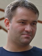
Dr.-Ing. David Mader
 © IPF
© IPF
Wiss. Mitarbeiter
NameHerr Dr.-Ing. David Mader
Eine verschlüsselte E-Mail über das SecureMail-Portal versenden (nur für TUD-externe Personen).
LEBENSLAUF
- Geodäsie-Studium an der Technischen Universität Dresden (2006-2012)
- Studienarbeit "Nutzung von RANSAC für die automatische Merkmalszuordnung beim photogrammetrischen Rückwärtsschnitt"
- 2012 Diplomarbeit "Optimierung und Verifikation geometrischer Modelle für ein reflektives Objektiv" (Zusammenfassung)
- Mitarbeiter am IPF seit 2012
- 2022 Promotion zum Thema "Entwicklung von Full-Waveform Stackingverfahren zur Detektion schwacher Gewässerbodenechos in der Laserbathymetrie" (TU Dresden Qucosa, Deutsche Geodätische Kommission - Reihe C 932 (pdf-Datei))
PROJEKTE
- Reflektive Optiken für breitbandige photogrammetrische Messsysteme 02/2012 - 12/2012 (abgeschlossen)
- ADFEX-Adaptive föderative 3D-Exploration mit Multi-Roboter-Systemen 03/2013 - 12/2015 (abgeschlossen)
- stadtPARTHEland - Kulturlandschaftsmanagement als Brücke zwischen Metropole und ländlichem Raum 01/2016 - 12/2016 (abgeschlossen)
- Ableitung von Trübungsparametern und Performanceverbesserung der Auswertealgorithmen der Laserbathymetrie im Bereich Elbe/Klöden 01/2016 - 12/2017 (abgeschlossen)
- PROQUATO - Entwicklung und Implementierung von herstellerunabhängigen Kalibriermodulen für terrestrische Laserscanner 01/2017 - 12/2020 (abgeschlossen)
- DFG-Projekt - Entwicklung eines Modells zur strengen Berücksichtigung von Refraktionseffekten in der Airborne Laserscanning Bathymetrie, 01/2018 - 12/2018 (abgeschlossen)
- DFG-Projekt - Tomographische Ansätze zur Laserbathymetriedatenverarbeitung 01/2019 - 05/2022 (abgeschlossen)
- High-resolution topography to measure and model river channel morphodynamics (DAAD Projekt in Kooperation mit dem Department of Physical Geography and Geoinformatics, University of Debrecen, Hungary)
(abgeschlossen) - Kooperationsprojekt mit dem Bundesamt für Seeschifffahrt und Hydrographie (BSH) - Laserbathymetrie in küstennahen Bereichen der Nordsee 07/2021 - 12/2024
Aufgaben
- Bedienung und Wartung der institutseigenen Multi-sensoriellen Flugroboter (UAV)
- Mitarbeit im UAV-Zentrum
- Betreuung von Master- und Bachelorarbeiten
- Betreuung Übung:
- MSc G12/Git08/INF - Photogrammetrische Deformationsanalyse (mit Aicon 3D Studio),
- MSc G12/Git08/INF - Laserlichtschichtverfahren (NextEngine Scanner, Matter and Form V2 Scanner)
- MSc G13/GIT13 - 3D-Punktwolkenverarbeitung
- MSc G07 - Projekt: Photogrammetrische Mehrbildverarbeitung
- MSc G07 - Seminar Photogrammetrie und Bildanalyse (MSc Geodäsie, Informatik im NF)
- Komplexpratikum Informatik
https://orcid.org/0000-0001-7662-8572
ResearchGate
Scopus Author ID: 56539555300
PUBLIKATION
32 Einträge
2022
-
Volumetrisches Full-Waveform Stacking zur Ableitung der Gewässerbodentopographie aus Laserbathymetriedaten - Erste Ergebnisse einer Pilotstudie am Fluss Elbe, 2022, Dreiländertagung DGPF – OVG – SGPF Photogrammetrie - Fernerkundung - Geoinformation - 2022. Band 30. S. 127-139, 13 S.Publikation: Beitrag in Buch/Konferenzbericht/Sammelband/Gutachten > Beitrag in Konferenzband
2021
-
USING THERMAL AND RGB UAV IMAGERY TO MEASURE SURFACE FLOW VELOCITIES OF RIVERS, 28 Juni 2021, International Archives of the Photogrammetry, Remote Sensing and Spatial Information Sciences - ISPRS Archives. B2-2021 Aufl., Band 43. S. 717-722, 6 S.Elektronische (Volltext-)VersionPublikation: Beitrag in Buch/Konferenzbericht/Sammelband/Gutachten > Beitrag in Konferenzband
-
Water turbidity estimation from LiDAR bathymetry data by full-waveform analysis - comparison of two approaches, 28 Juni 2021, in: International Archives of the Photogrammetry, Remote Sensing and Spatial Information Sciences . 43, B2-2021, S. 681-688, 8 S.Elektronische (Volltext-)VersionPublikation: Beitrag in Fachzeitschrift > Konferenzartikel
-
Potential of a Non-linear Full-Waveform Stacking Technique in Airborne LiDAR Bathymetry: Demonstration of Full-Waveform Stacking Techniques on Data from the Elbe River, April 2021, in: PFG - Journal of Photogrammetry, Remote Sensing and Geoinformation Science. 89, 2, S. 139-158, 20 S.Elektronische (Volltext-)VersionPublikation: Beitrag in Fachzeitschrift > Forschungsartikel
-
Refined Geometric Modeling of Laser Pulse Propagation in Airborne LiDAR Bathymetry: Verbesserte geometrische Modellierung der Laserpulsausbreitung in der Laserbathymetrie, April 2021, in: PFG - Journal of Photogrammetry, Remote Sensing and Geoinformation Science. 89, 2, S. 121-137, 17 S.Elektronische (Volltext-)VersionPublikation: Beitrag in Fachzeitschrift > Forschungsartikel
2020
-
Analyse der Auswirkung der Wasseroberflächenmodellierung auf die Genauigkeit von Gewässerbodenpunkten in der Laserbathymetrie, 2020, 40. Wissenschaftlich-Technische Jahrestagung der DGPF in Stuttgart – Publikationen der DGPF. Band 29. S. 143-155, 13 S.Elektronische (Volltext-)VersionPublikation: Beitrag in Buch/Konferenzbericht/Sammelband/Gutachten > Beitrag in Konferenzband
2019
-
Analyse der Auswirkung von Wellen auf konventionelle Refraktionskorrekturmethoden in der Laserbathymetrie, 2019, Dreiländertagung der DGPF, der OVG und der SGPF in Wien, Österreich – Publikationen der DGPF. Band 28. S. 334-346, 13 S.Elektronische (Volltext-)VersionPublikation: Beitrag in Buch/Konferenzbericht/Sammelband/Gutachten > Beitrag in Konferenzband
-
Detection and Extraction of Water Bottom Topography from Laserbathymetry Data by using Full-Waveform-Stacking Techniques, 2019, in: International Archives of the Photogrammetry, Remote Sensing and Spatial Information Sciences . 2019, XL-2/W 13, S. 1053-1059, 7 S.Elektronische (Volltext-)VersionPublikation: Beitrag in Fachzeitschrift > Forschungsartikel
-
Detektion und Extraktion von Gewässersohlenpunkten aus Laserbathymetriedaten unter Nutzung von Full-WaveformStacking, 2019, Dreiländertagung der DGPF, der OVG und der SGPF in Wien, Österreich – Publikationen der DGPF. Band 28. S. 407-417, 11 S.Elektronische (Volltext-)VersionPublikation: Beitrag in Buch/Konferenzbericht/Sammelband/Gutachten > Beitrag in Konferenzband
-
Entwicklung eines Untersuchungs- und Kalibrierkonzepts für Low-Cost-Laserscanner am Beispiel des Scanse Sweep, 2019, Photogrammetrie - Laserscanning - Optische 3D-Messtechnik: Beiträge der Oldenburger 3D-Tage 2018. Luhmann, T. & Schumacher, C. (Hrsg.). Wichmann-VerlagPublikation: Beitrag in Buch/Konferenzbericht/Sammelband/Gutachten > Beitrag in Konferenzband
VORTRÄGE
2019
- Runder Tisch Bathymetrie, Koblenz 2019:
Analyse und Anwendung von Full-Waveform-Stacking für eine verbesserte Detektion und Extraktion von Gewässerbodenpunkte in Flachwasserbereichen auf Grundlage von Airborne LiDAR Bathymetriedaten.