Apr 01, 2020
Droughts and Floods - Alleviation of consequences through new ways to measure and predict
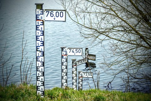
2002 and 2013 see two one-in-a-century floods in Saxony. In 2018 and 2019, the state is plagued by extraordinary drought periods, interrupted only by heavy rainfall events bringing sever flooding locally. In combination with the Saxon State Office for Environment, Agriculture and Geology and other partners, the Department of Hydrosciences developed measuring techniques and analysis methods for the more precise prediction of such extreme weather events to mitigate consequences for the affected. "The evaluation of long-going climate measurements showed differences in occurence for aridity and drought. While precipitation is decreasing long-term, there is a slight increase in yearly sums of precipitation since 1990", explains Thomas Pluntke, employee at the Chair of Meteorology at the TU Dresden. "From July to September, this increase is evident as more frequent heavy rainfalls between the dry patches. These rainfalls are not properly infiltrating into the ground and are thus not available for plants."
Prediction of climate and water budget through climate indices
"Contrary, there is a precipitation deficit between April and June, an important time for plant growth. This is further aggravated by the higher evaporation due to the increasing temperatures", as Pluntke explains. This has consequences for agriculture, forestry and water management, depending on the regional situations, like soil type. "The combination of existing meteorological measurements allows the derivation of so-called climate indices, which are highly expressive about different areas of our lifes", the scientist describes. "For example, calculation of the precipitation- and -evaporation-index for all of Saxony allows viewing the behaviour of precipitation and evaporation for every square kilometer. This allows analysis of both short-term developments, as well as long-term trends regarding dry and wet periods. This can then be used to make recommendations for agriculture, forestry and water management." "These observation time series can be enhanced by the specific models of different scientists to generate future projections of climate and water budget for the region, which allows planning of long-term adaptions," as the meteorologist concludes the aim of the new method.
Preventing losses through flooding with early-warning system
Helping faster is the aim of the HoWa-innovativ project, which applies new measurement and prediction methods for early-warning of floods in small catchment areas.
"Regular methods struggle to predict the precise location and amount of heavy rainfalls and their effects on small streams. Often, we can only see them after the stream has flooded and damaged the surrounding areas," as Dr. Jens Grundmann of the Chair of Hydrology outlines the problem. Thus, the aim of the new early-warning system that is developed at the TU Dresden in conjunction with the University of Augsburg and the Saxon Flood Center is to increase forecast lead times, allowing earlier warning of emergency personnel and population. For this, the new system takes into account prediction ensembles of the German Weather Service (DWD) and precipitation measurements via radio links for its warnings and predictions. "Ensemble methods incorporate different possible scenarios of future weather and thus allow an estimation of the uncertainty of the prediction", Jens Grundmann explains. Usually, precipitation measurements are done via radar and measuring buckets on the ground. This will now be enhanced with radio links, which are connections between cellular network base stations. The signal strength between these stations is dampened depending on the intensity of precipitation. This allows a fast, low-height correction of the radar precipitation measurement, which improves the spatial precipitation estimation. "Every measurement method has advantages and disadvantages, which we try to alleviate this way", the scientist says.
Possible forecast lead times of one to two hours
The development of a flood also depends on the humidity and characteristics of the area in question: has a weeks-long drought dried out the soil or are streams, rivers and soils unreceptive due to previous rainfalls? Hydrologists call these dependencies "Runoff disposition of watersheds". Area-specific computer models, called rainfall-runoff-models, are developed to estimate these current conditions of the watersheds based on discharge and precipitation measurements. "In conjunction with the enhanced precipitation estimation, this allows short-term predictions with forecast times of one to two hours, depending on the size of the watershed", as Grundmann explains one of the major targets of the project. Furthermore, the computer models are used to process prediction ensembles of the next 27 hours provided by the DWD. From this, discharges are calculated that can be used to estimate the probability of exceedance of certain flood warning stages for the watersheds. "From this, a warning can be issued to emergency personal and population. This gives them time to prepare and monitor the situation, as the underlying estimates are still uncertain, especially for small watersheds and high precipitations", Grundmann says. This forecast system, combining ensembles and short lead time predictions, will be developed and tested in three regions of Saxony (oberes Vogtland, Osterzgebirge and östliches Lausitzer Bergland). The HoWa-innovativ project is sponsored by the Federal Ministry of Education and Research.
Information for journalists:
Prof. Thomas Pluntke
Chair of Meteorology
HoWa-innovativ: https://www.howa-innovativ.sachsen.de/


