Cyface
Damage to the road surface as well as potholes not only stress drivers, but also increase vehicle wear and noise. Good road infrastructure ensures a healthy economy as well as mobility of the population. Currently, ca. 46% of German roads are in a deteriorated state.
Our vision enables cyclists and car drivers to safely navigate by circumventing areas of increased danger or deteriorated roads. Thus, we are the first to make damage to roads visible: our smartphone app ascertains vibration data, which is extracted and processed while driving. Our specially developed algorithm processes the anonymised raw data. In the end, we are able to draw a realistic and furthermost current, state of the road quality. Everything without requirement of expensive special measurement equipment.

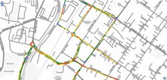
Cyface map within the Webportal
Knowing areas of bad road quality is double beneficiary: on one hand, the data can be the basis for road repair decisions; on the other hand, the data allows for smart navigation mostly circumventing areas of bad road quality.
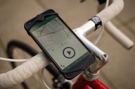
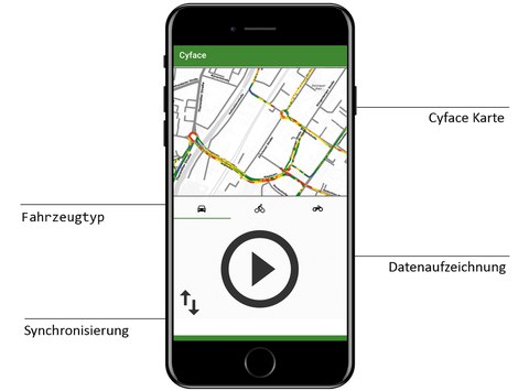
By means of accelerometers, GPS and gyroscopes all modern smartphones are able to ascertain the data we require. The interplay of these sensors allow us to not only gather the vibration data, but to also exactly pinpoint them within the road network. The vibration data can be collected by all road users, be it car drivers, bicyclist or motorcyclists. They just use our Cyface app or place a special small box with a mini computer in their vehicle. The raw data are transmitted to the Cyface server and classified there. Our four-step scale spans ‘excellent’ (blue), ‘good’ (green), ‘moderate’ (yellow), and ‘bad’ (red). That way, roads and cycle paths are always objectively classified. Of course, these data can be retrieved, too. Hence, existing (mobile) navigation application can be amended with current road quality data. Due to our long-time research expertise, our core competence lies within ascertainment and processing of traffic and road quality data.
- continuous and automated orientation calibration of smartphones
- scalability for collaborative road quality ascertainment
- map-matching algorithms for bicycle routing
- utilisation of Gamification to motivate contributions of surface quality data
- normalisation of acceleration data


