Orientieren auf dem Campus
Inhaltsverzeichnis
Wir freuen uns, dass Sie die TU Dresden und den Campus entdecken wollen. Hier finden Sie die wichtigsten Orientierungshilfen, um sich auf unserem Campus zurechtzufinden.
Video-Campustouren
Wir laden Sie zu einem virtuellen Spaziergang ein. Sie können sich in den insgesamt fünf Video-Campustouren auf eine geführte Entdeckungsreise über den Campus mitnehmen lassen. Die erste Tour führt Sie über den Hauptcampus der TU Dresden, weitere finden Sie auf unserer Webseite Campuseinblicke.
Den Campus der TU Dresden kennenlernen. © TU Dresden
Campus Navigator
Die TU Dresden hat das interaktive Informationssystem „Campus Navigator“ entwickelt, das Informationen über den Campus, die Gebäude, die Räume, zu Stundenplänen usw. bietet. Speziell für Besucher mit Behinderungen lassen sich hier wichtige Angaben ermitteln.
Der Campus Navigator dient der Orientierung und Information im gesamten Campusgebiet der TU Dresden. Er umfasst die Darstellung der Campuskarten, die Anzeige von Etagenplänen und Raumbelegungen, Informationen für mobilitätseingeschränkte Besucher und ein leistungsfähiges Routingsystem mit Standort- und Zieleingabe sowie GPS-Unterstützung. Mit Hilfe einer komfortablen Suchfunktion lassen sich Gebäude, Hörsäle und Seminarräume ebenso schnell finden wie Toiletten, Wickeltische und Aufzüge.
Der Campus Navigator ist unter navigator.tu-dresden.de direkt erreichbar, steht aber momentan nicht als App zur Verfügung.
Lagepläne der TU Dresden
Der Hauptcampus der TU Dresden liegt südlich des Stadtzentrums von Dresden und ist leicht mit Bus und Straßenbahn zu erreichen. Wenn Sie ein ganz bestimmtes Institut suchen oder Besuchern den Weg erklären möchten, finden Sie hier Lagepläne der wichtigsten Standorte der TU Dresden als Bild oder PDF-Dokument in Druckversion. Die Lage der einzelnen Teilpläne vermittelt dabei der Übersichtsplan. Für Detailinformationen zu einzelnen Gebäuden verwenden Sie den Campus Navigator - das interaktive Orientierungssystem der TU Dresden.
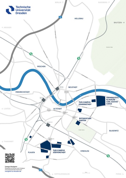
Dieser Plan gibt einen Überblick zur Verortung des Hauptcampus und der weiteren Standorte der TU Dresden im Stadtgebiet.
Ansicht als Bild
Download als PDF
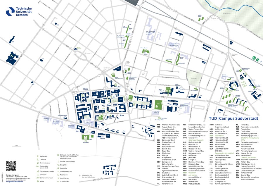
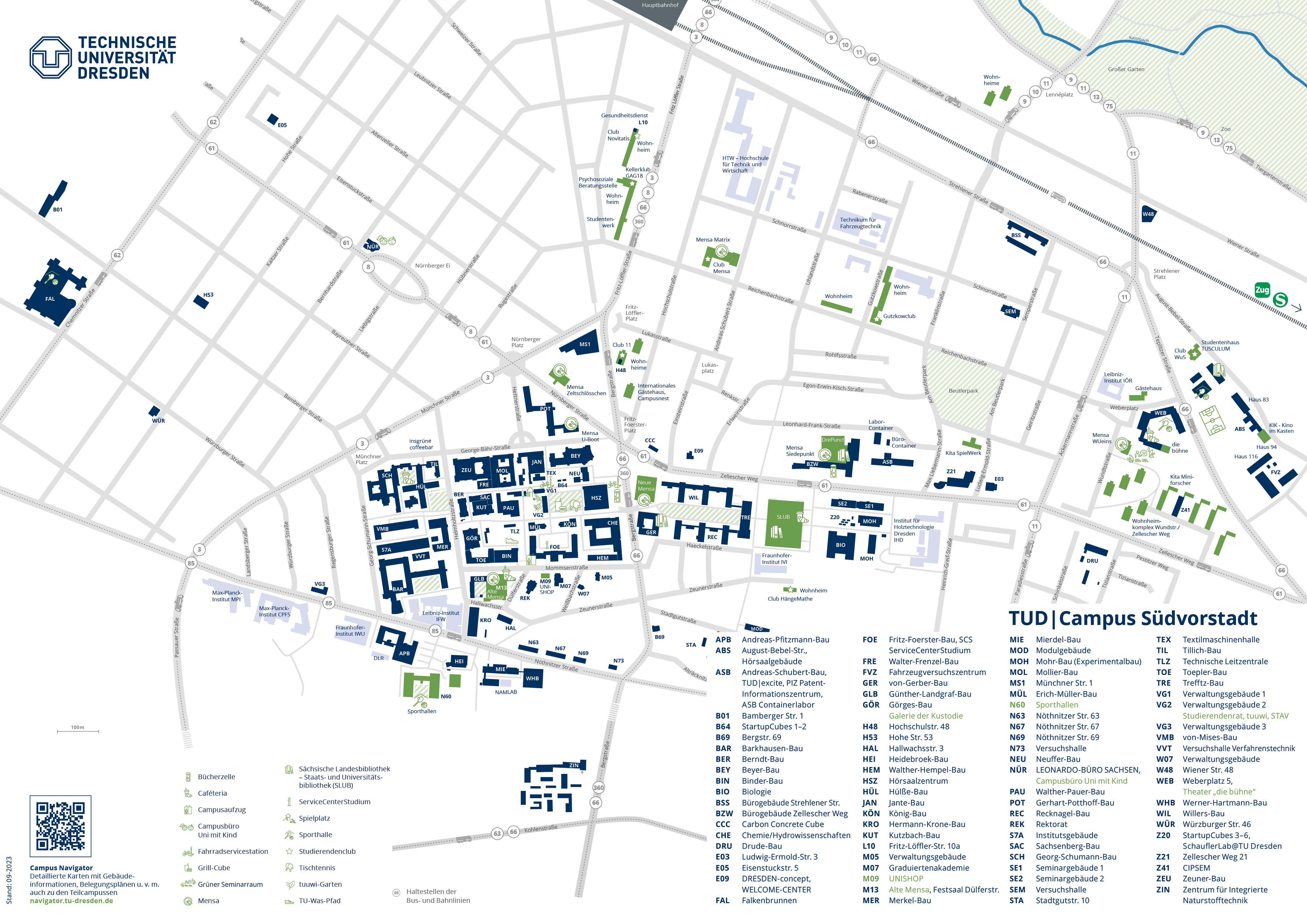
Dieser Lageplan enthält wesentliche Zentrale Einrichtungen sowie einen Großteil der Fakultäten der TU Dresden.
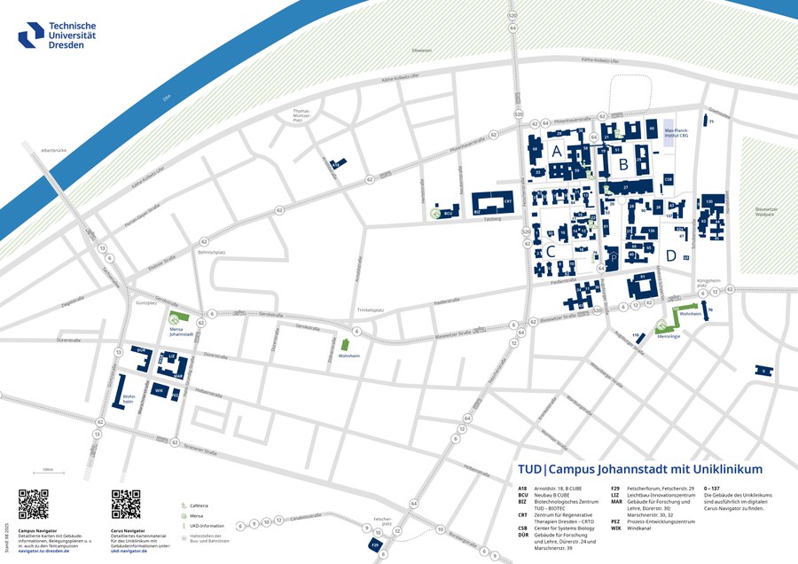
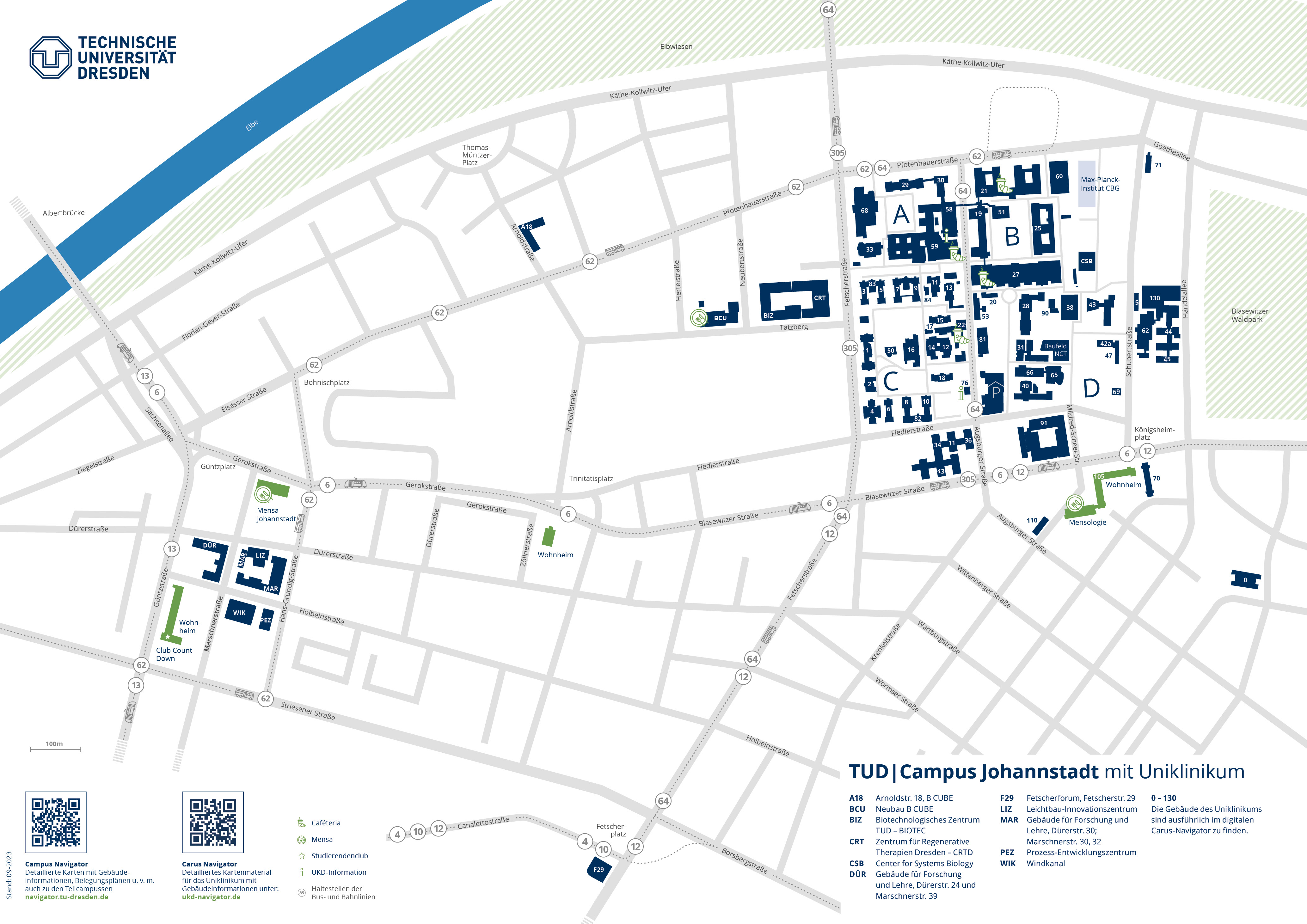
Dieser Lageplan enthält eine detaillierte Darstellung der Gebäude des Universitätsklinikum in Dresden Blasewitz und der Standorte in Dresden-Johannstadt.
Dieser Lageplan zeigt den Forstbotanischen Garten und Gebäude der Fachbereiche Forst- und Hydrowissenschaften.
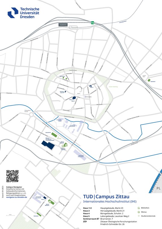
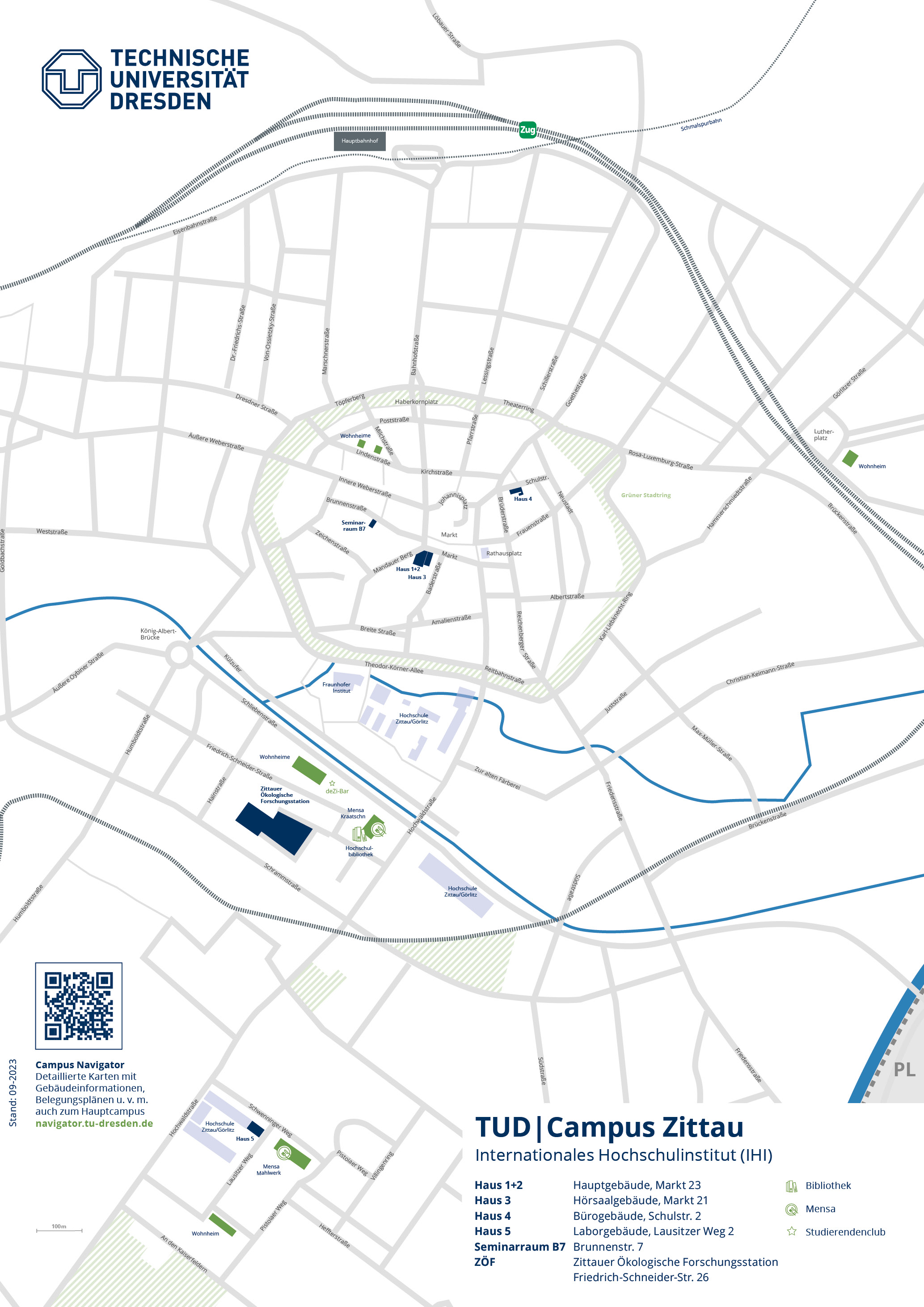
Dieser Lageplan zeigt den Campus in Zittau vom IHI – Internationales Hochschulinstitut Zittau.
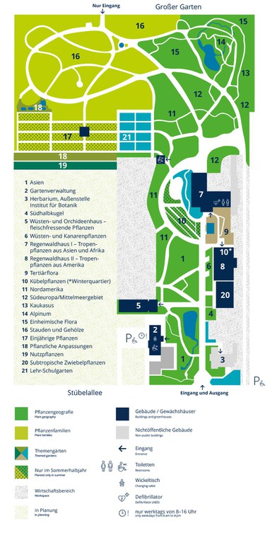
Dieser Lageplan zeigt den Botanischen Garten der TU Dresden mit seinen Pflanzbereichen.