
Sep 16, 2026
11 trillion tonnes lost since the 1970s: Ice sheet decline mainly due to accelerated glacier movement
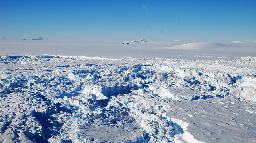
The longest satellite record ever assembled shows that Greenland and Antarctica have lost about 11 trillion tonnes of ice since the 1970s, raising global sea levels by more than 3 centimeters – and that most of this loss has been caused by glaciers flowing faster into the ocean, not from them melting on the surface. 11 trillion tonnes of ice have produced 11,000 km3 of meltwater. Spread over the area of Germany (358,000 km2), this would form a layer of water 31 meters deep; spread across the world’s oceans (360 million km2), it would correspond to the average sea-level rising by 3.1 centimeters.
The study, published in the journal Scientific Data, was led by Inès Otosaka (Northumbria University, United Kingdom) and involved contributions from four TUD scientists. These contributions from Dresden included the analysis of measurements of ice surface heights obtained from altimeter satellites. Additionally, changes in Earth's gravitational pull, determined by dedicated geodetic satellite missions, were analyzed to infer changes in continental ice mass. Other members of the team, which consists of researchers from a total of 37 institutions, contributed results on glacier flow, snowfall, surface melting, and other influencing factors.
The international team of polar scientists has produced the most complete picture of ice loss from Greenland and Antarctica to date. The Ice Sheet Mass Balance Inter-comparison Exercise (IMBIE) Team combined 42 independent satellite surveys, drawing on 27 satellite missions and reaching back to 1972 for Greenland and 1979 for Antarctica using the early Landsat archive.
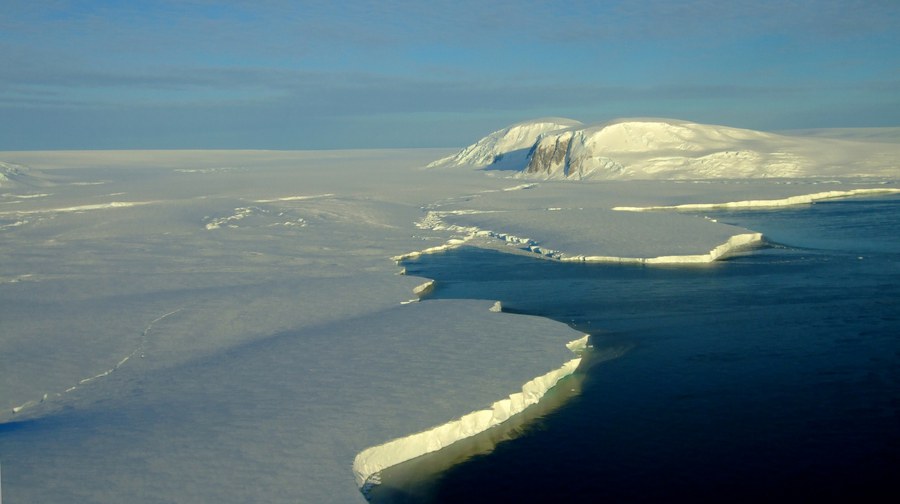
An outlet glacier in Pine Island Bay (West Antarctica) (background) with floating ice shelf in the foreground. Interactions between the glacier, the ocean and the solid bedrock cause the ice to move at an accelerated rate.
The findings show the two ice sheets lost 11 trillion tonnes of ice between 1979 and 2023, pushing global sea levels up by 3.1 centimeters. Greenland accounts for the larger share of 1.8 centimeters and Antarctica contributed 1.3 centimeters. Strikingly, 84% of the combined loss was driven by glaciers speeding up and pouring more ice into the ocean, with just 16% due to surface melting. The polar ice sheets are now responsible for around a quarter of all global sea level rises.
Martin Horwath, Professor of Geodetic Earth System Research at TUD, as well as co-author and member of the Executive Committee of the IMBIE study, said:
"The aggregated figures presented here reflect a long development of measurement systems and analytical expertise, providing a comprehensive picture not only of ice mass losses but also of the underlying mechanisms. At the same time, the comparison of methods highlights the need for further research, for example, in East Antarctica. This motivates ongoing geodetic research projects at TU Dresden."
The record shows ice losses climbing steeply from the 1990s onwards. Greenland, which was fairly balanced in the 1970s, saw its rate of loss rise from around 60 billion tonnes a year in the 1980s to 264 billion in the 2010s, a decade marked by repeated extreme summer melt events. Antarctica’s rate rose from around 48 billion tonnes a year in the 1980s to 202 billion in the 2010s, with all of its net loss caused by the higher ocean temperatures melting its outlet glaciers; West Antarctica’s ice discharge, led by Pine Island and Thwaites glaciers, has risen in every decade of the record.
The most recent years (2020–2023) brought a temporary slowdown in ice loss. Record snowfall over East Antarctica have offset some of the continent’s glacier losses elsewhere, while a run of milder Greenland summers roughly halved its surface melting. Scientists caution that these are short-term fluctuations standing in contrast to a clear, long-term trend; it is not a reversal of ice loss.
The findings also underline the ice sheets’ central role in the sea levels rising in the future. Their response to a warming climate is the single largest source of uncertainty in sea level projections: A continuous, half-century record of how the ice sheets are behaving is therefore vital to anticipating the risks facing the hundreds of millions of people who live in low-lying coastal areas.
Further information
Interactive data portal for ice sheet mass changes determined from data of the satellite gravimetry missions GRACE and GRACE-FO:
https://data1.geo.tu-dresden.de/ais_gmb/
https://data1.geo.tu-dresden.de/gis_gmb/
A media package with the study, films, animations and photographs is available at
https://imbie.org/news/.
The paper ‘Mass balance of the Greenland and Antarctic ice sheets from the 1970s to 2023’ by the IMBIE Team is published in Scientific Data. Embargoed until 10:00 London / 05:00 US Eastern on 16th September 2026. https://www.nature.com/articles/s41597-026-08088-0
Notes to editors
The study is an outcome of the Ice Sheet Mass Balance Inter-comparison Exercise (IMBIE), supported by the ESA Climate Change Initiative, the NASA Cryosphere Program, and the NERC UK Centre for Polar Observation and Modelling.
It combined 42 independent estimates – 23 for Greenland and 19 for Antarctica – from satellite altimetry, gravimetry and the input-output method, with regional climate models used to separate surface processes from ice dynamics. The data came from 27 satellite missions, including ESA’s CryoSat-2, the EU’s Sentinels, NASA’s ICESat-2, the NASA / German Aerospace Center GRACE mission, the NASA / GFZ Helmholtz Centre for Geosciences GRACE-FO mission, and the early Landsat archive.
360 billion tonnes of ice is equivalent to roughly 1 millimeter of global sea level rise. Between 1979 and 2023, the ice sheets lost a combined 11309 ± 565 billion tonnes (31.4 ± 1.6 mm); Antarctica lost 4780 ± 513 billion tonnes (13.3 ± 1.4 mm) and Greenland 6215 ± 467 billion tonnes since 1972. Ice dynamics accounted for 84% of the combined loss.
The dataset extends the previous IMBIE assessment (Otosaka et al., 2023), which reported a combined 21.0 ± 1.9 mm sea level contribution between 1992 and 2020.
Contact:
Prof. Martin Horwath
TUD Dresden University of Technology, Faculty of Environmental Sciences, Chair of Geodetic Earth System Research
+49-351-46337582
Website of the Chair of Geodetic Earth System Research:
https://tu-dresden.de/bu/umwelt/geo/ipg/gef