Mar 15, 2022
Scientists from Germany and Argentina are researching climate-related mass changes in the Patagonian Ice Fields

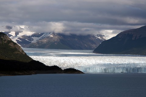
The Glaciar Perito Moreno, one of the few advancing glaciers of the Southern Patagonian Ice Field, empties into Lago Argentino at about 50.5°S and 73°W.
Everyone knows the anecdote of Newton and the apple. Since gravity is an interaction force, the earth is also attracted to the apple. It is therefore clear that even small changes in mass lead to a change in the gravitational field.
To track down these small changes, a team of German and Argentine scientists traveled to southern Patagonia, in the Argentine province of Santa Cruz. Scientists from the TU Dresden (TUD), the Federal Agency for Cartography and Geodesy (BKG) Leipzig, the Universidad Nacional de La Plata (UNLP) and the Argentine-German Geodetic Observatory (AGGO) ended the five-week measurement campaign at the beginning of March 2022 and then the more as a 2,700 km return trip from El Calafate to La Plata.

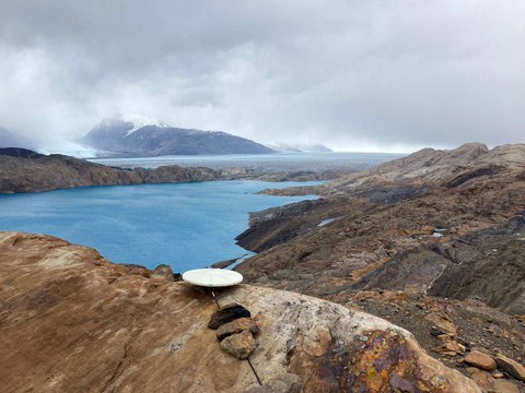
GPS measurement point near Upsala Glacier.
In southern Patagonia, in the border area between Argentina and Chile, the Patagonian Ice Fields are the largest contiguous mass of ice in the southern hemisphere outside of Antarctica. These ice fields are subject to significant mass loss, mostly due to climate change, but also due to natural climate variability and ongoing dynamic transients since the last glacial maximum. Which proportions can actually be attributed to these various causes is one of the important open questions that are currently being researched and this project is intended to make a contribution.
Perito Moreno as the best-known glacier. For this purpose, a Micro-g LaCoste FG5 absolute gravimeter was used, with the help of which it is possible to determine the gravitational acceleration with an extremely high accuracy of almost one billionth of Earth's gravity. These measurements are supplemented by relative gravity measurements with a Scintrex CG5 gravimeter to determine local gravity gradients and connections to security points or points of the Argentine Gravity Network (RAGA) and by precise GPS measurements to determine the crust deformation. A special feature are water level measurements using GPS reflectometry on the large Patagonian lakes and the Atlantic coast: the indirectly received signals from the GPS satellites reflected on the water surface are used in the evaluation to determine the height of the water level and thus the gravitational effect of changes in the level of the respective determine the body of water.
"In order to detect the changes in gravity due to the mass losses, at least one further measurement campaign is necessary after this second one," says Thorben Döhne, doctoral student at the Professorship for Geodetic Earth System Research, who is primarily responsible for the relative gravity measurements. "However, the weather conditions, especially with the strong, persistent winds, and the not always easy logistical circumstances, e.g. when transporting people and material over unpaved roads and fords, pose special challenges for such a measurement campaign," reports Andreas Richter, formerly an at the TU Dresden and now at the UNLP. By relating the absolute measured changes in gravity and the crustal deformations determined by GPS, the researchers hope to gain new insights into the structure of the Earth's interior and the nature of the observed deformation processes. "It will also help to link the measurements carried out on the earth's surface, i.e. ground-based measurements, with satellite geodetic measurements of the mass balance and height change of the Patagonian Ice Fields," adds Döhne.
Acknowledgments
The scientists involved expressly thank the Universidad Nacional de La Plata, Facultad de Ciencias Astronómicas y Geofísicas (Dean: Prof. Raúl Perdomo), the Argentinian-German Geodetic Observatory (Scientific Director: Prof. Claudio Brunini), the Consejo for the support Nacional de Investigaciones Científicas y Técnicas (CONICET) and the Instituto Geográfico Nacional (director: Sergio Cimbaro).
Contact:
Dr. Mirko Scheinert,
Institute of Planetary Geodesy
Chair of Geodetic Earth System Research
Tel.: 0351 463-33683
