
 © EnvRS
Environmental Remote Sensing
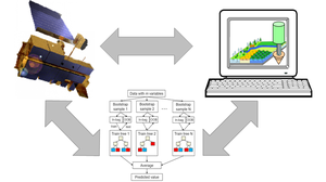
Environmental remote sensing is the observation, quantification, and modeling of environmental systems “from a distance” using aerial and satellite imagery.
The Chair of Environmental Remote Sensing was newly established as a Junior Professorship in September 2019 and was made a full professorship in September 2025. We teach and view remote sensing as an integrative environmental science at TU Dresden. The chair is held by Matthias Forkel.
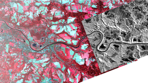
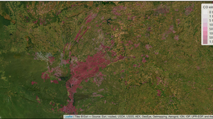
The Chair’s core research areas focus on the development of methods and the application of satellite data and derived products for the observation, analysis, modeling, and prediction of changes in terrestrial ecosystems and their interactions with the carbon and water cycles and the climate. Key topics include microwave remote sensing for forest-water interactions, remote sensing for wildfire research and management, and applied remote sensing for forestry and agriculture. To this end, we use and develop data-driven methods of time-series analysis, machine learning, and artificial intelligence, as well as process-based radiative transfer and environmental models and model-data integration techniques. Research projects and theses cover both basic research topics and practical applications.
In terms of teaching, the Chair offers comprehensive training in remote sensing for the bachelor’s programs in Environmental Informatics, Geodesy and Geoinformation, and Geography, as well as for the master’s programs in Geoinformatics, Geodesy, Cartography, Computational Modeling and Simulation, Forest Sciences, and Tropical Forestry. The focus of teaching is on imparting knowledge at the interface between remote sensing (physical fundamentals, sensors, data, methods), environmental research (carbon and water cycles, climate change), and data science (statistics, time series analysis, image processing, machine learning).

 © TUD/Sven Ellger
Secretary Environmental Remote Sensing | Ms Marta Bukowska-Bosse
Send encrypted email via the SecureMail portal (for TUD external users only).
Visiting address:
Nürnberger Ei (NÜR), Raum W532 Nürnberger Str. 31 A
01187 Dresden
Sanierungsbedingt ab dem 23.06.2025
Visiting address:
Hülsse-Bau (HÜL), Raum W532 Helmholtzstraße 10
01062 Dresden
Standardadresse nach Abschluss der Sanierungsmaßnahmen
Postal address:
TUD Dresden University of Technology Institut für Photogrammetrie und Fernerkundung
01062 Dresden
- Prof. Dr. Matthias Forkel - Contact and Office hours
- Team - Contacts and Office Hours
- Publications
- Environmental Remote Sensing - Research Information System
- BSc Umweltinformatik
- MSc Geoinformatics
- Topics for BSc/MSc theses
- Fire weather station: current measurements
- ESA Sense4Fire
- Interreg Wildfire CE
- TUD Research Focus: Forest-Water Dynamics in Climate Change
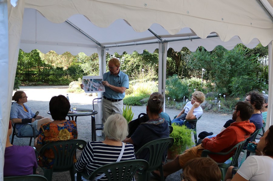
Matthias Forkel talks about researching forest fires with satellites at the event “Meet the expert under the conifer” in the Botanical Garden of TU Dresden.