Forschungsprojekte
Inhaltsverzeichnis
Diese Seite listet alle Forschunsprojekte an unserer Jun.-Professur.
Aktuell
RIVERWISE- AI-based change detection of riverbanks, riparian structures, and surrounding water environments in Saxony for the Water Framework Directive monitoring
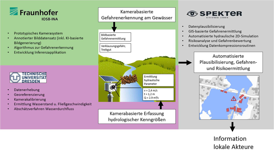
RivMon - Entwicklung einer Kamera- und KI-basierten Risikobewertung zur Gefahrenerkennung und -abwehr bei Starkregenereignissen für lokale Gewässerabschnitte
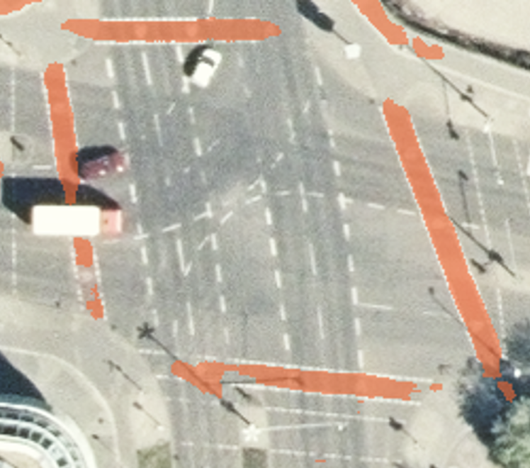
AI4CycleMaps - Automatische Kartierung der Radverkehrsinfrastruktur mittels Deep Learning
SFB/TRR 408 (AgiMo): Data driven agile planning for responsible mobility
Teilprojekt: A03 - New data on street design and street user activities for innovative safety assessment methods
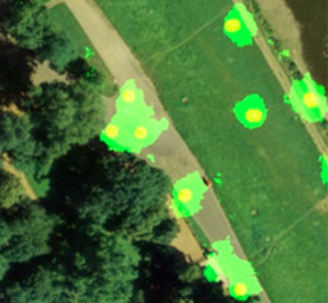
ValiGrün: Validierung des Klimaanpassungspotenzials und zur Optimierung der Funktionen blau-grüner Infrastrukturen im urbanen Raum - Durch die Messung und Validierung repräsentativer Parameter soll die Klimaanpassung von Gebäudegrün (Dächern und Fassaden) messbar gemacht werden, um daraus Handlungs- und Optimierungsempfehlungen abzuleiten.

ÖSL-NRW: Auf Basis von Leistungspunkten für ausgewählte Ökosystemdienstleistungen wird ein Vergütungssystem für die Wälder des Landes NRW entwickelt, welches dem komplexen Leistungsprofil des Waldes Rechnung trägt. Die UAV-gestützte Informationsgewinnung gibt eine Einschätzung gegebener Ökosystemdienstleistungen.

TransForMon: Analyse der Waldentwicklung in der Böhmischen/Sächsischen Schweiz mit Fernerkundung und die Implementierung eines grenzüberschreitenden, frei zugänglichen Informationssystems über die historische Entwicklung und den aktuellen Waldzustand sowie ein Portal für die gemeinsame Nutzung von Walddaten durch die Nationalpark-Behörden.
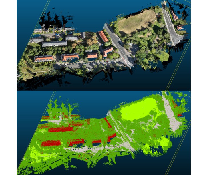
MPSC-Gewässerstrukturen: Entwicklung eines Open-Source-Tools zur automatisierten Erkennung des Bewuchses von Landoberflächen aus 3D-Punktwolken zur Anwendung an Kleinstgewässerrandstreifen und Unterstützung bei der Einführung eines Messsystems zur Detektion von Überflutungen im öffentlichen Raum.

AI4Glaciers: Entwicklung eines innovativen Ansatzes zur Kombination von multimodalen SfM-MVS mit Algorithmen der künstlichen Intelligenz und Multisensordaten, um eine 4D-Überwachung (3D + Zeit) des Gletscherkalbens mit bisher unerreichter räumlicher und zeitlicher Auflösung zu erreichen.

SFB/TRR 280: Konstruktionsstrategien für materialminimierte Carbonbetonstrukturen: Grundlagen für eine neue Art zu bauen
GRK2947 "AirMetro": Technisch-betriebliche Integration hochautomatisierter Luftfahrt in Ballungszentren
Abgeschlossen
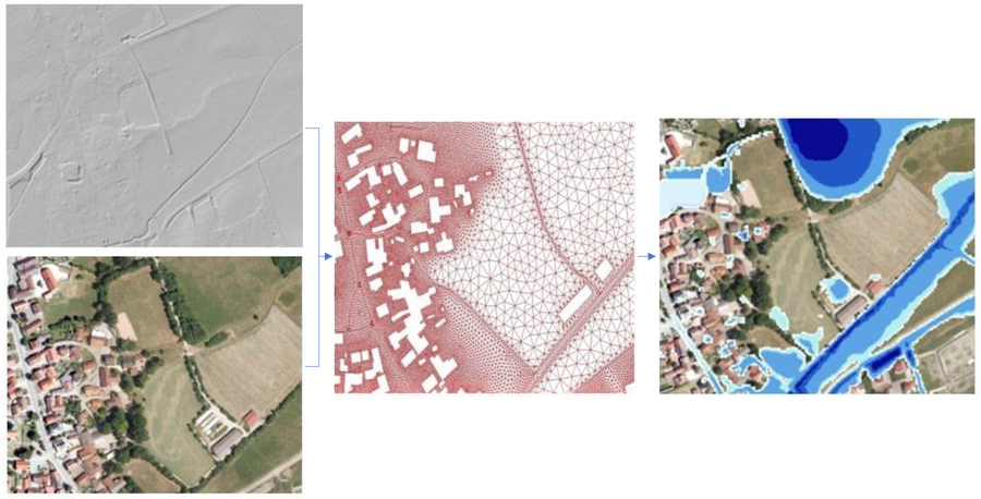
UAV-SRGK Automatisierte Fusion und Klassifikation von ALS- und UAV-Daten zur Erstellung von Starkregengefahrenkarten

EarthBridge Erdbeobachtungstechniken zur Erhaltung der Biodiversität und zur Landschaftsanpassung an den Klimawandel

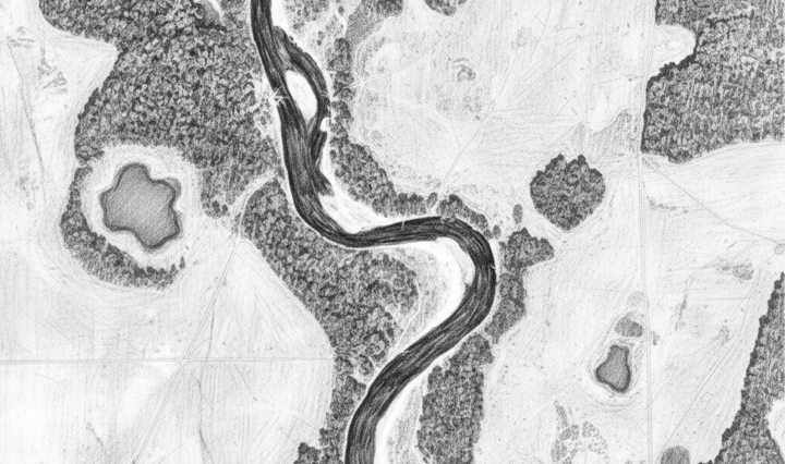
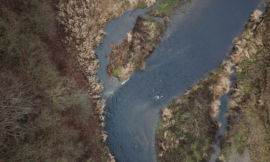
Entwicklung und Aufbau eines stationären Multisensorsystems zur Erfassung von räumlich-zeitlich hochauflösenden Beobachtungsdaten zur Messung von Flussuferveränderungen.

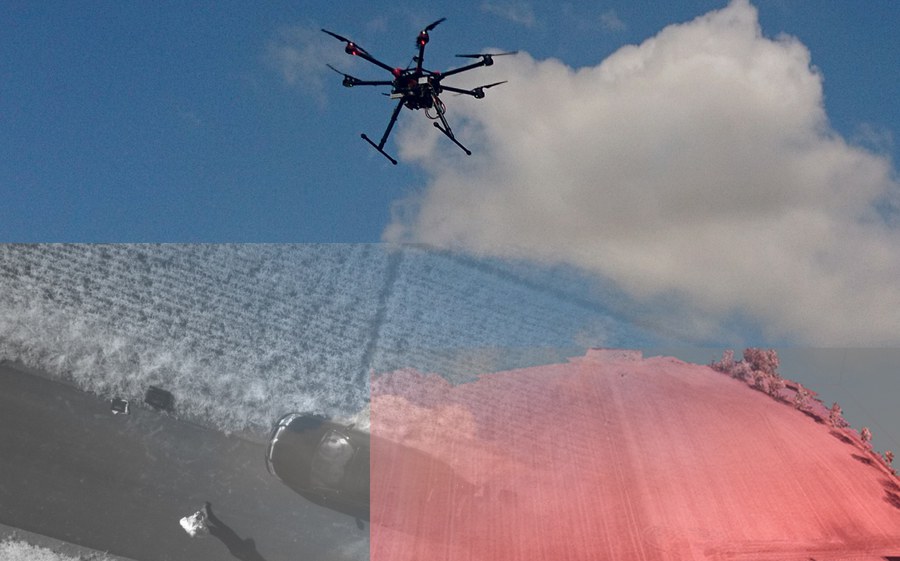
Multisensorsysteme für die Beobachtung von Sturzfluten Gekoppelter Einsatz von Kameraystemen und Umweltseismik für die Detektion und Observation von Sturzfluten.

Optimierung Intensivdachbegrünung Einfluss Intensivdachbegrünung auf Gebäude- und Stadtklima, Wasserhaushalt und Vegetation im urbanen Umfeld

Erosion 4D Hochauflösende photogrammetrische Methoden zur genesteten Parametrisierung und Validierung eines physikalisch-basierten Bodenerosionsmodells

KIWA Künstliche Intelligenz für die Hochwasserwarnung

Creek 4D - Messung von Kleinstgewässern Automatisierte hochauflösende Erfassung gewässermorphologischer Parameter kleiner Gewässer zur Unterstützung des Hochwasserrisikomanagements sowie der Erreichung des guten ökologischen Zustandes
UAVs in Environmental Sciences Wissenschaftliches Netzwerk zur Herausgabe eines Lehrbuches zur Nutzung von UAV in den Umweltwissenschaften

River reaches in cold climates Hydro-morphological change detection of rivers in cold climate regions with integrated spatio-temporal high resolution methods
OpenDrop Erstellung eines Portals zur Verwaltung und zum Teilen von UAV Daten

UAV and UWV for river change detection High-resolution topography to measure and model river channel morphodynamics

UAV and ML for earth and environment Integrating UAV multi-sensor data and machine learning for Earth and Environment

Starkregen in mediterranen Kleineinzugsgebieten Kamerabasiertes, hochauflösendes Monitoring eines Gullysystems in Extremadura