Diplomarbeit Till Sieberth
Titel:
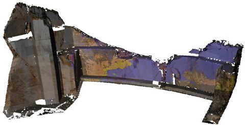
Entwicklung einer Methode zur Unterscheidung beleuchteter
und abgeschatteter Bereiche mit Hilfe eines
3D-Oberflächenmodells
Beschreibung:
Zurzeit
existieren nur wenige Algorithmen zur Schattendetektion oder
-Korrektur mit Hilfe von 3D Oberflächenmodellen. Für
Luftgestützte Anwendungen sind wenige Algorithmen vorhanden,
die auf Digitalen Oberflächenmodellen basieren um die
Intensitätswerte in hyperspectral Bildern zu korrigieren. Aber
mit der zunehmenden Wichtigkeit von terrestrischen 3D Modellen
und deren Texturierung und Visualisierung, wird die
Differenzierung von beleuchteten und unbeleuchteten Flächen
immer wichtiger. Das Centre for Integrated Petroleum Resesach
(Uni CIPR) analysiert geologischen Aufschlüssen mit
Hilfe von terrestrischem Laser-Scanning und terrestrischem
hyperspectral Line-Scanning. In diesem Anwendungsfeld ist
die Identifikation und eventuell auch Korrektur von
abgeschatteten Bereichen wichtig um die Prozessierung und
Qualität der Daten zu verbessern.
Für eine genaue Klassifikation von verschiedenen Gesteinen
in geologischen Aufschlüssen, müssen abgeschatten Flächen vor
der Analyse ausgeschlossen oder korrigiert werden. Das manuelle
maskieren von diesen Flächen, das automatische klassifizieren
oder die Nutzung von Grenzwert Algorithmen ist langsam und
fehleranfällig. Ziel dieser Arbeit ist es, einen geometrisch
korrekten Algorithmus zur Separierung beleuchteter und
unbeleuchteter Flächen zu entwickeln.
Zusätzlich berechnet der Algorithmus geometrisch korrekte
Übergänge zwischen den beiden Flächen, was für hohe
geometrische Auflösungen, höher als für airborne Anwendungen,
wichtig ist. Außerdem wir der Einstrahlwinkel der Sonne und
Ausstrahlwinkel zur Kamera für jedes einzelne Flächenelement
berechnet und zu einer gemeinsamen Maske für eine mögliche
spätere Korrektur der Intensitäts Werte, kombiniert.
Die Eingabedaten für die prozessiert welche ein 3D Model,
ein Zeitpunkt, die Parameter der Bildregistrierung und ein Bild
sind, machen die Methode auch attraktiv für bereits
existierende Daten. Basierend auf den Eingabedaten kann eine
Genauigkeit von besser als ein Pixel für die erzeugte Maske
erreicht werden.
Danksagung:
Dem Research Council of Norway und Statoil ASA sei für Ihre
finanzielle Unterstützung bei der Datenaufnahme gedankt. Danke
außerdem der Virtual Outcrop Geology Gruppe für die
Bereitstellung der Daten und die Unterstützung beim
Projekt.


