Oct 29, 2025
Review of the Juneau Icefield Research Program 2025 - Glacial Hydrology of TU Dresden in Alaska and British Columbia
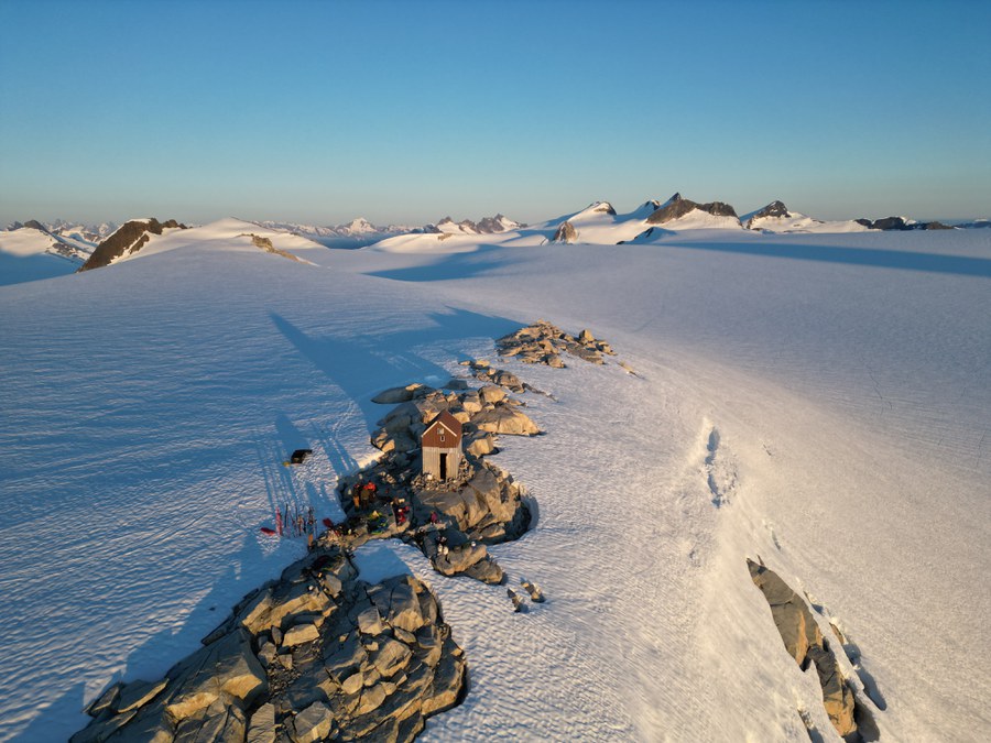
Camp 9, the smallest
Report by Lennart Spielmann
As part of my hydrology studies at TU Dresden, I was able to participate in the Juneau Icefield Research Program (JIRP) in Alaska/British Columbia from June to August 2025. JIRP is an internationally renowned training program in the field of glaciological field research. The Juneau Icefield on the border between Alaska and British Columbia serves as a model region for processes on the Greenland ice sheet due to its accessibility, size and long availability of time series data.
Intensive preparations
Following the approval of the FOSTER funding and the confirmation of participation by JIRP in February 2025, it became clear that I would be travelling to Alaska that year. An intensive preparation phase lay ahead of me. Given the high project costs, particularly the participation fees, travel costs and equipment, I tried to raise additional funding.
With the support of the Society of Friends and Sponsors of TU Dresden and the Konrad Adenauer Foundation, I finally succeeded. In addition to logistical and insurance issues, I had to work through an extensive list of equipment, which was very time-consuming and expensive.
For example, special backcountry skis were recommended, which I combined (out of concern for my telemark downhill skills) with an alpine touring binding. I went to Garmisch for this setup and took the opportunity to spend three days working on my technique with my ski instructor Thomas Hlawitschka to gain additional confidence. As a high fitness level was expected for participation in the JIRP, I began intensive training with three to four strength units per week to relieve the joints, prepare for carrying heavy rucksacks and prevent injuries, as well as around four endurance units. These included longer road bike tours, runs through the Great Garden and the "infamous" one-hour stair climb with 25 liters of water in the rucksack.
Departure and getting to know the participants
Once all the preparations were complete, my rucksack was packed and ready, and I had said goodbye to my friends, I set off on 13 June 2025. I flew from Frankfurt via Vancouver to Whitehorse in the Yukon, Canada. After the long flight, I met up with the other JIRP participants, who stood out thanks to their luggage and clothing. Together we drove to the small town of Atlin, about two hours away, where the JIRP base camp is located. The programme consisted of a week of getting to know each other and preparing for the trip. The equipment was checked and supplemented, initial theoretical content was taught and workshops were held on topics such as first aid, sun protection and behavior when encountering bears. Several day hikes were used to check fitness and test the equipment. Once these preparations were complete, the tent camp in Atlin was dismantled. We crossed the border to Skagway by bus and from there took the ferry to Juneau - a day-long journey. Our traverse was to start from Juneau and end back in Atlin at the end of the summer. After a short stopover, we finally made our way to Camp 17, the first of our field camps.
Camp 17 - The primer
We spent two weeks on the edge of the icefield, mainly completing safety training. This included moving on skis in different terrain, forming a rope team, using crampons, arresting falls with ice axes, and carrying out crevasse rescues. In addition to other lectures, an important goal was to get used to the living conditions in the research camp: communal dormitories (sometimes with 20 people in unheated huts, with wet clothes on ropes over their heads), lack of washing facilities, drying clothes in sleeping bags, simple sanitary conditions and communal tasks such as fetching water and kitchen duties. Cooking was done in teams, each of which was responsible for all meals throughout the day - these were the most stressful days for me.
A "mini-traverse", a long day trip with around 30 kg of luggage in heavy rain, served as a practical exercise in all forms of movement under real conditions. The start of Camp 17 was not without its challenges, which in retrospect proved to be a good endurance test. In the first week, the weather was so bad (strong winds and rain) that helicopter flights with equipment and food had to be postponed several times. We were initially living off the previous year's canned food supplies and only had some of our safety equipment. We therefore had to take it in turns to complete the training. And to top it all off, one of the bindings on my newly purchased ski equipment broke right at the start. To make matters worse, one of the bindings on my newly purchased ski equipment broke right at the start. As it couldn't be repaired on site, I organized a replacement over the phone in an outdoor store in Juneau.
The new bindings were delivered on the next helicopter flight and we fitted them ourselves in the equipment shed - an interesting new experience. Just in time for the next section, the equipment was ready for use again and I was able to start the two-day traverse to Camp 10 on my own skis. We set off early in the morning: First we went over the Lemon Creek Glacier, then with our skis on our backpacks over the Nugget Ridge, then again on skis through "Death Valley" (a long glacier crossing) and finally roped up the Norris Icefall, where our tent camp was located. After a small meal, we quickly got into dry clothes and our sleeping bags. The next morning, the route took us another 25 kilometers across the Norris and Taku glaciers in whiteout conditions until we reached Camp 10.
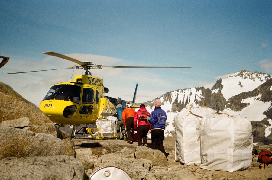
Supply deliveries with food — and (even more importantly!) letters from home — arrived about every 10 days.
Camp 10 - The research camp on the Taku
In the following two weeks at Camp 10, the largest camp in the Icefield, the focus was on getting to know various fields of glaciological research. We went on day excursions to the Taku Glacier, which is one of the thickest valley glaciers outside Antarctica with a thickness of over 1400 meters. A central task was the digging of mass-balance pits. This involves removing the fresh snow cover down to the previous year's firn layer, sometimes to a depth of seven meters. A sample wall is then prepared and the density of the snow is determined at 10-cm intervals with the help of a cutting cylinder with a known volume, also known as a "jacket ripper" due to its serrated teeth. This data can be used to calculate the Snow Water Equivalent (SWE), i.e. the water equivalent of the snow that fell in the previous year. In combination with the melt rates, this serves to determine the mass balance and thus the "health status" of the glacier. Although this method is extremely labor-intensive, it provides important reference results for the long-term time series.
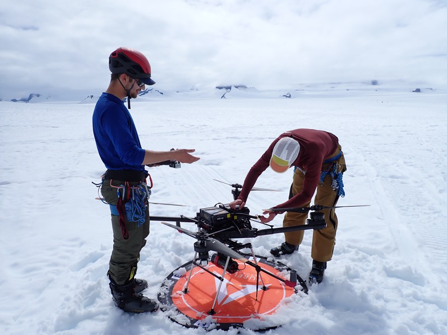
Preparation of a UAV LiDAR campaign for surveying the glacier surface
Geodetic profile measurements were also carried out. This involves using GPS to measure fixed points along a profile every year in order to document changes in the speed and absolute height of the glacier surface. In addition, the surface of the glacier was surveyed using a LiDAR drone in order to create a high-resolution digital elevation model.
Another measurement method was radar measurements to determine the bulk density of the snow cover. Material properties such as density and layer boundaries in the subsurface can be derived from the transit time of electromagnetic waves. In contrast to the pits, this method makes it possible to determine the SWE over a larger area. We also carried out snowpack and firn drilling. These allow undisturbed samples to be taken and analyzed in the laboratory for stable water isotopes. The isotope analyses provide information about precipitation processes and past climatic conditions. Practical safety training was not neglected either: among other things, we practiced climbing up a rope after a simulated crevasse fall using Prusik knots on a snow cornice. After completing the work at Camp 10, the traverse to Camp 18 began, with a two-day stopover at Camp 9, where we dug another mass-balance pit and carried out additional measurements.
Camp 18 - between Icefall and Ogives
Camp 18 was spectacularly located on a nunatak in the Vaughan Lewis Icefall and offered a view of the Gilkey Glacier, which was particularly impressive due to its striking banding (ogives). These wave-shaped structures with height differences of up to 20 meters between the mountain and the valley, some of which have small glacial lakes, are formed at the foot of icefalls. Their exact origin is still not fully understood. In Camp 18, the focus was on planning and carrying out independent research projects in small groups. I was part of a group that used Ground Penetrating Radar (GPR) to investigate the temporal changes in the density of the snowpack and compared this data with measurements from a nearby mass balance pit. In addition, we worked on an experimental approach: the construction of an air-coupled radar. The transmitter and receiver are not placed directly on the ground, but the signal first passes through an air gap. We implemented this concept using a self-built sled. The long-term goal of this development is to mount GPR systems on drones in order to carry out large-scale and autonomous investigations into bulk snow density, for example in areas that are difficult to access such as the Antarctic. The stay in Camp 18 ended with a mutual presentation of the project results, in which all groups presented their approaches, measurement methods and initial evaluations.
Camp 26 - Meltwater and glacier caves
The traverse to Camp 26 began early in the morning and after around seven hours led us to a special moment: the last turns on skis. There we deposited our skis in a field depot and swapped them for microspikes to cover the remaining kilometers on the bare ice of the so-called Blue Ice Zone. There is no longer any closed snow cover in this zone, so you walk directly on the ice, which is streaked with meltwater.
This water flows openly across the glacier and eventually disappears into moulins, also known as glacier mills, through which it reaches the inside of the glacier. Camp 26 is the smallest of all the camps and accordingly we spent the shortest time here. The program included a day trip to recover a meteorological station and several ablation levels as well as various excursions into glacier caves, which we explored in detail.
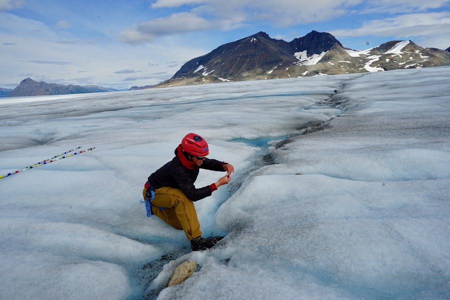
Sampling on the Llewellyn Glacier for TU Dresden
Camp 26 was particularly fascinating for me from a hydrological perspective, as here - in contrast to the higher camps - liquid water was available in large quantities. As part of my participation in the JIRP, I took water samples for TU Dresden with the aim of analyzing stable water isotopes. These analyses are intended to provide information about the areas of origin and the composition of the catchment runoff. In the long term, they will contribute to a better understanding of the water balance of glaciated regions that are difficult to access and how it is changing as a result of climate change.
"The long way home"
The final traverse down from the ice field was around 30 kilometers long. We covered the first half with microspikes on the glacier, then continued across the moraine landscape of the Llewellyn Glacier. There were numerous opportunities to collect more water samples along the way. Arriving on the shores of Atlin Lake, admittedly exhausted but happy, we bivouacked for one last night. The next morning, a local fisherman took us the 60 kilometers back to Atlin in his boat. There we were met by an officer from the Royal Canadian Mounted Police, who carried out passport control as we had crossed the border from the USA into Canada during the expedition. The first day in Atlin consisted of showering, doing laundry and resting - a new way of life after six weeks on the ice. The following days were spent preparing for the end of summer and a presentation to the local community in Atlin. Over coffee and home-baked cookies, each participant gave a short pitch about the most important insight of the summer, followed by a joint discussion. After about a week in Atlin, JIRP 2025 ended and from there I went to Whitehorse and on to Vancouver. I spent two weeks' vacation there before returning to Germany.
Taking part in JIRP was an intensive and personally formative experience for me. Of course, I was able to expand my knowledge of glaciology, field methodology and mountaineering skills, and I also learned how to work in a team under challenging conditions and take on responsibility. I am very grateful for the support that enabled me to participate, especially from FOSTER funding, the Society of Friends and Sponsors of TU Dresden and the Konrad Adenauer Foundation. Special thanks go to Dr. Thomas Wöhling, who supervised the implementation of my project on behalf of the Chair of Hydrology.