Geodäsie und Geoinformation (Bachelor of Science)
Inhalt dieser Webseite:
Inhaltsverzeichnis
Was ist Geodäsie?
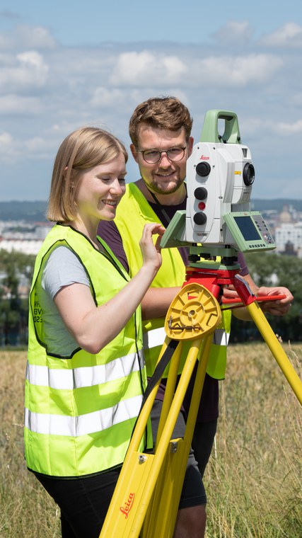
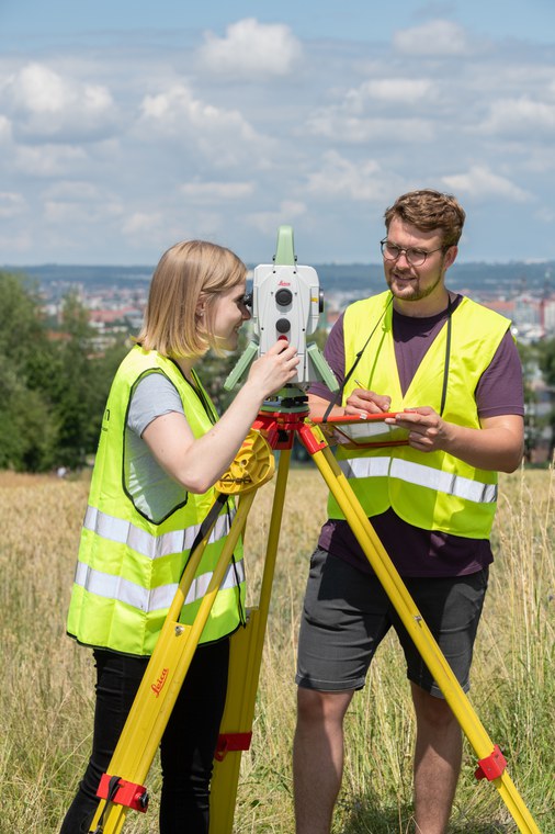
Geodäsie ist die Wissenschaft von der Vermessung der Erde. Zuallerst denkt man dabei meist an Vermesser, die mit Warnwesten bekleidet an der Straße oder auf der Baustelle stehen und durch Vermessungsgeräte schauen. Dieses Bild des Geodäten deckt jedoch bei weitem nicht das Spektrum ab, mit dem sich die Geodäsie und damit auch das Studium heutzutage beschäftigt.
Hatten Sie schon mit Geodäsie zu tun?
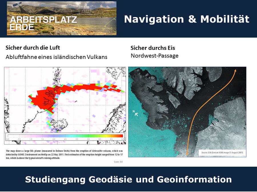
Falls Sie schon einmal digitale Karten im Internet oder auf Ihrem Smartphone (z.B. Google Maps) genutzt haben, um herauszufinden, wo sich ein bestimmtes Restaurant befindet oder wie weit es bis zur nächsten Großstadt ist, hatten Sie schon mit der Arbeit von Geodäten zu tun. Aber auch wenn Sie mit analogen Karten wandern gehen, profitieren Sie von der Arbeit von Geodäten, nämlich von der Aufnahme der Geo-Daten über die Aufbereitung bis hin zur Visualisierung. Vielleicht haben Sie sich auch schon zu einem bestimmten Ort navigieren lassen oder Sie suchen ab und zu Geo-Caches bei Ihren Wanderungen? Auch damit, wie und wie genau Ihr Navi (bzw. Smartphone) mittels Satelliten seine eigene Position bestimmen und die beste Strecke zu einem anderen Ort bestimmen kann, beschäftigt sich die Geodäsie. Und falls Sie lieber am Computer virtuelle 3D-Welten realer Gebiete und Objekte entdecken, wussten Sie wahrscheinlich noch nicht, dass Geodäten auch 3D-Modelle von ganzen Städten erstellen können.
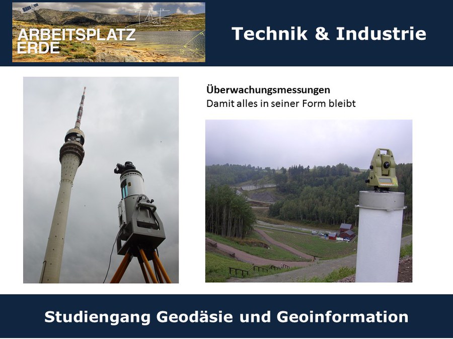
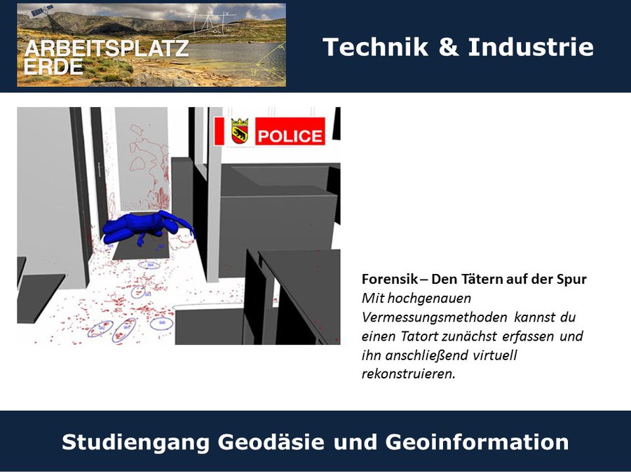
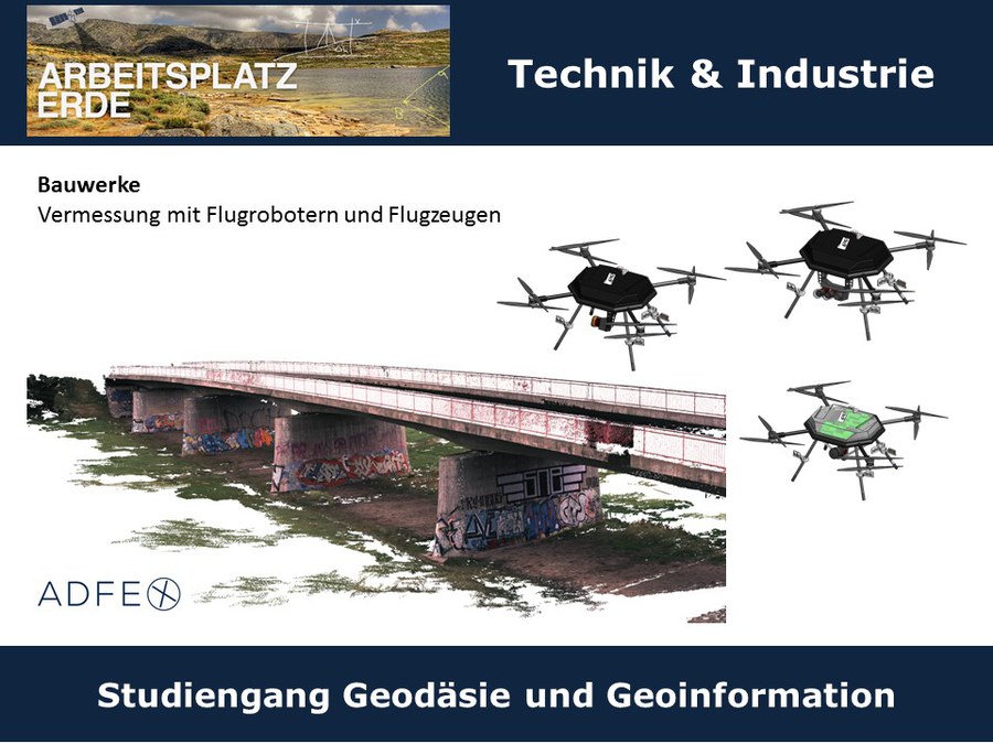
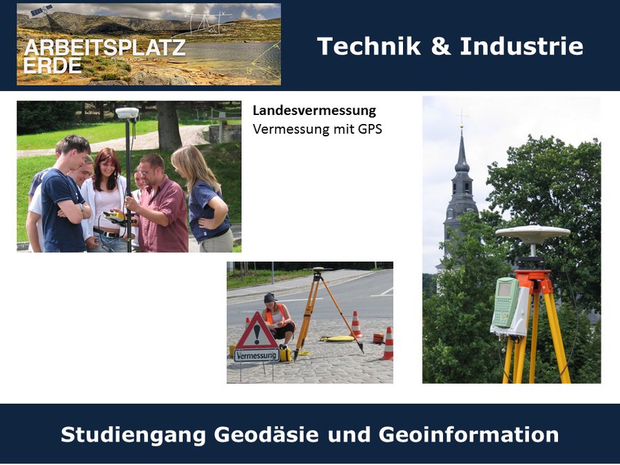
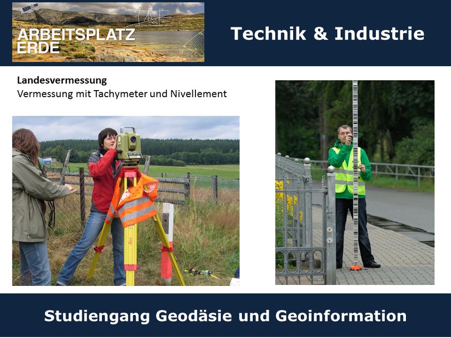
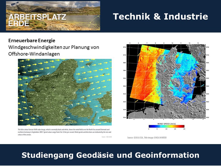
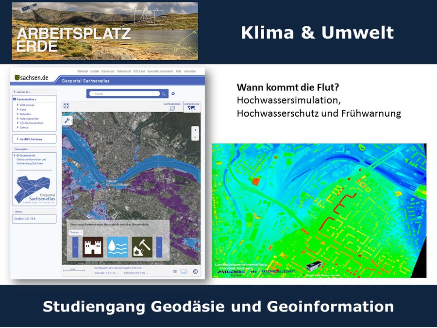
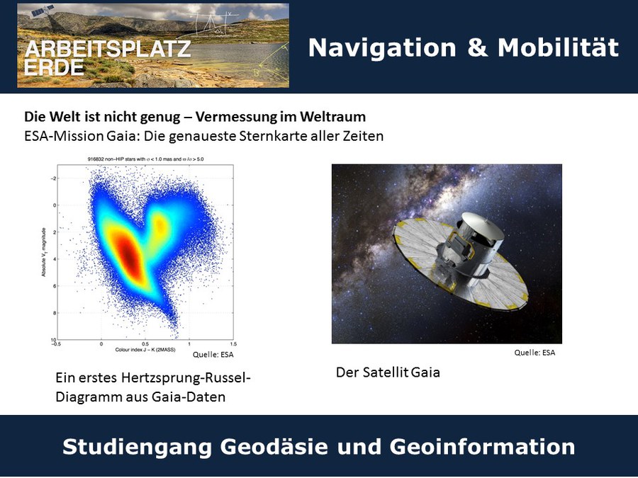
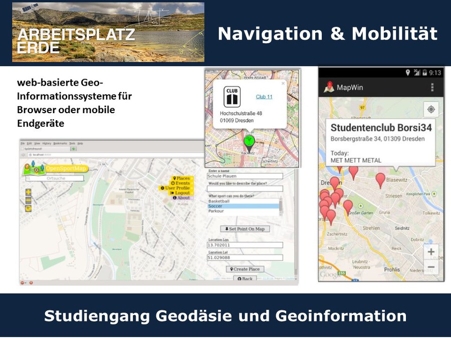
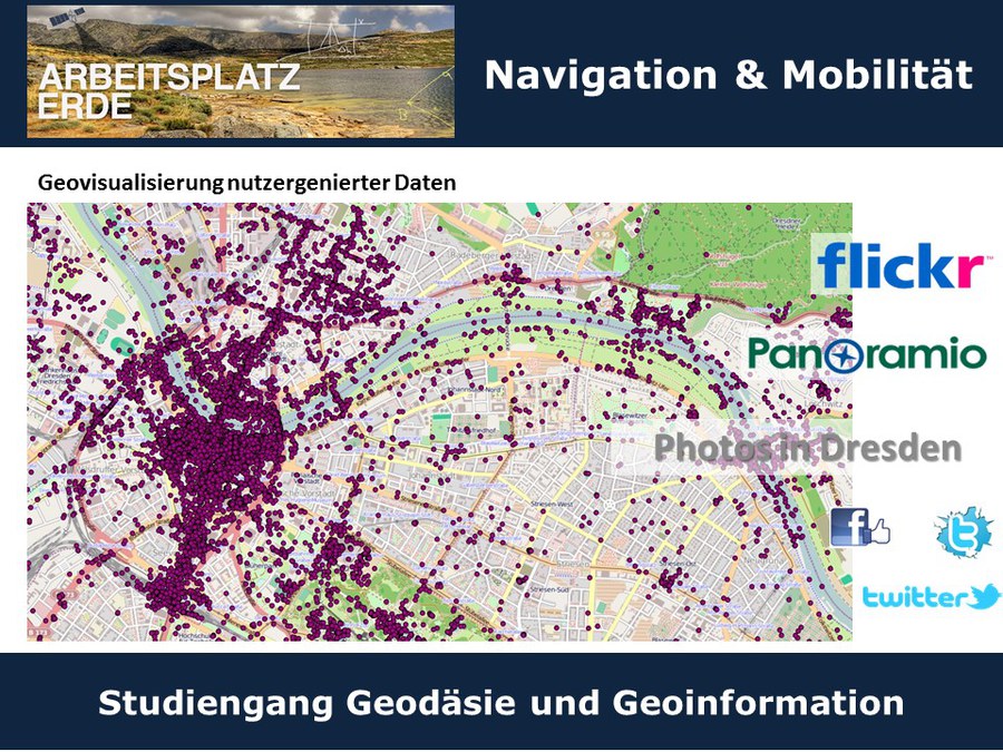
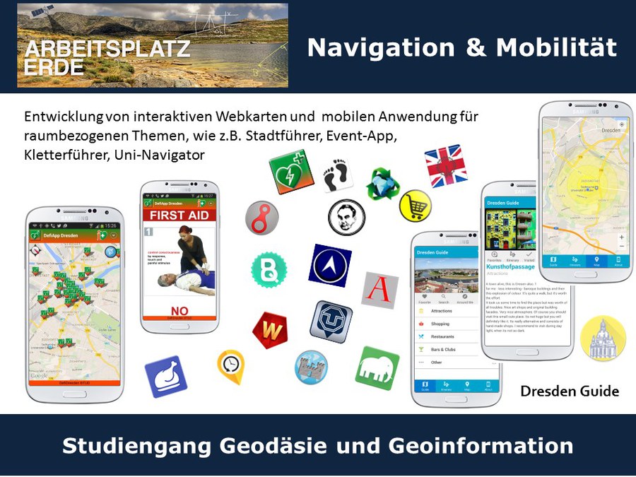
Einen Eindruck davon, womit sich die Geodäten an der TU Dresden beschäftigen, bekommen Sie, wenn Sie sich durch die folgende Bildersammlung durchklicken:
© GeoDD

© GeoDD

© GeoDD

© GeoDD

© GeoDD

© GeoDD
© GeoDD

© GeoDD
© GeoDD
© GeoDD
© GeoDD
© GeoDD
© GeoDD
© GeoDD

© GeoDD

© GeoDD

© GeoDD

© GeoDD
© GeoDD

© GeoDD

© GeoDD

© GeoDD
© GeoDD
© GeoDD
© GeoDD
© GeoDD
© GeoDD
© GeoDD
© GeoDD
© GeoDD
© GeoDD

© GeoDD
© GeoDD
© GeoDD

© GeoDD

© GeoDD
© GeoDD

© GeoDD
© GeoDD
© GeoDD
© GeoDD

© GeoDD

© GeoDD
© GeoDD
© TU Dresden

© TU Dresden


Was gehört noch zur Geodäsie?
Das Berufsfeld Geodäsie und Geoinformation ist eine Ingenieurdisziplin mit vielfältigen Bezügen zu den Naturwissenschaften. Die Geodäsie befasst sich mit der Vermessung der Erde in globalen, regionalen und lokalen Maßstäben.
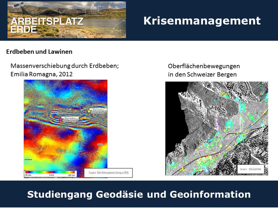
Mit modernen computergestützten Messverfahren, Satellitentechnologie und Fernerkundungssensoren werden Aufgabenstellungen gelöst, die von der Berechnung der Größe und Figur der Erde und deren Schwerefeld bis hin zu Präzisionsmessungen bei Ingenieurprojekten im Bauwesen und in der Industrie, beispielweise in Crashtest in der Autoindustrie, reichen. Weitere Aufgabengebiete liegen in den Bereichen Umweltmonitoring, Raumplanung und in der Stadt- und Landentwicklung. Darüber hinaus befasst sich die Geodäsie mit der Neuordnung von Grundstücken und der Bewertung von Immobilien. Neben der Erfassung von Geodaten, die für Kartenwerke und als Planungsgrundlagen benötigt werden, beschäftigt sich die Geodäsie vor allem mit der Verarbeitung und Analyse von Geoinformationen und stützt sich dabei auf Verfahren der Informatik und Computergrafik.
Weitere Informationen
Weitere Informationen zum Studium der Geodäsie auch an anderen Studienorten in Deutschland: Arbeitsplatz-Erde.de
Geodäsie an der TU Dresden studieren
Voraussetzung für das Studium im Bachelor-Studiengang „Geodäsie und Geoinformation“ an der TU Dresden ist die allgemeine Hochschulreife. Es bestehen keine Zulassungsbeschränkungen. Weitere Hinweise zu Bewerbungsmodalitäten finden Sie im Studieninformationssystem der TU Dresden.
Die gestufte Studienstruktur ist gekennzeichnet durch ein dreijähriges Bachelor-Studium und ein daran anschließendes zweijähriges Master-Studium. Der Bachelor ist der erste berufsqualifizierende Hochschulabschluss. Die Absolventen haben im Anschluss die Wahl zwischen dem Masterstudiengang Geodäsie und den Masterstudiengang Geoinformationstechnologie. Oder sie nutzen den Bachelorabschluss als Plattform für den Wechsel an eine andere Universität im In- oder Ausland.
In dem sechssemestrigen Bachelor-Studium werden wissenschaftliche Grundlagen, Methodenkompetenz und berufsfeldbezogene Qualifikationen vermittelt. Die Studierenden werden befähigt, raumbezogene Informationen und deren zeitliche Veränderungen zu erfassen, zu strukturieren, zu analysieren, zu modellieren und zu visualisieren. Einen wichtigen Bestandteil des Studiums bilden praktische Übungen, in denen konkrete Messaufgaben mit modernsten Messsystemen gelöst werden. Der Bachelor-Studiengang ist modular aufgebaut. Das Studium umfasst 19 Pflichtmodule und 2 Wahlpflichtmodule, bei denen Veranstaltungen aus Wahlpflichtkatalogen gewählt werden können. Folgende Fächer und Module sind Bestandteil des Geodäsie-Bachelor-Studiums:
- Mathematisch-naturwissenschaftlichen Grundlagen
- Geoinformatik und Geosoftwareentwicklung
- Astronomische Referenzsysteme
- Geodätische Messverfahren
- Ausgleichungsrechnung
- Raumplanung und Bodenrecht
- Geoinformationssysteme
- Fernerkundung
- Grundlagen der Erdmessung
- Kartographie und Geovisualisierung
- Grundlagen der Photogrammetrie
- Amtliches Vermessungswesen: Geobasisinformationssystem und Raumbezug
- Ingenieurgeodäsie
- Aktuelle Forschungsthemen der Geodäsie
- Grundlagen des Landmanagements
- Methoden der Erdmessung
- Schlüsselkompetenzen (Fremdsprachen, wissenschaftliche Arbeitsmethoden, Projektmanagement und Präsentationstechniken)
Das Studium wird mit einer Bachelorarbeit und einer Verteidigung abgeschlossen, und es wird der akademischen Grad „Bachelor of Science (B.Sc.)“ verliehen. Dieser Abschluss erlaubt den sofortigen Beginn der beruflichen Tätigkeit. Es besteht aber auch die Möglichkeit, das Studium an der TU Dresden, an einer anderen deutschen oder ausländischen Hochschule fortzusetzen, um den „Master of Science (M.Sc.)“ zu erlangen, der unter anderem auch Zugangsvoraussetzung für eine Laufbahn im höheren Verwaltungsdienst ist.
Berufsfelder für Absolventen liegen z.B. in der Industrie und in der freien Wirtschaft:
- bei der Nutzung der Satellitennavigation in Auto, Schiff und Flugzeug,
- bei der Verarbeitung und Analyse von Luftbildern und Satellitenbilddaten,
- beim Bau und der Überwachung von Ingenieurbauwerken und Trassen,
- bei der Nutzung und Verarbeitung von Geobasisdaten in Geoinformationssystemen,
- in der industriellen Messtechnik
oder in der öffentlichen Verwaltung und in der Forschung:
- bei der Stadt- und Landentwicklung,
- der Bodenordnung sowie der Immobilienbewertung,
- im Umweltmonitoring,
- an Universitäten, Hochschulen, Fachhochschulen oder Forschungsinstituten,
- als öffentlich bestellter Vermessungsingenieur
Das Spektrum der Einsatzmöglichkeiten von Geodäsie-Absolventen wird auch auf Arbeitsplatz-Erde.de vorgestellt.
Angebote für Schüler und Studieninteressierte
- Expedition Campus
- Sommeruniversität
- UNI-Tag (Tag der offenen Tür)
- Lange Nacht der Wissenschaften
- UNI Live (Hochschulinformationstag)
- Girls'Day
- Vorlesungen für Studieninteressierte
- Schülerpraktika
- UNI TESTEN (Zusammenfassung aller Angebote der TU Dresden)
Kontaktinformationen
AG Studierendenmarketing Geowissenschaften:
Angela Wollmann (Ingenieurgeodäsie, Studienfachberaterin)
Marita Scheller (Ingenieurgeodäsie)
Anja Jahn (Landmanagement)
Maria Kappelsberger, Eric Buchta (Erdystemforschung)
Enrico Gerlach (Astronomie)
Stephan Mäs (Geoinformatik)
Marion Pause (Geofernerkundung)
Katja Richter, Danilo Schneider (Photogrammetrie)
Fachschaftsrat Geowissenschaften