Table of contents
Admission requirements
• BA in the area(s) of Geoinformatics, Geodesy and Geoinformation, Cartography and Geomedia technology, Geography, Computer science or Media computer science or a comparable degree of
• English language skills at level B2 of the Common European Framework of Reference for Languages (proof e.g. by a certificate of general or subject-specific university entrance qualification with language level B2, a certificate of a university degree completed entirely in English or a language certificate such as the TOEFL iBT 72 (Neww: 4.0) or IELTS (5.5)
• at least 55 credits (ECTS) in Mathematics, Computer science, Geoinformatics, Cartography, Photogrammetry and Remote Sensing see Rules of Procedure for the Aptitude Test (Eignungsfeststellungsordnung)
Aptitude assessment procedure
The participation in an aptitude assessment or selection procedure is a prerequisite for enrollment in this degree program. Please note that the deadline for submitting an application may be earlier than the application deadlines for the degree program (see above under application deadlines). The following links will provide you with information on all documents to be submitted within the specified deadline and on the relevant regulations.
- Information and documents to be submitted
- Rules of Procedure for the Aptitude Test on the webpage of the discipline
Notes on the application process
If, at the time of application, proof of the first degree qualifying the applicant for a profession is not yet available, the application will be considered under the precondition that 80% of the credit points attainable for the degree have already been achieved based on completed module examinations or the final thesis and the colloquium (if applicable). A certification from the awarding institute of higher education (examination office) serves as proof of the above-mentioned academic achievements. You can find the appropriate form on the Admissions Office website.
General information about the degree program
The Geoinformatics degree program is offered by the Faculty of Environmental Sciences of TU Dresden. The program enables students to acquire skills in developing and executing scientific and technological methods in geoinformatics. Geoinformatics is a subfield of applied computer science which focuses on the spatial bearing of data and finding answers to spatial questions. The goal is to develop and apply methods of computing to solve subject-specific issues in the geosciences, forest sciences and hydrosciences as well as in landscape, environmental and infrastructural planning, environmental medicine and other related disciplines. Geoinformatics forms the scientific foundation for navigation systems, geoinformation systems, spatial data infrastructure and other systems for spatial decision-making support and planning. It provides the technological basis for improving system understanding and for solving spatial issues relating to current topics such as climate change and sustainable management of natural resources at the local, regional and global level.
Study contents
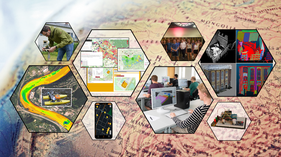
The Geoinformatics Master’s degree program at TU Dresden covers in-depth foundational knowledge as well as current research and development trends in this field. The Master’s degree program offers the concentrations:
• Geodata acquisition: Laser scanning, photogrammetry, optical 3D measurement techniques, GNSS, and remote sensing, as well as methods of data analysis and data integration;
• Geodata services: Modeling, methods, and technologies for spatial data infrastructures, as well as the development of geoinformation services and web applications;
• Geodata visualization: Methods of geovisual analysis and cartographic communication, techniques for automatic generalization, as well as mobile and field-based cartography.
These concentrations are supplemented by content from computer science to expand methodological knowledge (e.g., virtual reality, (geo)databases, (geo)software development) as well as content from environmental sciences, which serve as a key application area of geoinformatics (e.g., environmental risks, spatial planning). In-depth seminars and projects focus on the latest research topics in geoinformatics (e.g., sensor networks, GI usability, web-based decision support applications, geodata fusion, etc.). In addition, students are taught key skills in the following areas: Foreign languages, management methods, leadership skills, marketing, work organization, contract law, cultural awareness, public speaking, presentation skills. The program spans four semesters and consists of 6 compulsory modules and 8 elective compulsory modules, for which students can choose courses from the elective catalogs. This allows students to choose their own specializations. The fourth semester is dedicated to writing the Master’s thesis and its defense.
Particularities
TU Dresden's Master's degree program in Geoinformatics integrates computer science and environmental sciences and offers a highly customizable specialization in the areas of data collection, analysis, and visualization. It is particularly beneficial due its combination of practice-oriented project work addressing current research topics alongside targeted instruction in management and leadership skills tailored to the international job market.
Occupational fields
Public planning, site analysis, resource management, land-use planning, environmental studies, geodata development, application development, map design, research, and administration
Study documents
The official announcements of TU Dresden include all published regulations . Please use the search bar to find the document you need: Official proclamation
The regulations are also available on each institution’s website.
- Aptitude Assessment Regulation
- Study Regulation
- Examination Regulation
… you will find on the respective site of the responsible unit.
Contacts
Admissions Office
ServiceCenterStudies
Post address:
Technische Universität Dresden
Immatrikulationsamt
01062 Dresden
- Tel.
- +49 351 463-42000
Office Hours:
Faculty of Environmental Sciences
Academic Advisor
Ms. Jun.-Prof. Dr.-Ing. Anette Eltner
Post address:
TU Dresden
Fakultät Umweltwissenschaften
Fachrichtung Geowissenschaften
01062 Dresden
- Tel.
- +49 351 463 32737
Office Hours:
Please arrange an appointment or visit us during our office hours.
International Office
International Office
Office address:
Bürogebäude Strehlener Str. (BSS) 22, 6. Etage, Raum 671
Post address:
TU Dresden
International Office
01062 Dresden
- Tel.
- +49 351 463-42000
Office Hours: